- All Categories (52)
- News (3)
- Missions (1)
- Events (1)
- Tools (5)
- Activities (4)
- Documents (38)
Document - Product Cal/Val Plan/Report

Validation Report following the 3rd MERIS data reprocessing
This document prepared by the MERIS Quality Working Group (QWG) corresponds to the Validation Report following the 3rd MERIS data reprocessing. It aims at qualifying and quantifying the accuracy of the MERIS L2 products generated with the version 8.0 of MERIS Ground Segment prototype (MEGS), delivered to the whole community through the ODESA software (http://earth.eo.esa.int/odesa/). It is equivalent to version 6.0 of the Instrument Processing Facilities (IPF) at ESRIN.
Document - Product Cal/Val Plan/Report
Validation of GOMOS version ozone profiles
Validation of GOMOS version ozone profiles using ground-based lidar observations
News - Thematic area articles

Transforming space data into climate action
ESA’s Earth observation activities are playing a key role in the revitalised global drive to combat climate change.
News - Success Stories
Trailblazing ERS-2 mission enables climate change applications
As ESA’s ERS-2 satellite approaches Earth’s atmosphere for reentry, it’s time to reflect on the mission’s great achievements in powering climate-related applications.
Activity - Quality
SEOM CAWA
The Advanced Clouds, Aerosols and WAter vapour products for Sentinel-3/OLCI project aims to develop and improve the advanced atmospheric retrieval algorithms developed for MERIS and OLCI instruments.
Tools - Processing

SciaL1C Command-line Tool
The SCIAMACHY Calibration and Extraction Tool (SciaL1c) is an application to process SCIAMACHY Level 1b products. It allows you to select specific calibrations to apply to Level 1b data.
Tools - Analysis
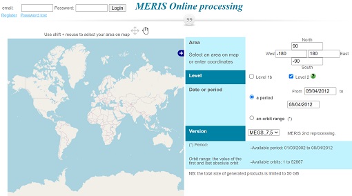
Optical Data processor of the European Space Agency
ODESA system provides a complete Level 2 processing environment for the MERIS instrument and future Sentinel-3 optical sensors.
Document - Technical Note

MERIS-Level-2-Detailed-Processing-Model.pdf
This document is the Detailed Processing Model document for the MERIS data processing. It covers the MERIS Level 2 processing.
Document - Technical Note
MERIS-Level-1-Detailed-Processing-Model-Parameters-Data-List.pdf
This document is the Detailed Processing Model and Parameters Data List document for the MERIS data processing.
Document - Technical Note
MERIS-Detailed-Instrument-Description.pdf
This document provides information about the Envisat platform, each part of the MERIS instrument and internal data flow. A more detailed description is provided in the MERIS Product Handbook.
Document - Algorithms Theoretical Baseline Document

MERIS-ATBD-2-9.pdf
Pigment Index Retrieval in Case 1 Waters.
Document - Algorithms Theoretical Baseline Document
MERIS-ATBD-2-24.pdf
Vicarious adjustment of the MERIS Ocean Colour Radiometry.
Document - Algorithms Theoretical Baseline Document
MERIS ATBD 2-7
Atmospheric Correction over the Ocean (Case 1 Waters)
Document - Algorithms Theoretical Baseline Document
MERIS ATBD 2-25
Alternative Atmospheric Correction Procedure for Case 2 Water Remote Sensing using MERIS
Document - Algorithms Theoretical Baseline Document
MERIS ATBD 2-22
MERIS Terrestrial Chlorophyll Index
Document - Algorithms Theoretical Baseline Document
MERIS ATBD 2-18
PHOTOSYNTHETICALLY AVAILABLE RADIATION (PAR)