- All Categories (971)
- Data (5)
- News (10)
- Missions (2)
- Events (3)
- Tools (4)
- Activities (2)
- Documents (945)
Document - Proceedings
1st MSG RAO Workshop
Proceedings of the workshop organised by ESA and EUMETSAT held in CNR of Bologna, Italy in May 2000.
Document - Proceedings
2004 Envisat and ERS Symposium
The 2004 Envisat and ERS Symposium was held in Salzburg - Austria from 6 to 10 September 2004. The 2004 Envisat and ERS Symposium provided a forum for investigators to present results of ongoing research project activities and assess the development of applications and services.
Document - General Reference
2013 Dragon 3 Brochure
The 2013 Dragon 3 cooperation brochure presents the activities undertaken since the formal start of programme in June 2012.
Document - Proceedings
2nd-MSG-RAO-Workshop.pdf
Proceedings of the 2nd MSG RAO Workshop, held on 9-10 September 2004 in Salzburg, Austria
Document - Proceedings
2nd-Workshop-on-the-Atmospheric-Chemistry-Validation-of-Envisat-ACVE-2.pdf
This is the collection of presentations given at the 2nd Workshop on the Atmospheric Chemistry Validation of Envisat, organised by the ESA Directorate of Earth Observation Programmes, held from 3-7 May 2004 at ESA ESRIN, Frascati, Italy.
Document - Proceedings
3rd-MSG-RAO-Workshop.pdf
Proceedings of the 3rd MSG RAO Workshop held on 5 June 2006 in Helsinki, Finland
Document - Proceedings
3rd-Workshop-on-the-Atmospheric-Chemistry-Validation-of-Envisat-ACVE-3.pdf
Proceedings of the 3rd Workshop on the Atmospheric Chemistry Validation of Envisat, held from 4-7 December 2006 at ESA ESRIN, Frascati, Italy
Document - General Reference
ACECHEM-Atmospheric-Composition-Explorer-for-Chemistry-and-Climate-Interaction.pdf
This report describes the ACECHEM mission, one of the candidate Earth Explorers in the second cycle in 2001.
Event - Training
Advanced Training Course in Ocean Remote Sensing 2011
Within the framework of the Dragon Programme, a joint collaboration between the European Space Agency (ESA) and the Chinese Ministry of Science and Technology (MOST), ESA and NRSCC are providing a series of advanced thematic training courses on remote sensing applications hosted by university and research institutions in P.R. China.
Document - Proceedings
Advances-in-Atmospheric-Science-and-Applications.pdf
Proceedings in Advances in Atmospheric Science and Applications held in 18-22 June 2012 in Bruges, Belgium.
Tools - Processing
Atmospheric Toolbox
The Atmospheric Toolbox (previously known as BEAT) is a collection of executable tools and API, developed to facilitate the utilisation, viewing and processing of e.g. GOMOS, MIPAS, SCIAMACHY and GOME data.
News - Events and Proceedings
Data preservation takes centre stage at Living Planet Symposium
Against the backdrop of the famed Rhine River, world-class scientists and Earth observation data-users are gathered this week in the historical city of Bonn, at the Living Planet Symposium (LPS).
Activity - Projects
Dragon 2 Cooperation Programme
The Dragon 2 Programme focussed on the exploitation of ESA, ESA's Third Party Missions and Chinese Earth observation data for science and applications development in land, ocean and atmospheric applications.
Document - Proceedings
Dragon Programme Mid-Term Results
Proceedings of the 2005 Dragon Symposium held on 27 June - 1 July 2005 in Santorini, Greece.
Document - Proceedings
Earth Observation for Land-Atmosphere Interaction Science
Proceedings of the Topical Conference Earth Observation for Land-Atmosphere Interaction Science held from 3-5 November 2010 at the premises of ESA-ESRIN in Frascati (Rome) Italy.
Document - General Reference
EarthCARE-Earth-Clouds-Aerosols-and-Radiation-Explorer.pdf
This report describes the EarthCARE mission, one of the candidate Earth Explorers in the second cycle in 2001.
Mission - Heritage Missions
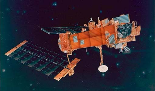
Envisat
Envisat was ESA's successor to ERS. Envisat carried ten instruments aboard for a wide range of Earth observing fields. The mission was operational from 2002 to 2012.
Data - Fast Registration with immediate access (Open)
Envisat DORIS Doppler [DOR_DOP_1P]
This product was generated by the Centre de Traitement Doris Poseidon (CTDP). The DORIS Doppler product (DOR_DOP_1P) was consolidated offline 2-4 weeks after sensing and stored in the F-PAC archive. The file size is 0.5 Mbytes per orbit.
Data - Fast Registration with immediate access (Open)
Envisat DORIS Precise Orbit [DOR_VOR_AX]
The latest version of the Envisat DORIS Precise Orbit product, DOR_VOR_AX, was generated by the Centre de Traitement Doris Poseidon (CTDP) using the Geophysical Data Records F standards (GDR-F). The product is used to obtain the satellite orbital parameters (latitude, longitude, height and height rate) by using orbit computation routines. The most significant changes related to the GDR-F standards concern the new ocean tide model (FES2014) and the updated Terrestrial Reference Frame (ITRF2014). The new standards significantly improve all Precise Orbit Determination (POD) metrics with respect to GDR-E. The mean difference and variance of Sea Surface Height (SSH) at crossovers is slightly reduced. The DOR_VOR_AX product adopts the Envisat format, and the size is 0.2 Mbytes per orbit. Users are recommended to apply the GDR-F version, but the previous datasets are still available (i.e. GDR-D and GDR-E versions). See further details in the readme file for Envisat DORIS Precise Orbit Determination files. Comparison of Envisat Sea Level Anomaly trends obtained using DORIS Precise Orbit GDR-E and F standards. North/South patterns are evident. Credits: CNES/CLS.


