- All Categories (465)
- Data (9)
- News (9)
- Missions (5)
- Events (4)
- Tools (3)
- Activities (3)
- Campaigns (7)
- Documents (425)
Document - Product Specifications
wind-scatterometer-processing-requirements-from-sigma-nought-triplets-to-dealiased-wind.pdf
This document defines the ground processing algorithms for the ERS-1 AMI wind mode (Scatterometer) from the sigma nought triplets to the wind speed and direction, including the wind retrieval and the ambiguity removal processing.
News - Data Release news
Updated Precise Orbit data (POD) for the full ERS-1 and ERS-2 mission available
The Precise Orbit files (ERS.ORB.POD) for the entire ERS-1 and ERS-2 mission periods have been reprocessed with up-to-date standards.
Campaign
TropiScat
The major objectives of the experiment were the temporal survey of the variation of the measurements in time scales ranging from diurnal, weekly, monthly, up to 12 months of observation.
News - Thematic area articles
Transforming space data into climate action
ESA’s Earth observation activities are playing a key role in the revitalised global drive to combat climate change.
News - Success Stories
Trailblazing ERS-2 mission enables climate change applications
As ESA’s ERS-2 satellite approaches Earth’s atmosphere for reentry, it’s time to reflect on the mission’s great achievements in powering climate-related applications.
Tools - Other
Swarm-Aurora
Swarm-Aurora, a web-based tool, was designed to facilitate and drive the use of Swarm in-situ measurements in auroral science.
Mission - Earth Explorers
Swarm
Swarm is dedicated to creating a highly detailed survey of Earth’s geomagnetic field and its temporal evolution as well as the electric field in the atmosphere using a constellation of three identical satellites.
Activity - Quality
SCIRoCCo
The SCIRoCCo project is an interdisciplinary cooperation of scatterometry experts aimed at promoting the continuing exploitation of ESA's unique 20 years' worth of ERS Scatterometer data.
Campaign
ROVE (1975-1981)
The Dutch research team ROVE (Radar Observation on Vegetation), funded by the remote sensing organization NIWARS, started in 1974 to investigate the scattering of microwaves by crops and soils, in order to help interpretation of radar imagery.
Campaign
NoSREx-I -II and -III
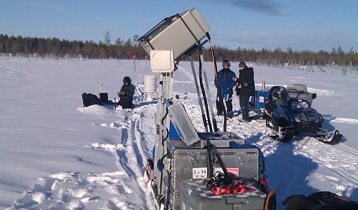
The Nordic Snow Radar Experiment (NoSREx) took place between November 2009 and May 2010. The objective of the campaign was to provide a continuous time series of active and passive microwave observations of snow cover in a representative location.
News - Data Release news
New reprocessing of datasets celebrates 30 years of ERS
The ERS programme celebrated its 30th anniversary on 17 July. Today, we are still exploiting ERS data and experts continue to work on improving the altimeter, radiometer and SAR data the programme acquired.
Document - General Reference
MetOp-Monitoring-the-Weather-from-Polar-Orbit.pdf
This brochure describes in details the MetOp mission, the satellite and its instruments.
Document - General Reference
MetOp-A-Truly-Global-Picture-About-MetOp-mission-and-its-instruments.pdf
This flyer describes the MetOp mission and its instruments.
Mission - Meteorological Missions
MetOp
MetOp is a mission dedicated to improving weather forecasts and monitoring Earth's climate.
News - Spotlight on EO community
Introducing Mirko Albani
In this short introduction, ESA's Heritage Missions Programme Manager describes what he likes most about ESA's long term archive of satellite mission data and his role in the programme.
News - Success Stories
How Envisat helped to shape global understanding of Earth’s systems
Twenty years have passed since a ground-breaking European spacecraft designed to deliver unprecedented insight into the planet’s changing environment was lofted into orbit.
Tools - Apps
Heritage Missions app for iOS
Download the Heritage Missions application to discover what the missions were about, how it worked and what the elements of the space and ground segment that make these missions unique.
Tools - Apps
Heritage Missions app for Android
Download the Heritage Missions application to discover what the missions were about, how it worked and what the elements of the space and ground segment that make these missions unique.
Mission - Earth Explorers
GOCE
ESA's Gravity field and Ocean Circulation Explorer (GOCE) mission mapped Earth's geoid very accurately, opening a window into Earth's interior structure as well as the currents circulating within the depths of its oceans.


