- All Categories (337)
- Data (5)
- News (4)
- Missions (1)
- Events (13)
- Tools (3)
- Activities (1)
- Documents (310)
Data - EO Sign In Authentication (Open)
Ocean Waves Thematic Data Product [ALT_TDP_WA]
This is the Ocean Waves Thematic Data Product (TDP) V1 resulting from the ESA FDR4ALT project and containing Significant Wave Height estimates for the ERS-1, ERS-2 and Envisat missions. Compared to existing datasets, the Ocean Waves TDP demonstrates notable improvements in several aspects: Great improvements for Envisat due to noise reduction from Adaptive retracker and High-Frequency Adjustment (HFA) All variables are given at 5 Hz The FDR4ALT products are available in NetCDF format. Free standard tools for reading NetCDF data can be used. Information for expert altimetry users is also available in a dedicated NetCDF group within the products. Please consult the FDR4ALT Product User Guide before using the data. The FDR4ALT datasets represent the new reference data for the ERS/Envisat altimetry missions, superseding any previous mission data. Users are strongly encouraged to make use of these datasets for optimal results.
News - Data Release news
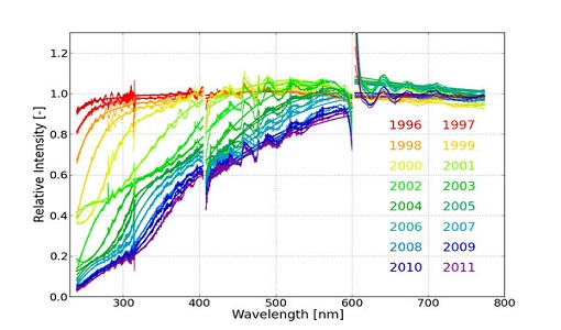
New ERS-2 GOME Level 1 v5.1 dataset available online
A new GOME Level 1b dataset has been generated for the 16-year mission period bringing relevant quality improvements for the revised calibration approach, compensating aging and instrument degradation, and provide enhanced accessibility.
Event - Conference
Living Planet Symposium 2022
Learn about the 2022 edition of ESA's Living Planet Symposium.
Event - Conference
Living Planet Symposium 2019
ESA's Living Planet Symposia are amongst the biggest Earth observation conferences in the world. Scientists present their latest findings on Earth's environment and climate.
Event - Conference
IGARSS 2019
World-class scientists, engineers and educators in geoscience and remote sensing gathered in Yokohama, Japan, for the 39th annual IGARSS symposium.
News - Thematic area articles
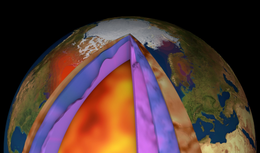
How ESA uses space data to explore deep Earth
As anthropogenic activities continue to unbalance our environment, scientists strive to fully understand the intricate interactions within Earth’s system.
Tools - Apps
Heritage Missions app for iOS
Download the Heritage Missions application to discover what the missions were about, how it worked and what the elements of the space and ground segment that make these missions unique.
Tools - Apps
Heritage Missions app for Android
Download the Heritage Missions application to discover what the missions were about, how it worked and what the elements of the space and ground segment that make these missions unique.
Tools - Analysis
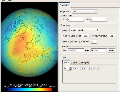
GOCE User Toolbox
The GOCE User Toolbox is a compilation of tools for the utilisation and analysis of products from ESA's GOCE gravity mission.
Event - Workshop
Fringe 2007 Workshop
Fringe 2007 was the third International Workshop on Envisat ASAR interferometry and fifth International Workshop on ERS SAR Interferometry.
Event - Workshop
Fringe 2005 Workshop
Fringe 2005 was the second International Workshop on Envisat ASAR interferometry and fourth International Workshop on ERS SAR Interferometry.
Event - Workshop
Fringe 2003 Workshop
The third ESA International Workshop on ERS SAR Interferometry and its first Workshop on ASAR interferometry: Advances in SAR interferometry from ERS and Envisat missions.
Event - Workshop
Fringe 1996 Workshop
The workshop on ERS SAR Interferometry was open to scientists and students working in the field of Synthetic Aperture Radar (SAR) interferometry and its applications.
News - Data Release news
FDR4ALT - ESA unveils new cutting-edge ERS/Envisat Altimeter and Microwave Radiometer Datasets
The European Space Agency (ESA) has developed a comprehensive suite of innovative Earth system data records as part of the Fundamental Data Records for Altimetry project - FDR4ALT.
Document - Quality Report
ERS-2 AMI-SAR/AMI-Scatterometer Weekly Report 31 May 2010
ERS-2 AMI-SAR/AMI-Scatterometer Weekly Report
Document - Quality Report
ERS-2 AMI-SAR/AMI-Scatterometer Weekly Report 31 May 2004
ERS-2 AMI-SAR/AMI-Scatterometer Weekly Report
Document - Quality Report
ERS-2 AMI-SAR/AMI-Scatterometer Weekly Report 31 Mar 2003
ERS-2 AMI-SAR/AMI-Scatterometer Weekly Report
Document - Quality Report
ERS-2 AMI-SAR/AMI-Scatterometer Weekly Report 31 Jan 2011
ERS-2 AMI-SAR/AMI-Scatterometer Weekly Report
Document - Quality Report
ERS-2 AMI-SAR/AMI-Scatterometer Weekly Report 31 Jan 2005
ERS-2 AMI-SAR/AMI-Scatterometer Weekly Report
Document - Quality Report
ERS-2 AMI-SAR/AMI-Scatterometer Weekly Report 31 Aug 2009
ERS-2 AMI-SAR/AMI-Scatterometer Weekly Report


