- All Categories (25)
- Data (10)
- News (4)
- Missions (1)
- Events (8)
- Campaigns (1)
- Documents (1)
News - Success Stories
Trailblazing ERS-2 mission enables climate change applications
As ESA’s ERS-2 satellite approaches Earth’s atmosphere for reentry, it’s time to reflect on the mission’s great achievements in powering climate-related applications.
Document - Proceedings
EO-Summer-School-6-ESA-explorer-mission-GOCE-earth-gravity-from-space.pdf
This presentation from ESA's EO Summer School 6 presents the ESA explorer mission GOCE earth gravity from space
Event - Training
EO Summer School 3
ESA's series of summer schools, on Monitoring of the Earth System, aims to promote the exploitation of Earth observation data.
News - Events and Proceedings
Data preservation takes centre stage at Living Planet Symposium
Against the backdrop of the famed Rhine River, world-class scientists and Earth observation data-users are gathered this week in the historical city of Bonn, at the Living Planet Symposium (LPS).
News - Success Stories
10 years of Envisat data help to illuminate ocean processes
A decade after Envisat beamed its final image to the planet, the pioneering ESA mission is continuing to foster improved understanding of Earth’s systems.
Event - Workshop
Coastal and Marine Applications of SAR Workshop 2003
The second in the Coastal and Marine Applications of SAR Workshop series covered a range of topics on applications of synthetic aperture radar (SAR) in coastal and marine environments.
Event - Workshop
SEASAR 2008
The "Advances in SAR Oceanography from Envisat and ERS missions" was a thematic workshop on SAR remote sensing techniques for oceanography.
Mission - Copernicus Sentinels
Copernicus Sentinel-3
Copernicus Sentinel-3 is an European Earth Observation satellite mission developed to support Copernicus ocean, land, atmospheric, emergency, security and cryospheric applications.
Event - Training
3rd Advanced Training Course on Ocean Remote Sensing 2013
The 3rd Advanced Training Course on Ocean Remote Sensing was held from 23 to 27 September 2013 in Cork, at the National Maritime College of Ireland.
Event - Workshop
SEASAR 2012
The European Space Agency and the Norwegian Space Centre jointly organised the fourth SAR oceanography workshop, 'SEASAR 2012', entitled 'Advances in SAR Oceanography'.
Data - Data Description
ERS-1/2 Radar Altimeter REAPER METEO Product - [ERS_ALT_2M]
This is a RA Meteo product containing only the 1 Hz parameters for altimeter (surface range, satellite altitude, wind speed and significant wave height at nadir) and ATSR/MWR data (brightness temperature at 23.8 GHz and 36.5 GHz, water vapour content, liquid water content) used to correct altimeter measurements. It also contains the full geophysical corrections. This product corresponds to a subset of the REAPER GDR product (ERS_ALT_2_). The REAPER (REprocessing of Altimeter Products for ERS) product is generated by applying a similar processing as for Envisat RA-2 on the Level 1b consolidated waveforms using 4 different re-trackers, RA calibration improvement, new precise orbit solution (POD), new ionospheric corrections (NICO09 until 1998 and GIM up to 2003), ECMWF ERA-interim model and updated SSB tables. This product contains only the low rate of 1 Hz data. The REAPER Meteo (ERS_ALT_2M) is a global product including data over ocean, ice and land. It should be noted that this product differs from the Envisat RA2 in the following ways: The product format; which is NetCDF (more details can be found in the Product Handbook), and not PDS The product is delivered based on orbit acquisition and not per pass (pole-to-pole). This product is extended through Envisat RA-2 data.
Data - Fast Registration with immediate access (Open)
Envisat RA-2 Sensor and Geophysical Data Record - SGDR [RA2_MWS__2P]
This is a RA-2 Sensor and Geophysical Data Record (SGDR) Full Mission Reprocessing (FMR) V3 product. This FMR follows the first Envisat Altimetry reprocessing Version (V2.1) completed in 2012. The GDR and S-GDR data products were reprocessed for all cycles from 6 to 113 (May 2002 to April 2012) into a homogeneous standard in NetCDF format (close to Sentinel-3). The Sensor Data Record (SGDR) Product from RA-2/MWR includes the data in the GDR product (RA-2 geophysical data, MWR data) and also RA-2 averaged waveforms (18Hz) and RA-2 individual waveforms (1800Hz). This product is a continuation of ERS RA data. This data product has a coverage of 1 pass and pole to pole, a spatial sampling of about 390 m along track and a size of 31 to 40 MB, depending on presence of individual waveforms. The radiometric accuracy is 0.2 dB and auxiliary data include: Orbit state vectors (DORIS, FOS), RA2 and MWR characterisation data, Platform attitude, Gain calibration, USO frequency, ECMWF data, time relation, leap second, Ionospheric corrections, geoid, mean sea surface, slope data, and tide model (ocean, earth, loading, pole). Please consult the Envisat RA-2/MWR Product Quality Readme file before using the data.
Data - Fast Registration with immediate access (Open)
Envisat RA-2 Geophysical Data Record - GDR [RA2_GDR__2P]
This is a RA-2 Geophysical Data Record (GDR) Full Mission Reprocessing (FMR) V3 product containing radar range and orbital altitude, wind speed, wave height, water vapour from the MWR and geophysical corrections. This FMR follows the first Envisat Altimetry reprocessing Version (V2.1) completed in 2012. The GDR and S-GDR data products were reprocessed for all cycles from 6 to 113 (May 2002 to April 2012) into a homogeneous standard in NetCDF format (close to Sentinel-3). For many aspects, the V3.0 reprocessed data are better than the previous dataset: In terms of available and valid data, the coverage is better, notably thanks to a better availability of MWR data at the beginning of the mission In terms of performance at cross-overs, the quality is improved: the annual signal and average of Mean SSH is decreased, as well as the standard deviation The new MWR characteristics were shown to improve largely the global quality of data. As well as the new tide model, the new MSS and the new orbit standard The Global and regional Mean Sea Level trend is very weakly impacted though the effort was put, this time, on the mesoscale restitution, rather than long term drift, as during V2.1 reprocessing. Please consult the Envisat RA-2/MWR Product Quality Readme file PDF before using the data.
Data - Fast Registration with immediate access (Open)
ERS-1/2 Radar Altimeter REAPER Geophysical Data Record - GDR [ERS_ALT_2]
This is a RA Geophysical Data Record (GDR) product containing radar range, orbital altitude, wind speed, wave height and water vapour from the ATSR/MWR as well as geophysical corrections. The REAPER (REprocessing of Altimeter Products for ERS) product is generated by applying a similar processing as for Envisat RA-2 on the Level 1b consolidated waveforms using 4 different re-trackers, RA calibration improvement, new precise orbit solution (POD), new ionospheric corrections (NICO09 until 1998 and GIM up to 2003), ECMWF ERA-interim model and updated SSB tables. This product contains two data rates: a low rate of 1 Hz and a high rate of 20 Hz. Most 1 Hz data is also represented at 20 Hz, while microwave radiometer (ATSR/MWR) data and the atmospheric and geophysical corrections are only given at 1 Hz. The REAPER GDR (ERS_ALT_2_) is a global product including data over ocean, ice and land. It should be noted that this product differs from the Envisat RA2 in the following ways: The product format; which is NetCDF (more details can be found in the Product Handbook, and not PDS The product is delivered based on orbit acquisition and not per pass (pole-to-pole). This product is extended through Envisat RA-2 data.
Data - Fast Registration with immediate access (Open)
ERS-1/2 Radar Altimeter REAPER Sensor Geophysical Data Record - SGDR [ERS_ALT_2S]
This is a RA Geophysical Data Record (GDR) product containing radar range, orbital altitude, wind speed, wave height and water vapour from the ATSR/MWR as well as geophysical corrections. The REAPER (REprocessing of Altimeter Products for ERS) product is generated by applying a similar processing as for Envisat RA-2 on the Level 1b consolidated waveforms using 4 different re-trackers, RA calibration improvement, new precise orbit solution (POD), new ionospheric corrections (NICO09 until 1998 and GIM up to 2003), ECMWF ERA-interim model and updated SSB tables. This product contains two data rates: a low rate of 1 Hz and a high rate of 20 Hz. Most 1 Hz data is also represented at 20 Hz, while microwave radiometer (ATSR/MWR) data and the atmospheric and geophysical corrections are only given at 1 Hz. The REAPER GDR (ERS_ALT_2_) is a global product including data over ocean, ice and land. It should be noted that this product differs from the Envisat RA2 in the following ways: The product format; which is NetCDF (more details can be found in the Product Handbook, and not PDS The product is delivered based on orbit acquisition and not per pass (pole-to-pole). This product is extended through Envisat RA-2 data.
Data - EO Sign In Authentication (Open)
SeaSat ESA archive
This collection gives access to the complete SEASAT dataset acquired by ESA and mainly covers Europe. The dataset comprises some of the first ever SAR data recorded for scientific purposes, reprocessed with the most recent processor. The Level-1 products are available as: SAR Precision Image [SEA_PRI_1P] SAR Single Look Complex Image [SEA_SLC_1P] SAR Ellipsoid Geocoded Precision Image [SEA_GEC_1P] Spatial coverage: Check the spatial coverage of the collection on a map available on the Third Party Missions Dissemination Service.
Data - Data Description
GRACE-A and GRACE-B Level 1B, Level 1B combined and Level 2 Data Products
Level-1A Data Products are the result of a non-destructive processing applied to the Level-0 data at NASA/JPL. The sensor calibration factors are applied in order to convert the binary encoded measurements to engineering units. Where necessary, time tag integer second ambiguity is resolved and data are time tagged to the respective satellite receiver clock time. Editing and quality control flags are added, and the data is reformatted for further processing. The Level-1A data are reversible to Level-0, except for the bad data packets. This level also includes the ancillary data products needed for processing to the next data level. The Level-1B Data Products are the result of a possibly destructive, or irreversible, processing applied to both the Level-1A and Level-0 data at NASA/JPL. The data are correctly time-tagged, and data sample rate is reduced from the higher rates of the previous levels. Collectively, the processing from Level-0 to Level-1B is called the Level-1 Processing. This level also includes the ancillary data products generated during this processing, and the additional data needed for further processing. The Level-2 data products include the static and time-variable (monthly) gravity field and related data products derived from the application of Level-2 processing at GFZ, UTCSR and JPL to the previous level data products. This level also includes the ancillary data products such as GFZ's Level-1B short-term atmosphere and ocean de-aliasing product (AOD1B) generated during this processing. GRACE-A and GRACE-B Level-1B Data Product: Satellite clock solution [GA-OG-1B-CLKDAT, GB-OG-1B-CLKDAT, GRACE CLKDAT]: Offset of the satellite receiver clock relative to GPS time, obtained by linear fit to raw on-board clock offset estimates GPS flight data [GA-OG-1B-GPSDAT, GB-OG-1B-GPSDAT, GRACE GPSDAT]: Preprocessed and calibrated GPS code and phase tracking data edited and decimated from instrument high-rate (10 s (code) or 1 s (phase)) to low-rate (10 s) samples for science use (1 file per day, level-1 format) Accelerometer Housekeeping data [GA-OG-1B-ACCHKP, GB-OG-1B-ACCHKP, GRACE ACCHKP]: Accelerometer proof-mass bias voltages, capacitive sensor outputs, instrument control unit (ICU) and sensor unit (SU) temperatures, reference voltages, primary and secondary power supply voltages (1 file per day, level-1 format) Accelerometer data [GA-OG-1B-ACCDAT, GB-OG-1B-ACCDAT, GRACE ACCDAT]: Preprocessed and calibrated Level-1B accelerometer data edited and decimated from instrument high-rate (0.1 s) to low-rate (1s) samples for science use (1 file per day, level-1 format) Intermediate clock solution [GA-OG-1B-INTCLK, GB-OG-1B-INTCLK, GRACE INTCLK]: derived with GIPSY POD software (300 s sample rate) (1 file per day, GIPSY format) Instrument processing unit (IPU) Housekeeping data [GA-OG-1B-IPUHKP, GB-OG-1B-IPUHKP, GRACE IPUHKP]: edited and decimated from high-rate (TBD s) to low-rate (TBD s) samples for science use (1 file per day, level-1 format) Spacecraft Mass Housekeeping data [GA-OG-1B-MASDAT, GB-OG-1B-MASDAT, GRACE MASDAT]: Level 1B Data as a function of time GPS navigation solution data [GA-OG-1B-NAVSOL, GB-OG-1B-NAVSOL, GRACE NAVSOL]: edited and decimated from instrument high-rate (60 s) to low-rate (30 s) samples for science use (1 file per day, level-1 format) OBDH time mapping to GPS time Housekeeping data [GA-OG-1B-OBDHTM, GB-OG-1B-OBDHTM, GRACE OBDHTM]: On-board data handling (OBDH) time mapping data (OBDH time to receiver time Star camera data [GA-OG-1B-SCAATT, GB-OG-1B-SCAATT, GRACE SCAATT]: Preprocessed and calibrated star camera quaternion data edited and decimated from instrument high-rate (1 s) to low-rate (5 s) samples for science use (1 file per day, level-1 format) Thruster activation Housekeeping data [GA-OG-1B-THRDAT, GB-OG-1B-THRDAT, GRACE THRDAT]: GN2 thruster data used for attitude (10 mN) and orbit (40 mN) control GN2 tank temperature and pressure Housekeeping data [GA-OG-1B-TNKDAT, GB-OG-1B-TNKDAT, GRACE TNKDAT]: GN2 tank temperature and pressure data Oscillator frequency data [GA-OG-1B-USODAT, GB-OG-1B-USODAT, GRACE USODAT]: derived from POD product GRACE-A and GRACE-B Combined Level-1B Data Product Preprocessed and calibrated k-band ranging data [GA-OG-1B-KBRDAT, GB-OG-1B-KBRDAT, GRACE KBRDAT]: range, range-rate and range-acceleration data edited and decimated from instrument high-rate (0.1 s) to low-rate (5 s) samples for science use (1 file per day, level-1 format) Atmosphere and Ocean De-aliasing Product [GA-OG-1B-ATMOCN, GB-OG-1B-ATMOCN, GRACE ATMOCN]: GRACE Atmosphere and Ocean De-aliasing Product. GRACE Level-2 Data Product: GAC [GA-OG-_2-GAC, GB-OG-_2-GAC, GRACE GAC]: Combination of non-tidal atmosphere and ocean spherical harmonic coefficients provided as average over certain time span (same as corresponding GSM product) based on level-1 AOD1B product (1file per time span, level-2 format) GCM [GA-OG-_2-GCM, GB-OG-_2-GCM, GRACE GCM]: Spherical harmonic coefficients and standard deviations of the long-term static gravity field estimated by combination of GRACE satellite instrument data and other information for a dedicated time span (multiple years) and spatial resolution (1 file per time span, level-2 format) GAB [GA-OG-_2-GAB, GB-OG-_2-GAB, GRACE GAB]: Non-tidal ocean spherical harmonic coefficients provided as average over certain time span (same as corresponding GSM product) based on level-1 AOD1B product (1file per time span, level-2 format) GAD [GA-OG-_2-GAD, GB-OG-_2-GAD, GRACE GAD]: bottom pressure product - combination of surface pressure and ocean (over the oceans, and zero over land). Spherical harmonic coefficients provided as average over certain time span (same as corresponding GSM product) based on level-1 AOD1B product (1file per time span, level-2 format) GSM [GA-OG-_2-GSM, GB-OG-_2-GSM, GRACE GSM]: Spherical harmonic coefficients and standard deviations of the static gravity field estimated from GRACE satellite instrument data only for a dedicated time span (e.g. weekly, monthly, multiple years) and spatial resolution (1 file per time span, level-2 format).
Data - Fast Registration with immediate access (Open)
Envisat ASAR Wave Imagette Cross Spectra L1 [ASA_WVS_1P]
The ASAR Wave product is extracted from the combined SLC and Cross Spectra product, ASA_WVI_1P, which is generated from data collected when the instrument was in Wave Mode using the Cross Spectra methodology. The product is meant for Meteo users. The spatial coverage is up to 20 spectra acquired every 100 km, with a minimum coverage of 5km x 5km. The file size has a maximum of 0.2 Mbytes. Auxiliary data include Orbit state vector, Time correlation parameters, Wave Processing parameters ADS, Wave Geolocation ADS, SQ ADS. The product provides a continuation of the ERS-SAR wave mode data. Output: Wavelength range from 20 to 1000 m in 24 logarithmic steps.
Data - EO Sign In Authentication (Open)
Envisat ASAR WS Single Look Complex L1 [ASA_WSS_1P]
The Level-1B data product offered by ESA from the ASAR Wide-Swath Mode (WS) is a multi-look detected product, ASA_WSM_1P, intended to support applications that exploit intensity data. In order to support the development of new applications with the ASAR ScanSAR data, a WSM product providing phase information has been developed and implemented in the ESA ASAR processor - the Wide-Swath Single-Look complex product (ASA_WSS_1P). This product is mainly used for INSAR applications based either on wide-swath/wide-swath pairs or wide-swath/image mode pairs, applications of ocean current mapping, large-area ocean wave retrievals and atmospheric water vapour characterisation. It is important to mention that the standard ESA WSS product is based on the prototype WSS processor developed by Polimi/Poliba, which has also been used to generate prototype products for testing potential and preparing the exploitation of the WSS product. The ESA ASA_WSS_1P product is available as a standard Envisat ASAR product. The ASA_WSS_1P product format is slightly different from other ASAR products since: There are 5 different MDSs, one per sub-swath A "Doppler Grid" ADS has been included to support ocean current mapping applications There are 5 records in the MPP ADS, one per sub-swath There are 5 records in the SQ ADS, one per sub-swath. Other key characteristics of the ASA_WSS_1P product are summarised below: Processing is fully phase preserving Data in the MDSs is sampled in a common grid both in range and in azimuth Standard product is 60 sec long with 80 m az. pixel spacing Auxiliary timeline information has been added in the Main Processing Parameters ADS Elevation antenna pattern correction is applied by default (although the product is a single-look complex). Spatial Resolution: Approximately 8 m slant range x 80 m azimuth.
Data - Campaigns (Open)
AirScatterGNSS
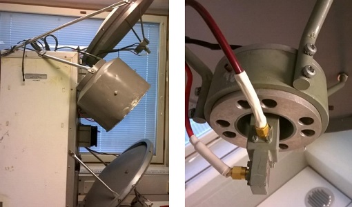
In this project an Airborne Wind Vector Scatterometer (AWVS) system was designed and built for measurements of sea surface backscattering from an aircraft.


