- All Categories (129)
- Data (31)
- News (50)
- Missions (4)
- Events (20)
- Tools (5)
- Campaigns (8)
- Documents (11)
News - Data Release news
New Ocean data and more boost CryoSat data platform
Eight new datasets have been added to the CS2EO platform to support, enhance, and simplify research using CryoSat data. They include the CryoSat Ocean Product, and the Cryo-TEMPO Land Ice, Sea Ice, Polar Ocean, Coastal Ocean and Inland Water datasets.
News - General News
ESA's improved Earth system data records: what is in store for the future?
Fundamental Data Records (FDRs) are instrumental in advancing our understanding of Earth systems and for addressing societal challenges effectively. These long-term records contain uncertainty-quantified, calibrated and geo-located multi-instrument/multi-platform satellite sensor data spanning several decades to support climate-related applications.
Document - Newsletter
Earth Online Newsletter - 08 March 2024
This issue of the Earth Online Newsletter covers a selection of the latest news and events from ESA.
News - Data Release news
FDR4ALT - ESA unveils new cutting-edge ERS/Envisat Altimeter and Microwave Radiometer Datasets
The European Space Agency (ESA) has developed a comprehensive suite of innovative Earth system data records as part of the Fundamental Data Records for Altimetry project - FDR4ALT.
Data - EO Sign In Authentication (Open)
Land Ice Thematic Data Product [ALT_TDP_LI]
This is the Land Ice Thematic Data Product (TDP) V1 resulting from the ESA FDR4ALT project and containing estimates of ice sheet surface elevation and associated uncertainties. The collection covers data for three different missions: ERS-1, ERS-2 and Envisat, and based on Level 1 data coming from previous reprocessing (ERS REAPER and the Envisat V3.0) but taking into account the improvements made at Level 0/Level 1 in the frame of FDR4ALT (ALT FDR). The Land Ice TDP focuses specifically on the ice sheets of Greenland and Antarctica, providing these data in different files. For many aspects, the Land Ice Level 2 and Level 2+ processing is very innovative: Improved relocation approach correcting for topographic effects within the beam footprint to identify the Point of Closest Approach Homogeneous timeseries of surface elevation measurements at regular along-track reference nodes. The FDR4ALT products are available in NetCDF format. Free standard tools for reading NetCDF data can be used. Information for expert altimetry users is also available in a dedicated NetCDF group within the products. Please consult the FDR4ALT Product User Guide before using the data. The FDR4ALT datasets represent the new reference data for the ERS/Envisat altimetry missions, superseding any previous mission data. Users are strongly encouraged to make use of these datasets for optimal results.
Data - Sample Data (Open)
CryoSat Data Samples
Download CryoSat data samples from Baseline-B, C, and D products.
News - Data Release news
CryoSat swath data boosted with new glacier regions and gridded products
Additional products have been added to CryoTEMPO-EOLIS Baseline 2, increasing global coverage and adding to the range of available gridded data.
News - Maintenance News
CryoSat CalVal server downtime on 27 February 2024
Due to routine maintenance activities on 27 February 2024, between 08:00-10:00 UTC, the distribution of CryoSat L0 products and AUX files may be impacted.
News - Operational News
Announcement for CryoSat Quaternions Product users
CryoSat users who use the Quaternions Products should be aware that the method to access these products is changing.
News - Operational News
Delay in the availability of CryoSat Products
A technical issue occurred at the CryoSat Payload Data Ground Segment (PDGS).
News - Data Release news
CryoSat Ice Baseline-E Reprocessed Data - Update
Previously, quality checks of the Ice Baseline-E reprocessing products observed a discrepancy in the metadata of products with incremented version numbers (E002, E003).
News - Success Stories
New CryoSat data to boost understanding of the oceans
A new CryoSat sea level anomaly product designed to enable ocean science and the development of operational marine applications has been released.
News - Data Release news
CryoSat Ice Baseline-E Reprocessed Data - Update
Quality checks of the Ice Baseline-E reprocessing products have observed a discrepancy in the metadata of products with incremented version numbers.
News - Data Release news
New CryoSat Ice Baseline-E Reprocessed Data – Available now!
The CryoSat Ice Baseline-E Reprocessing campaign is now complete.
Mission - Third Party Missions
FSSCat
The FSSCat mission was an innovative concept that consisted of two federated 6-Unit Cubesats, called ³Cat-5/A and ³Cat-5/B, which operated in support of the Copernicus Land and Marine Environment services.
News - Spotlight on EO community
Introducing the Aeolus and CryoSat missions
In this video, Tommaso Parrinello - Mission Manager of Aeolus and CryoSat - describes what is involved in managing the missions and the unique challenges offered by such innovative satellites.
News - General News
Stunning new features for ESA and NASA altimetry portal cs2eo.org
Working with combined ESA and NASA altimetry data is easier than ever thanks to a range of handy new features on cs2eo.org.
News - Success Stories
Robust airborne radar instrument aids CryoSat ice data
During the 12 years that ESA’s ice mission – CryoSat – has been monitoring Earth’s ice masses from space, simultaneous airborne measurements were made by ASIRAS.
News - Infographics
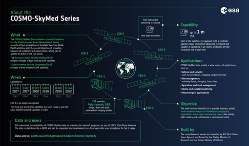
The COSMO-SkyMed series - Two generations of SAR satellites
Learn about the COSMO-SkyMed (Constellation of small Satellites for the Mediterranean basin Observation) series in our latest infographic.
News - Success Stories
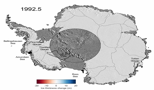
Decades of satellite data reveal the risks of climate tipping points
Decades-long time series that draw on ESA’s Earth observation archives are enabling scientists to uncover the threat of sudden and potentially irreversible changes to the icy parts of the planet.


