- All Categories (83)
- Data (16)
- News (24)
- Missions (3)
- Events (19)
- Tools (2)
- Activities (6)
- Campaigns (5)
- Documents (8)
News - General News

ESA's improved Earth system data records: what is in store for the future?
Fundamental Data Records (FDRs) are instrumental in advancing our understanding of Earth systems and for addressing societal challenges effectively. These long-term records contain uncertainty-quantified, calibrated and geo-located multi-instrument/multi-platform satellite sensor data spanning several decades to support climate-related applications.
Data - Sample Data (Open)
IRS-P6 (ResourceSat-1) Sample Data
Download free IRS-P6 (ResourceSat-1) sample datasets to preview products available for this mission.
News - Infographics
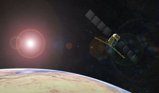
Showcasing the NovaSAR-1 radar satellite
Learn about the NovaSAR-1 mission in our new infographic.
News - Announcement of Opportunity updates
ESA encourages S-band applications with NovaSAR-1 Announcement of Opportunity
ESA is offering possibilities to develop new applications in the S-band microwave frequency range, with a new Announcement of Opportunity for NovaSAR-1 data, via ESA’s Third Party Mission programme.
Document - Campaign Report

FLEXSense 2019 Final Report
This report summarises the FLEXSense 2019 campaign.
Campaign
FLEXSense 2019
The FLEXSense 2019 campaign activities were undertaken in Germany and Italy with the goal of providing a complete set of high-resolution experimental data, including all relevant elements required for the preparation of the FLEX satellite mission.
Mission - Third Party Missions
NovaSAR-1
Launched on 16 September 2018, NovaSAR-1 features an S-band synthetic aperture radar (SAR) instrument offering a variety of modes with different resolutions and swath widths.
Data - Announcement of Opportunity (Restrained)
Announcement of Opportunity for NovaSAR-1
ESA is launching an Announcement of Opportunity for the international scientific community to access data from the NovaSAR-1 mission for science and EO-based applications development.
Data - Project Proposal (Restrained)
NovaSAR-1 new tasking
NovaSAR-1 new acquisition data are available in two baseline acquisition modes: Stripmap – provides the highest resolution of 6 metres with up to 20 km swath selected from a 150 km field of regard, available in single polarisation. ScanSAR – has a 20 - 30 metre resolution and up to 150 km swath. Available in single polarisation. Within each of the baseline modes there are a variety of mode options that vary according to ground range resolution, incidence angles, swath width and the number of looks: Acquisition Mode Polarisation Resolution (m) Swath Width (km) Incidence Angles Number of Looks Stripmap Single: HH 6 20 16.0 – 25.38° 3 (1 range, 3 azimuth) 13 – 20 21.29 – 31.2° Single: VV 6 20 16.0 – 25.38° 3 (1 range, 3 azimuth) 13 – 20 21.29 – 31.2° ScanSAR Single: HH 20 100 15.0 - 24.66° 4 (2 range, 2 azimuth) 50 24.51 - 28.94° Single: VV 20 100 15.0 – 24.66° 4 (2 range, 2 azimuth) 50 24.51 - 28.94° Single: HH 30 150 11.29 – 25.93° 4 (2 range, 2 azimuth) 55 27.35 - 32.01° Single: VV 30 150 11.29 – 25.93° 4 (2 range, 2 azimuth) 55 27.35 - 32.01° NovaSAR-1 data are provided as a Level 2 (ARD) product as standard, but the accompanying Level 1 data may also be requested. Level 1 – delivered as reconstructed, unprocessed instrument data at full resolution. Level 2 (ARD) – delivered as a processed product with applied radiometric and geometric corrections i.e. orthorectification and spatial registration: Geocoded Ellipsoid Corrected (GEC) – Maritime and ocean applications Geocoded Terrain Corrected (GTC) – Land applications and change detection Where available, associated automatic identification system (AIS) data may be requested alongside the NovaSAR-1 data products.
Event - Workshop

PROBA-1 CHRIS End of Mission Workshop
The PROBA-1 CHRIS End of Mission Workshop will take place from 18-19 January 2024 in Ghent, Belgium.
News - General News
SMOS Tools updates
Updates for two SMOS tools have been released, offering new features and improvements.
News - Spotlight on EO community

An overview of the SMOS mission
In this video, Klaus Scipal - Biomass and SMOS Mission Manager - talks about ESA's Soil Moisture and Ocean Salinity mission.
News - Success Stories
ESA missions help to reveal worldwide lake water loss trend
Climate change, human consumption and sedimentation are depleting more than half of the world’s biggest lakes of water, according to a ground-breaking analysis that drew on three decades of satellite data.
News - Success Stories
SMOS data reveal ecosystems' resistance to drought
Climate change is rapidly altering the world’s ecosystems, causing extreme weather conditions, such as droughts, to become increasingly frequent. Understanding the factors that contribute to ecosystem resilience to extreme events is vital to develop more effective strategies for climate adaptation and mitigation.
News - Infographics
Key facts about SMOS Level-1 and Level-2 science data
Learn about data products from the SMOS mission in our latest infographic.
News - Events and Proceedings
Scientists to showcase value of Earth observation data at EGU
Remote sensing scientists are getting ready to present innovative and exciting applications of satellite data at the European Geosciences Union general assembly which will take place from 24 to 28 April in Vienna, Austria.
Data - Fast Registration with immediate access (Open)
FSSCat products
The FSSCat collection provides hyperspectral data coverage over a number of locations around the world, as measured by the HyperScout 2 sensor. The FSSCat hyperspectral data products are comprised of 50 spectral bands, covering a spectral range of 450 – 950 nm with a spectral resolution of 18 nm (at FWHM). Imagery is available with an along-track ground sampling distance (GSD) of 75 m. To ensure a high degree of radiometric accuracy, HyperScout 2 data are validated through comparison with Sentinel-2 data products. The processing level of the data is L1C – calibrated top-of-atmosphere radiance, reflectance or brightness temperature. The raster type of the L1C data product is a GRID – a 2D or 3D raster where the (geo)location of the data is uniquely defined by the upper left pixel location of the raster and the pixel size of the raster, and the projection parameters of the raster (if georeferenced). The third dimension can e.g. be a spectral or third spatial dimension. The L-1C VNIR data product includes a hyperspectral cube of TOA reflectance in the VNIR range, as well as relevant meta-data that adheres to EDAP's best practice guidelines. This product consists of georeferenced and ortho-rectified image tiles that contain spectral reflectance data at the top-of-the-atmosphere. Each image tile contains radiometrically corrected and ortho-rectified band images that are projected onto a map, as well as geolocation information and the coordinate system used. Additionally, each image pixel provides TOA spectral reflectance data in scaled integers, conversion coefficients for spectral radiance units, viewing and solar zenith and azimuth angles, and quality flags.
Activity - Projects
ESA's multi-level global thermosphere data products consistent with Swarm and GRACE (-FO)
In this project, the possibility of using the space-based along-track Thermospheric Neutral Density (TND) estimates for generating the European Space Agency (ESA)'s Level 3 (L3) global multi-level TND data products is assessed.
Activity - Projects

Swarm Ionospheric Polar Electrodynamics
The goal of the Swarm ionospheric polar electrodynamics (SWIPE) project is to create and disseminate the most advanced models of high-latitude Joule dissipation, ionospheric convection, and ionospheric conductances.
News - Thematic area articles
Monitoring water on Earth's surface
ESA's Earth observation satellites are playing a leading role in furthering our understanding of how Earth's terrestrial hydrosphere is being influenced by humankind.