- All Categories (34)
- Data (5)
- News (12)
- Missions (2)
- Events (13)
- Campaigns (1)
- Documents (1)
Event - Conference

3rd ERS Symposium
The ESA Directorate for Observation of the Earth and its Environment held the 3rd ERS Symposium, in 1997, where many of the results from the ERS-1 and ERS-2 missions were presented and discussed by the scientific community.
Event - Workshop

3rd CHRIS PROBA Workshop
This 2005 workshop was on the treatment of Compact High Resolution Images Spectrometer (CHRIS) data.
Event - Workshop
4th CHRIS PROBA Workshop
Workshop on the treatment of Compact High Resolution Images Spectrometer (CHRIS) data.
Event - Workshop
POLinSAR 2009
The 2009 workshop focused on theory and methods in the fields of SAR Polarimetry and Polarimetric Interferometry
Mission - Third Party Missions

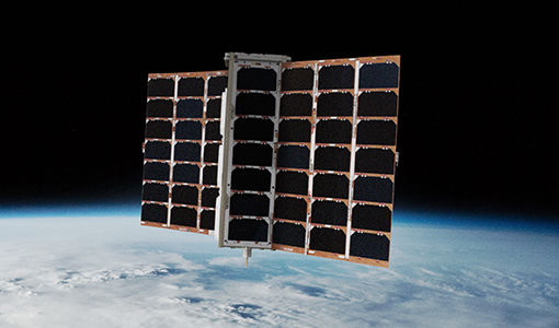
ICEYE
As of June 2023, 27 X-band Synthetic Aperture Radar (SAR) satellites have been launched for the ICEYE constellation. This enables all-weather Earth observation.
Mission - Third Party Missions
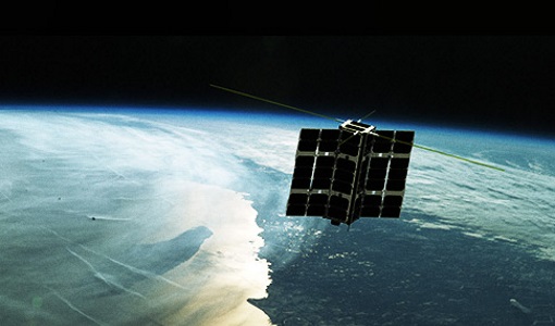
Spire
Spire Global's constellation of Lemur nanosatellites offer satellite-based maritime, aviation and weather tracking.
Event - Meeting

3rd Sentinel-2 Validation Team Meeting
This Sentinel-2 Validation Team (S2VT) meeting was the third edition of a meeting series, initiated in 2016. The S2VT is organised under the auspices of ESA, CNES, and ENSEEIHT.
Event - Workshop
POLinSAR 2019
ESA organised POLinSAR 2019, the 9th International Workshop on Science and Applications of SAR Polarimetry and Polarimetric Interferometry.
Campaign
CHARADMexp
The ESA CHARADMExp campaign focuses on marine and marine-dust aerosol mixture characterisation.
Data - Project Proposal (Restrained)
COSMO-SkyMed full archive and tasking
The archive and new tasking X-band SAR products are available from COSMO-Skymed (CSK) and COSMO-SkyMed Second Generation (CSG) missions in ScanSAR and Stripmap modes, right and left looking acquisition (20 to 60° incidence angle). COSMO-SkyMed modes: Acquisition Mode Single look Resolution [Az. X. Rg, SCS] (m) Scene size [Az. X. Rg] (km) Polarisation Scene duration (seconds) Number of looks Multilook resolution (m) Geolocation accuracy ±3 s (m) [DGM, GEC, GTC] Stripmap Himage 2.6 x 3 40 x 40 Single: HH, HV, VH, VV 7 3 5 25 Stripmap PingPong 9.7 x 11 30 x 30 Alternate: HH/VV, HH/HV, VV/VH 6 3 20 25 ScanSAR Wide 23 x 13.5 100 x 100 Single: HH, HV, VH, VV 15 4 - 9 30 30 ScanSAR Huge 38 x 13.5 200 x 200 Single: HH, HV, VH, VV 30 25 - 66 100 100 COSMO-Skymed Second Generation Modes: Acquisition Mode Single look Resolution [Az. X. Rg, SCS] (m) Scene size [Az. X. Rg] (km) Polarisation Scene duration (seconds) Number of looks Multilook resolution (m) Geolocation accuracy ±3σ (m) [DGM, GEC, GTC] Stripmap 3 x 3 40 x 40 Single (HH, VV, HV, VH) or Dual (HH+HV, VV+VH) 7 2 x 2 4 x 4 6 x 7 11 x 14 3.75 Stripmap PingPong 12 x 5 30 x 30 Alternate (HH/VV, HH/HV+VV/VH) 6 1 x 2 2 x 5 12 x 10 23 x 26 12 QuadPol 3 x 3 40 x 15 Quad (HH+HV+VV+VH) N/A 2 x 2 4 x 4 6 x 7 11 x 14 3.75 ScanSAR 1 20 x 4 100 x 100 Single (HH, VV, HV, VH) or Dual (HH+HV, VV+VH) 15 1 x 3 1 x 5 2 x 8 20 x 14 23 x 27 35 x 40 12 ScanSAR 2 40 x 6 200 x 200 Single (HH, VV, HV, VH) or Dual (HH+HV, VV+VH) 30 1 x 4 1 x 7 3 x 16 40 x 27 47 x 54 115 x 135 12 Following Processing Levels are available, for both CSK and CSG: SCS (Level 1A, Single-look Complex Slant): Data in complex format, in slant range projection (the sensor's natural acquisition projection) and zero doppler projection, weighted and radiometrically equalised; the coverage corresponds to the full resolution area illuminated by the SAR instrument DGM (Level 1B, Detected Ground Multi-look): Product obtained detecting, multi-looking and projecting the Single-look Complex Slant data onto a grid regular in ground: it contains focused data, amplitude detected, optionally despeckled by multi-looking approach, radiometrically equalised and represented in ground/azimuth projection GEC (Level 1C, Geocoded Ellipsoid Corrected): Focused data, amplitude detected, optionally despeckled by multi-looking approach, geolocated on the reference ellipsoid and represented in a uniform preselected cartographic presentation. Any geometric correction derived by usage of terrain model isn't applied to this product by default GTC (Level 1D, Geocoded Terrain Corrected): Focused data, fully calibrated with the usage of terrain model, amplitude detected, optionally despeckled by multi-looking approach, geolocated on a DEM and represented in a uniform preselected cartographic presentation. The image scene is located and accurately rectified onto a map projection, through the use of Ground Control Points (GCPs) and Digital Elevation Model (DEM); it differs from GEC for the use of the DEM (instead of reference ellipsoid) for the accurate conversion from slant to ground range and to approximate the real earth surface. The list of available data can be retrieved using the CLEOS COSMO-SkyMed products catalogue. User registration is required to use the catalogue. As per ESA policy, very high-resolution data over conflict areas cannot be provided.
Data - Project Proposal (Restrained)
COSMO-SkyMed ESA archive
The COSMO-SkyMed archive collection consists of COSMO-SkyMed products requested by ESA supported projects over their areas of interest around the world. The dataset regularly grows as ESA collects new products over the years. The following list delineates the characteristics of the SAR measurement modes that are disseminated under ESA Third Party Missions (TPM). STRIPMAP HIMAGE (HIM): Achieving medium resolution (3 m x 3 m single look), wide swath imaging (swath extension ≥40 km). STRIPMAP PINGPONG (SPP): Achieving medium resolution (15 m), medium swath imaging (swath ≥30 km) with two radar polarization's selectable among HH, HV, VH and VV. SCANSAR WIDE (SCW): Achieving radar imaging with swath extension of 100 x 100 km2 and a spatial resolution of 30 x 30 m2. SCANSAR HUGE (SCH): Achieving radar imaging with swath extension of 200 x 200 km2 and a spatial resolution selectable of 100 x 100 m2. Processing Levels: Level 1A - Single-look Complex Slant - (SCSB and SCSU): RAW data focused in slant range-azimuth projection, that is the sensor natural acquisition projection; product contains In-Phase and Quadrature of the focused data, weighted and radiometrically equalised.The processing of the 1A_SCSU product differs from that of the 1A_SCSB product for the following features:a non-weighted processing is performed, which means that windowing isn't applied on the processed bandwidth; radiometric equalisation (in terms of compensation of the range antenna pattern and incidence angle) is not performed; hence only compensation of the antenna transmitter gain and receiver attenuation and range spreading loss is applied. Level 1B - Detected Ground Multi-look (DGM): Product obtained detecting, multi-looking and projecting the Single-look Complex Slant data onto a grid regular in ground. Spotlight Mode products are not multi-looked. Level 1C - Geocoded Ellipsoid Corrected (GEC) and Level 1D - Geocoded Terrain Corrected (GTC): Obtained projecting the Level 1A product onto a regular grid in a chosen cartographic reference system. In case of Lev 1C the surface is the earth ellipsoid while for the Lev 1D a DEM (Digital Elevation Model) is used to approximate the real earth surface. Spatial coverage: Check the spatial coverage of the collection on a map available on the Third Party Missions Dissemination Service. As per ESA policy, very high-resolution data over conflict areas cannot be provided.
Data - EO Sign In Authentication (Open)
SMOS L3 Daily Wind Speed
SMOS L3WS products are daily composite maps of the collected SMOS L2 swath wind products for a specific day, provided with the same grid than the Level 2 wind data (SMOS L2WS NRT) but separated into ascending and descending passes. This product is available the day after sensing from Ifremer, in NetCDF format. Before using this dataset, please check the read-me-first note available in the Resources section below.
Data - EO Sign In Authentication (Open)
SMOS NRT L2 Swath Wind Speed
SMOS retrieved surface wind speed gridded maps (with a spatial sampling of 1/4 x 1/4 degrees) are available in NetCDF format. Each product contains parts of ascending and descending orbits and it is generated by Ifremer, starting from the SMOS L1B data products, in Near Real Time i.e. within 4 to 6 hours from sensing time. Before using this dataset, please check the read-me-first note available in the Resources section below.
Data - EO Sign In Authentication (Open)
SMOS Tropical Cyclone Wind Radii Fixes
The SMOS WRF product is available in Near Real Time to support tropical cyclones (TC) forecasts. It is generated within 4 to 6 hours from sensing from the SMOS L2 swath wind speed products, in the so-called "Fix (F-deck)" format compatible with the US Navy's ATCF (Automated Tropical Cyclone Forecasting) System. The SMOS WRF "fixes" to the best-track forecasts contain: the SMOS 10-min maximum-sustained winds (in knots) and wind radii (in nautical miles) for the 34 kt (17 m/s), 50 kt (25 m/s) and 64 kt (33 m/s) winds per geographical storm quadrants, and for each SMOS pass intercepting a TC in all the active ocean basins.
Event - Workshop

SEASAR 2012
The European Space Agency and the Norwegian Space Centre jointly organised the fourth SAR oceanography workshop, 'SEASAR 2012', entitled 'Advances in SAR Oceanography'.
News - Data Release news
Spire data now open to users
Following the submission of a project proposal, data from the Spire mission are now available.
Document - Technical Note

ICEYE-Terms-Of-Applicability.pdf
This document contains the Terms of Applicability for accessing data from the ICEYE Third Party Mission.
News - Data Release news
ICEYE data familiarization phase for the Earthnet TPM programme continues with new ICEYE-X2 data
The ICEYE data familiarization phase freely offers ICEYE imagery over several demonstration sites
Event - Workshop
Aquaculture User Consultation
The main goal of the workshop was to define a detailed set of user requirements for the future ESA Aquaculture project.
Event - Workshop
Insurance Industry Workshop on Earth Observation
This ESA workshop examined the potential value of satellite Earth Observation data to the insurance industry.