- All Categories (191)
- News (8)
- Missions (5)
- Events (2)
- Tools (4)
- Activities (1)
- Campaigns (1)
- Documents (170)
Document - General Reference

The Nine Candidate Earth Explorer Missions - Topography Mission
This report for assessment addresses the Topography mission when it was selected with other nine Earth Explorer missions as a potential candidate for Phase A study.
Document - General Reference
The Science and Research Elements of ESA Living Planet Programme
This document presents the plans for the Earth Explorer element of the European Space Agency's 'Living Planet' Programme for Earth Observation.
Document - General Reference
Further-Achievements-of-the-ERS-Missions.pdf
This publication shows how with time the various uses of ERS data are developing and consolidating in key areas of science and economic exploitation.
Document - General Reference
CoReH2O-Report-for-Mission-Selection-An-Earth-Explorer-to-observe-snow-and-ice.pdf
This report describes the CoReH2O (Cold Regions Hydrology high-resolution Observatory) mission, which was selected for feasibility study in the third cycle of Earth Explorers.
Document - General Reference
The-Changing-Earth-New-Scientific-Challenges-for-ESAs-Living-Planet-Programme.pdf
This article is extracted from ESA Bulletin Nr. 129.
Event - Conference

3rd ERS Symposium
The ESA Directorate for Observation of the Earth and its Environment held the 3rd ERS Symposium, in 1997, where many of the results from the ERS-1 and ERS-2 missions were presented and discussed by the scientific community.
News - Success Stories
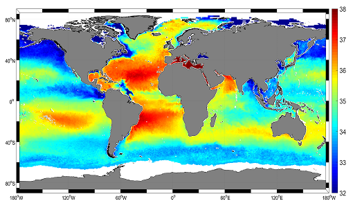
Mapping salty waters
The length and precision with which climate scientists can track the salinity, or saltiness, of the oceans is set to improve dramatically.
Tools - Processing
SMOS NetCDF Conversion Tool
The SMOS NetCDF Conversion Tool, for batch processing of large amounts of files, is available as a stand-alone command line executable or integrated in the SMOS Toolbox/SNAP.
Event - Workshop

Workshop on International Cooperation in Spaceborne Imaging Spectroscopy
The workshop aimed to recommend future international coordination permitting cooperation in the deployment, operation, and exploitation of space-based imaging spectrometers for terrestrial and coastal scientific and operational applications.
Document - Proceedings

2004 Envisat and ERS Symposium
The 2004 Envisat and ERS Symposium was held in Salzburg - Austria from 6 to 10 September 2004. The 2004 Envisat and ERS Symposium provided a forum for investigators to present results of ongoing research project activities and assess the development of applications and services.
Document - General Reference
DRAGON 2 Programme - Brochure 2009
The Dragon Programme is a cooperation between ESA and the Ministry of Science and Technology (MOST) of the P.R. China. This brochure presents the activities undertaken since the formal start of the programme in April 2009, its background, objectives, partners and project themes.
Tools - Visualisation
SMOS Global Mapping Tool
The SMOS Global Mapping Tool (GMT) is useful for plotting the SMOS data into a single global geographical map.
Mission - Heritage Missions

NOAA POES
NOAA's AVHRR sensor is carried on the POES mission, a constellation of polar orbiting weather satellites.
Campaign

DOMEX-1
The purpose of the DOMEX experiment was to acquire the first combined, in-situ microwave emission measurements using C- and L-band radiometers.
Mission - Heritage Missions

ERS
The ERS programme was composed of two missions, ERS-1 and ERS-2, which together observed the Earth for 20 years, from 1991 to 2011.
Mission - Heritage Missions

Envisat
Envisat was ESA's successor to ERS. Envisat carried ten instruments aboard for a wide range of Earth observing fields. The mission was operational from 2002 to 2012.
Mission - Earth Explorers

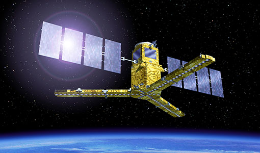
SMOS
The Soil Moisture and Ocean Salinity (SMOS) mission is dedicated to making global observations of soil moisture over land and salinity over oceans.
Tools - Apps

Heritage Missions app for Android
Download the Heritage Missions application to discover what the missions were about, how it worked and what the elements of the space and ground segment that make these missions unique.