- All Categories (333)
- Data (13)
- News (11)
- Missions (4)
- Events (8)
- Tools (7)
- Activities (4)
- Documents (286)
Document - General Reference
Two Years of ERS-1 Data Exploitation
This bulletin reports on the first two years of the ERS-1 satellite.
News - Thematic area articles
Transforming space data into climate action
ESA’s Earth observation activities are playing a key role in the revitalised global drive to combat climate change.
Document - Product Cal/Val Plan/Report
The-Calibration-of-the-ERS-1-Radar-Altimeter.pdf
This report describes the calibration of ERS-1's Radar Altimeter during the commissioning phase, which used Venice as a basis for calibration.
Document - Product Cal/Val Plan/Report
The ERS SPTR2000 Altimetric Range Correction- Results and Validation
Document - Technical Note
Technical-Note-on-Data-Flows-and-Volumes-between-ISS-and-Other-Entities-of-the-ERS-1-Ground-Segment.pdf
This document lists all the messages exchanged between the Interface Subset (ISS) and the other entities of the ERS-1 Ground Segment.
Document - General Reference
Taking-the-Measure-of-Earth-Fifteen-Years-of-Progress-in-Radar-Altimetry.pdf
This article is extracted from ESA Bulletin Nr. 128.
Data - Project Proposal (Restrained)
SPOT-6 to 7 full archive and tasking
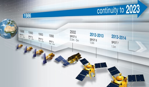
The SPOT 6 and 7 satellites ensure data continuity with the no longer operational SPOT 5 satellite and provide an archive of very high resolution optical acquisition as well as the possibility to task the satellites for new acquisitions. Following the completion of the SPOT 7 mission in March 2023, new acquisition tasking is only available for the SPOT 6 satellite. The ortho-products are automatically generated by the SPOT 6 and 7 ground segment, based on SRTM database or Reference3D when available. The projection available for SPOT 6 and 7 ortho-products is UTM, datum WGS84. Bands combinations: Pansharpened: colour image at 1.5 m resolution Bundle: 1.5 m panchromatic image and 6 m multispectral image. Geometric processing levels: Primary: The Primary product is the processing level closest to the natural image acquired by the sensor. This product restores perfect collection conditions: the sensor is placed in rectilinear geometry, and the image is clear of all radiometric distortion. Standard Ortho: The Ortho product is a georeferenced image in Earth geometry, corrected from acquisition and terrain off-nadir effects. Tailored ortho: Aside from the Standard Ortho product, when different specifications are needed, a custom orthorectification, with a more precise 3D model provided by the client or acquired for the purpose, can be provided on demand. As per ESA policy, very high-resolution imagery of conflict areas cannot be provided.
Mission - Heritage Missions
SPOT 7
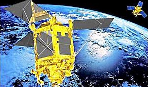
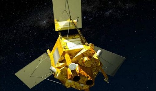
SPOT 7 (also known as Azersky), like all of the other SPOT missions, was aimed at supplying high-resolution, wide-area optical imagery.
Data - Fast Registration with approval (Restrained)
SPOT 6 and 7 ESA archive
The SPOT 6 and 7 ESA archive is a dataset of SPOT 6 and SPOT 7 products that ESA collected over the years. The dataset regularly grows as ESA collects new SPOT 6 and 7 products. SPOT 6 and 7 Primary and Ortho products can be available in the following modes: Panchromatic image at 1.5m resolution Pansharpened colour image at 1.5m resolution Multispectral image in 4 spectral bands at 6m resolution Bundle (1.5m panchromatic image + 6m multispectral image) Spatial coverage: Check the spatial coverage of the collection on a map available on the Third Party Missions Dissemination Service. As per ESA policy, very high-resolution imagery of conflict areas cannot be provided.
Mission - Third Party Missions
SPOT 6
SPOT 6, like all the SPOT missions, is aimed at supplying high-resolution, wide-area optical imagery.
News - General News
SPOT 1 to 5 production now suspended
Following the news of 14 May 2020, Airbus will now suspend the production of SPOT 1 to 5 data.
Mission - Heritage Missions
SPOT
The SPOT (from French "Satellite pour l'Observation de la Terre") series of missions has been supplying high-resolution, wide-area optical imagery since 1986.
Data - EO Sign In Authentication (Open)
Sea Ice Thematic Data Product [ALT_TDP_SI]
This is the Sea Ice Thematic Data Product (TDP) V1 resulting from the ESA FDR4ALT project and containing the sea ice related geophysical parameters, along with associated uncertainties: snow depth, radar and sea-ice freeboard, sea ice thickness and concentration. The collection covers data for the ERS-1, ERS-2 and Envisat missions, and bases on Level 1 data coming from previous reprocessing (ERS REAPER and the Envisat V3.0) but taking into account the improvements made at Level 0/Level 1 in the frame of FDR4ALT (ALT FDR). The Sea Ice TDP provides data from the northern or southern hemisphere in two files corresponding to the Arctic and Antarctic regions respectively for the winter periods only, i.e., October to June for the Arctic, and May to November for the Antarctic. For many aspects, the Sea Ice TDP is very innovative: First time series of sea-ice thickness estimates for ERS Homogeneous calibration, allowing the first Arctic radar freeboard time series from ERS-1 (1991) to CryoSat-2 (2021) Uncertainties estimated along-track with a bottom-up approach based on dominant sources ERS pulse blurring error corrected using literature procedure [Peacock, 2004] The FDR4ALT products are available in NetCDF format. Free standard tools for reading NetCDF data can be used. Information for expert altimetry users is also available in a dedicated NetCDF group within the products. Please consult the FDR4ALT Product User Guide before using the data. The FDR4ALT datasets represent the new reference data for the ERS/Envisat altimetry missions, superseding any previous mission data. Users are strongly encouraged to make use of these datasets for optimal results.


