- All Categories (59)
- Data (5)
- News (33)
- Missions (3)
- Tools (5)
- Activities (1)
- Documents (12)
Document - Technical Note
Visual Inspection Report for PlanetScope (SuperDOVE)
Visual Inspection Report for PlanetScope (SuperDOVE)
News - Events and Proceedings
VHR Data Quality in the limelight
In recent years, the satellite landscape has steadily expanded with a variety of very high resolution (VHR) commercial satellites, also emerging from new space providers. A result of this growth is an increased need to address data quality assurance.
News - Data Release news
Two new ESA archive collections have been opened for PlanetScope and SkySat
PlanetScope ESA archive and SkySat ESA archive collections are available through ESA’s Third Party Missions programme via Fast Approval Registration.
Document - User Guide
TPM-L-OADS-dissemination-service-User-Manual.pdf
This guide describes the Third Party Missions Dissemination System.
News - Success Stories
TPM data help advance plastic litter detection from space
Several innovative ESA Discovery element projects exploring remote sensing of plastic marine litter lean on commercial satellite data disseminated via the Agency’s Third Party Mission programme.
News - General News
Three new Third Party Missions under evaluation
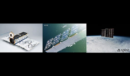
ICEYE, PlanetScope and Spire under evaluation. Interested users can investigate suitability of the data for scientific and R&D activities.
Document - General Reference
Third Party Missions Brochure
This brochure summarises ESA's Third Party Missions programme, providing a timeline and examples of content related to some of the missions.
Document - Technical Note
Technical Note on Quality Assessment for PlanetScope (SuperDOVE)
Technical Note on Quality Assessment for PlanetScope (SuperDOVE)
Document - Technical Note
Technical Note on Quality Assessment for PlanetScope (DOVE-R)
Technical Note on Quality Assessment for PlanetScope (DOVE-R)
News - Success Stories
Showcasing success stories from ESA's Third Party Missions
ESA’s Third Party Missions programme consists of more than 50 missions from around the world.
Tools - Analysis
Sentinel-2 Toolbox
The Toolbox consists of a rich set of visualisation, analysis and processing tools for the exploitation of optical high-resolution products including the Sentinel-2 MSI sensor.
News - Thematic area articles
Satellites investigate Earth’s terrestrial hydrosphere
ESA’s Earth observation satellites are playing a leading role in furthering our understanding of how Earth’s water cycle is being influenced by humankind.
News - Thematic area articles
Satellite data boost global understanding of land surface
Understanding our changing land surface is essential in the study of climate change. Satellites are used to monitor changes to the material that covers Earth’s surface, so-called land cover, such as vegetation and water.
News - Data Release news
Sample data products from ESA’s Third Party Missions
Samples of data products from a range of Third Party Missions are now available to download, offering a preview of what these missions provide.
News - Thematic area articles
Remote sensing data underpin research on soil
Environmental data disseminated by ESA’s Earth observation programmes provide knowledge about the stresses on Earth’s soils – aiding many applications such as crop management, drought and flood forecasting, and ecosystem protection.
News - Thematic area articles
Remote sensing data map impacts of natural hazards
As climate change increases the frequency and severity of natural disasters, remote sensing data can warn about extreme events and help tackle emergency situations.
News - Success Stories
Predicting crop yield using Planet data
The world’s population continues to grow, while the climate crisis is raising Earth’s temperatures and increasing the likelihood of extreme weather events – all of which affect food security.
Data - Sample Data (Open)
PlanetScope Sample Data
Download free PlanetScope sample datasets to preview products available for this mission.
Data - Fast Registration with approval (Restrained)
PlanetScope Full Archive
The PlanetScope Level 1B Basic Scene and Level 3B Ortho Scene full archive products are available as part of Planet imagery offer. The Unrectified Asset: PlanetScope Basic Analytic Radiance (TOAR) product is a Scaled Top of Atmosphere Radiance (at sensor) and sensor corrected product, without correction for any geometric distortions inherent in the imaging processes and is not mapped to a cartographic projection. The imagery data is accompanied by Rational Polynomial Coefficients (RPCs) to enable orthorectification by the user. This kind of product is designed for users with advanced image processing and geometric correction capabilities. Basic Scene Product Components and Format Product Components Image File (GeoTIFF format) Metadata File (XML format) Rational Polynomial Coefficients (XML format) Thumbnail File (GeoTIFF format) Unusable Data Mask UDM File (GeoTIFF format) Usable Data Mask UDM2 File (GeoTIFF format) Bands 4-band multispectral image (blue, green, red, near-infrared) or 8-band (coastal-blue, blue, green I, green, yellow, red, Rededge, near-infrared) Ground Sampling Distance Approximate, satellite altitude dependent Dove-C: 3.0 m-4.1 m Dove-R: 3.0 m-4.1 m SuperDove: 3.7 m-4.2 m Accuracy <10 m RMSE The Rectified assets: The PlanetScope Ortho Scene product is radiometrically-, sensor- and geometrically- corrected and is projected to a UTM/WGS84 cartographic map projection. The geometric correction uses fine Digital Elevation Models (DEMs) with a post spacing of between 30 and 90 metres. Ortho Scene Product Components and Format Product Components Image File (GeoTIFF format) Metadata File (XML format) Thumbnail File (GeoTIFF format) Unusable Data Mask UDM File (GeoTIFF format) Usable Data Mask UDM2 File (GeoTIFF format) Bands 3-band natural colour (red, green, blue) or 4-band multispectral image (blue, green, red, near-infrared) or 8-band (coastal-blue, blue, green I, green, yellow, red, RedEdge, near-infrared) Ground Sampling Distance Approximate, satellite altitude dependent Dove-C: 3.0 m-4.1 m Dove-R: 3.0 m-4.1 m SuperDove: 3.7 m-4.2 m Projection UTM WGS84 Accuracy <10 m RMSE PlanetScope Ortho Scene product is available in the following: PlanetScope Visual Ortho Scene product is orthorectified and colour-corrected (using a colour curve) 3-band RGB Imagery. This correction attempts to optimise colours as seen by the human eye providing images as they would look if viewed from the perspective of the satellite. PlanetScope Surface Reflectance product is orthorectified, 4-band BGRN or 8-band Coastal Blue, Blue, Green I, Green, Yellow, Red, RedEdge, NIR Imagery with geometric, radiometric and corrected for surface reflection. This data is optimal for value-added image processing such as land cover classifications. PlanetScope Analytic Ortho Scene Surface Reflectance product is orthorectified, 4-band BGRN or 8-band Coastal Blue, Blue, Green I, Green, Yellow, Red, RedEdge, NIR Imagery with geometric, radiometric and calibrated to top of atmosphere radiance. As per ESA policy, very high-resolution imagery of conflict areas cannot be provided.
Data - Project Proposal (Restrained)
PlanetScope ESA archive
The PlanetScope ESA archive collection consists of PlanetScope products requested by ESA supported projects over their areas of interest around the world and that ESA collected over the years. The dataset regularly grows as ESA collects new products. Three product lines for PlanetScope imagery are offered, for all of them the Ground Sampling Distance at nadir is 3.7 m (at reference altitude 475 km). EO-SIP Product Type Product description Processing Level PSC_DEF_S3 3 bands – Analytic and Visual - Basic and Ortho Scene level 1B and 3B PSC_DEF_S4 4 bands – Analytic and Visual - Basic and Ortho Scene level 1B and 3B PSC_DEF_OT 3 bands, 4 bands and 5 bands – Analytic and Visual - Ortho Tile level 3A The Basic Scene product is a single-frame scaled Top of Atmosphere Radiance (at sensor) and sensor-corrected product. The product is not orthorectified or corrected for terrain distortions, radiometric and sensor corrections are applied to the data. The Ortho Scenes product is a single-frame scaled Top of Atmosphere Radiance (at sensor) or Surface Reflectance image product. The product is radiometrically, sensor and geometrically corrected and is projected to a cartographic map (UTM/WGS84). The Ortho Tiles are multiple orthorectified scenes in a single strip that have been merged and then divided according to a defined grid. Radiometric and sensor corrections are applied, the imagery is orthorectified and projected to a UTM projection. Spatial coverage: Check the spatial coverage of the collection on a map available on the Third Party Missions Dissemination Service. As per ESA policy, very high-resolution imagery of conflict areas cannot be provided.
