- All Categories (19)
- Data (2)
- News (13)
- Missions (2)
- Tools (1)
- Documents (1)
News - Thematic area articles
How to use space data to probe humankind’s ancient past
Data disseminated by ESA’s Third Party Missions (TPM) programme are enabling archaeological investigations that could help to unravel the mysteries of past societies and cultures.
News - Success Stories
TPM data help advance plastic litter detection from space
Several innovative ESA Discovery element projects exploring remote sensing of plastic marine litter lean on commercial satellite data disseminated via the Agency’s Third Party Mission programme.
News - Thematic area articles
Remote sensing data map impacts of natural hazards
As climate change increases the frequency and severity of natural disasters, remote sensing data can warn about extreme events and help tackle emergency situations.
News - Thematic area articles

Satellites investigate Earth’s terrestrial hydrosphere
ESA’s Earth observation satellites are playing a leading role in furthering our understanding of how Earth’s water cycle is being influenced by humankind.
News - Thematic area articles

How satellite data help to shape society
Data from ESA’s Earth observation archives are improving understanding of the interactions between human activities and the environment, helping to power green economic development and boosting prosperity in Europe and beyond.
News - Data Release news

Two new ESA archive collections have been opened for PlanetScope and SkySat
PlanetScope ESA archive and SkySat ESA archive collections are available through ESA’s Third Party Missions programme via Fast Approval Registration.
News - Data Release news

PlanetScope and Skysat data available through ESA’s Third Party Missions Programme
Through ESA’s Third Party Missions Programme, researchers, scientists and companies from around the world can apply to access Planet’s high-frequency, high-resolution satellite data for non-commercial use.
News - Success Stories

Predicting crop yield using Planet data
The world’s population continues to grow, while the climate crisis is raising Earth’s temperatures and increasing the likelihood of extreme weather events – all of which affect food security.
News - Infographics

PlanetScope and SkySat - The high-resolution nanosatellite constellation
Find out more about the PlanetScope and SkySat missions in our new infographic.
News - Success Stories

New open-source Python library improves rapid mapping services
In emergency services, rapid response is paramount. ICube-SERTIT’s Rapid Mapping Service provides near real-time delivery of geo-information to help emergency services respond quickly to disasters such as flooding, fires and landslides. A new Python open-source library, called EOReader, speeds up this mapping response by enabling the easy opening of imagery from multiple satellite sensors, both optical and synthetic aperture radar (SAR).
News - Infographics

An overview of ESA's Third Party Missions programme
ESA’s Third Party Missions programme consists of almost 50 satellite missions, which are owned by organisations around the world. ESA has agreements with these organisations to acquire, process, and distribute data from their missions
Tools - Other

Geohazards TEP
The Geohazards Thematic Exploitation Platform (TEP) aims to provide Earth observation data for supporting geohazards applications.
Data - EO Sign In Authentication (Open)
KOMPSAT-2 ESA archive
KOMPSAT-2 ESA archive collection is composed by bundle (Panchromatic and Multispectral separated images) products from the Multi-Spectral Camera (MSC) onboard KOMPSAT-2 acquired from 2007 to 2014: 1m resolution for PAN, 4m resolution for MS. Spectral Bands: Spectral Band Application PAN 500 – 900 nm Locate, identify and measure surface features and objects primarily by their physical appearance MS1 Blue 450 – 520 nm Mapping shallow water, differentiating soil from vegetation MS2 Green 520 - 600 nm Differentiating vegetation by health MS3 Red 630 - 690 nm Differentiating vegetation by species MS4 NIR 760 – 900 nm Mapping vegetation, mapping vegetation vigor/health, Differentiating vegetation by species Spatial coverage: Check the spatial coverage of the collection on a map available on the Third Party Missions Dissemination Service.
Data - Fast Registration with approval (Restrained)
PlanetScope Full Archive
The PlanetScope Level 1B Basic Scene and Level 3B Ortho Scene full archive products are available as part of Planet imagery offer. The Unrectified Asset: PlanetScope Basic Analytic Radiance (TOAR) product is a Scaled Top of Atmosphere Radiance (at sensor) and sensor corrected product, without correction for any geometric distortions inherent in the imaging processes and is not mapped to a cartographic projection. The imagery data is accompanied by Rational Polynomial Coefficients (RPCs) to enable orthorectification by the user. This kind of product is designed for users with advanced image processing and geometric correction capabilities. Basic Scene Product Components and Format Product Components Image File (GeoTIFF format) Metadata File (XML format) Rational Polynomial Coefficients (XML format) Thumbnail File (GeoTIFF format) Unusable Data Mask UDM File (GeoTIFF format) Usable Data Mask UDM2 File (GeoTIFF format) Bands 4-band multispectral image (blue, green, red, near-infrared) or 8-band (coastal-blue, blue, green I, green, yellow, red, Rededge, near-infrared) Ground Sampling Distance Approximate, satellite altitude dependent Dove-C: 3.0 m-4.1 m Dove-R: 3.0 m-4.1 m SuperDove: 3.7 m-4.2 m Accuracy <10 m RMSE The Rectified assets: The PlanetScope Ortho Scene product is radiometrically-, sensor- and geometrically- corrected and is projected to a UTM/WGS84 cartographic map projection. The geometric correction uses fine Digital Elevation Models (DEMs) with a post spacing of between 30 and 90 metres. Ortho Scene Product Components and Format Product Components Image File (GeoTIFF format) Metadata File (XML format) Thumbnail File (GeoTIFF format) Unusable Data Mask UDM File (GeoTIFF format) Usable Data Mask UDM2 File (GeoTIFF format) Bands 3-band natural colour (red, green, blue) or 4-band multispectral image (blue, green, red, near-infrared) or 8-band (coastal-blue, blue, green I, green, yellow, red, RedEdge, near-infrared) Ground Sampling Distance Approximate, satellite altitude dependent Dove-C: 3.0 m-4.1 m Dove-R: 3.0 m-4.1 m SuperDove: 3.7 m-4.2 m Projection UTM WGS84 Accuracy <10 m RMSE PlanetScope Ortho Scene product is available in the following: PlanetScope Visual Ortho Scene product is orthorectified and colour-corrected (using a colour curve) 3-band RGB Imagery. This correction attempts to optimise colours as seen by the human eye providing images as they would look if viewed from the perspective of the satellite. PlanetScope Surface Reflectance product is orthorectified, 4-band BGRN or 8-band Coastal Blue, Blue, Green I, Green, Yellow, Red, RedEdge, NIR Imagery with geometric, radiometric and corrected for surface reflection. This data is optimal for value-added image processing such as land cover classifications. PlanetScope Analytic Ortho Scene Surface Reflectance product is orthorectified, 4-band BGRN or 8-band Coastal Blue, Blue, Green I, Green, Yellow, Red, RedEdge, NIR Imagery with geometric, radiometric and calibrated to top of atmosphere radiance. As per ESA policy, very high-resolution imagery of conflict areas cannot be provided.
News - General News

Three new Third Party Missions under evaluation
ICEYE, PlanetScope and Spire under evaluation. Interested users can investigate suitability of the data for scientific and R&D activities.
News - Data Release news

PlanetScope and SkySat data now available
PlanetScope and SkySat missions under evaluation. Interested users can investigate suitability of the data for scientific and R&D activities.
Document - General Reference

The International Charter- Space and Major Disasters
The Charter is an important step forward in linking the needs of disaster and relief organisations with space technology solutions to help mitigate the effects of disaster on human life, property and the environment.
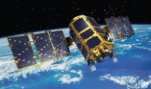
Mission - Third Party Missions

PlanetScope
The PlanetScope satellite constellation consists of multiple launches of groups of individual cubesats (Doves and SuperDoves).
Mission - Heritage Missions
KOMPSAT-2
KOMPSAT-2 (Korea Multi-Purpose Satellite-2), also known as Arirang-2, was developed by KARI (Korea Aerospace Research Institute) to continue the observation programme of the KOMPSAT-1 mission.