- All Categories (15)
- News (7)
- Missions (1)
- Events (4)
- Tools (1)
- Documents (2)
Event - Workshop

1st International GOCE User Workshop
The workshop provided a forum for presentations and discussions on the development, use and exploitation of GOCE Level 2 (global and regional) geoid products and Level 3 (science and application) data products.
Document - Proceedings

EO-Summer-School-6-ESA-explorer-mission-GOCE-earth-gravity-from-space.pdf
This presentation from ESA's EO Summer School 6 presents the ESA explorer mission GOCE earth gravity from space
Event - Conference

Living Planet Symposium 2022
Learn about the 2022 edition of ESA's Living Planet Symposium.
News - Events and Proceedings

Data preservation takes centre stage at Living Planet Symposium
Against the backdrop of the famed Rhine River, world-class scientists and Earth observation data-users are gathered this week in the historical city of Bonn, at the Living Planet Symposium (LPS).
News - Spotlight on EO community

Interviewing Mirko Albani
ESA’s Heritage Space Programme Manager describes the goals of the programme, some of the challenges involved in preserving and improving 40 years of historical Earth observation data, and his passion for curating this long-term archive.
Event - Workshop

2nd International GOCE User Workshop
This workshop provided a forum for presenting progress on the development of the GOCE mission's payload, ground segment and data products.
Event - Workshop
3rd International GOCE User Workshop
This workshop focussed on the oceanographic applications, such as absolute dynamic topography, of GOCE data in conjunction with other space-borne data, such as radar altimetry, and in-situ data and models.
News - Infographics

GOCE – An overview of ESA’s gravity satellite mission
Learn more about ESA's first Earth Explorer - the Gravity field and Ocean Circulation Explorer (GOCE) mission - in our latest infographic.
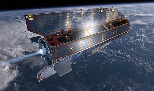
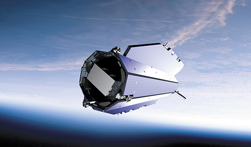
Mission - Earth Explorers

GOCE
ESA's Gravity field and Ocean Circulation Explorer (GOCE) mission mapped Earth's geoid very accurately, opening a window into Earth's interior structure as well as the currents circulating within the depths of its oceans.
Tools - Analysis

GOCE User Toolbox
The GOCE User Toolbox is a compilation of tools for the utilisation and analysis of products from ESA's GOCE gravity mission.
News - Operational News

Release 6 of the GOCE Gravity Field Model variance covariance matrix published
Release 6 of the GOCE Gravity Field Model variance covariance matrix is now available on the GOCE Online Dissemination Service.
News - Operational News
Release 6 of the GOCE Gravity Field Model now available
Release 6 of the GOCE Gravity Field Model is now available on the GOCE Online Dissemination Service.
News - Success Stories

ESA's Earth Explorers surpassing expectations
In this video, learn how each Earth Explorer mission is contributing to Earth science, and changing the way we look at our beloved planet.
News - Data Release news
Version 2.0 of GOCE thermosphere reprocessed data released
Version 2.0 of the GOCE thermosphere dataset is now available on the GOCE Online Dissemination Service.
Document - General Reference

An-oceanographers-guide-to-GOCE-and-the-geoid.pdf
This article was published in Ocean Science Discussions. It gives a review of the geodetic concepts necessary for oceanographers to make use of satellite gravity data to define the geoid, and to interpret the resulting product.