- All Categories (54)
- Data (2)
- News (5)
- Missions (1)
- Events (5)
- Activities (2)
- Campaigns (1)
- Documents (38)
Event - Meeting
VH-RODA and CEOS SAR workshop
The workshop provided an open forum for the presentation and discussion of current status and future developments related to the calibration and validation of space borne very high-resolution SAR and optical sensors and data products.
Document - Proceedings
Topographic mapping from small satellites- a case study of CHRIS-PROBA data
This paper presents a study on the use of various empirical models for satellite orientation and terrain modelling using multidirectional CHRIS data, and evaluates the potential of small satellites with multidirectional viewing capabilities for topographic mapping.
Document - User Guide
Third Party Missions, Cat-1 Data Availability
This brochure gives a quick overview on the availability of the Third Party Missions IRS-P3, JERS-1, NIMBUS, Proba, Landsat, KOMPSAT-1, SCISAT-1, Terra/Aqua, NOAA, QSCAT, OrbView, SPOT-1,-2,-3,-4, ALOS.
Document - General Reference
The MSG System - consisting of a Space Segment and a Ground Segment, designed to provide data, based on a series of three satellites called MSG-1, -2 and -3
This article was published in the ESA Bulletin Nr. 111.
Document - General Reference
The In-Orbit Commissioning of MSG-1
This article was published in the ESA Bulletin Nr. 114.
Document - General Reference
The Earth Observation Handbook, 2010 Update - Key Tables
This is the 2010 update of the CEOS Earth Observation Handbook. You can browse the live database at http://database.eohandbook.com/ or download the printable PDF of key tables based on the 2010 database contents for a handy reference.
Campaign
SPARC
ESA's SPectra bARrax Campaign (SPARC) activity was part of the preparatory study for a proposed ESA Earth Explorer mission called SPECTRA. The objective was to collect a CHRIS/PROBA reference dataset for SPECTRA-related studies.
News - Thematic area articles
Space helps monitor Earth’s changing biosphere
Earth’s biosphere is continually changing. Through its pioneering Earth observation missions, ESA is making critical contributions to monitor these changes and their impacts on Earth’s water and carbon cycles.
Document - Proceedings
Second-EPS-MetOp-RAO-Workshop.pdf
Proceedings of the 2nd EPS/MetOp RAO Workshop held from 20-22 May 2009 in Barcelona, Spain.
Document - Product Readme Note
Retrieving-Canopy-Structure-from-Hyperspectral-Multi-Angular-Satellite-Data.pdf
This article was presented at the 5th EARSeL SIG IS workshop Imaging Spectroscopy : Innovation in Environmental Research held on 23-25 April 2007 in Bruges, Belgium, ed. By I. Reusen and J. Cools. EARSEL, 2007. 7 p.
Data - EO Sign In Authentication (Open)
PROBA-1 HRC
The HRC Level 1A product is an image with a pixel resolution of 8m. The data are grey scale images, an image contains 1026 x 1026 pixels and covers an area of 25 km2. HRC data is supplied in BMP format. All PROBA-1 passes are systematically acquired according to the current acquisition plan, HRC data are processed every day to Level 1A and made available to ESA users. Spatial coverage: Check the spatial coverage of the collection on a map available on the Third Party Missions Dissemination Service.
Data - EO Sign In Authentication (Open)
PROBA-1 CHRIS Level 1A
CHRIS acquired a set of up to five images of each target during each acquisition sequence, these images were acquired when PROBA-1 was pointing at distinct angles with respect to the target. CHRIS Level 1A products (supplied in HDF data files, version 4.1r3) include five formal CHRIS imaging modes, classified as modes 1 to 5: Mode Name Swath Spectral Bands/Ground Resolution Mode 1 Aerosols 13 km 62 at 34 m (773 nm / 1036 nm) Mode 2 Water bands 13 km 18 at 18 m Mode 3 Land channels 13 km 18 at 18 m Mode 4 Chlorophyll band set 13 km 18 at 18 m Mode 5 Land channels 6.5 km 37 at 18 m Spatial coverage: Check the spatial coverage of the collection on a map available on the Third Party Missions Dissemination Service.
Event - Workshop
PROBA-1 CHRIS End of Mission Workshop
The PROBA-1 CHRIS End of Mission Workshop will take place from 18-19 January 2024 in Ghent, Belgium.
News - Infographics
PROBA-1 - From technology demonstration to long-term Earth observation
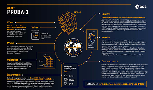
Learn about ESA's PROBA-1 (Project for On-Board Autonomy) mission in our new infographic.
Mission - Third Party Missions
PROBA-1
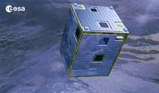
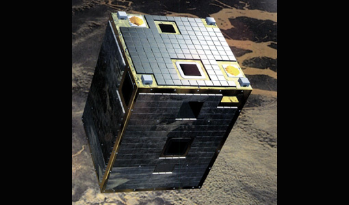
PROBA-1 is a technology demonstration satellite that later became an operational Earth observation mission.
Document - General Reference
PREMIER-Report-for-Mission-Selection-An-Earth-Explorer-to-observe-atmospheric-composition.pdf
The objective of the PREMIER mission is to quantify the processes controlling global atmospheric composition in the mid/upper troposphere and lower stratosphere (5-25 km height range), which is a region of particular importance for climate change.
Document - General Reference
Overview of an Intelligent Sensorweb for Integrated Earth Sensing Project
Document - General Reference
On-the-Potential-of-CHRIS-PROBA-for-Estimating-Vegetation-Canopy-Properties-from-Space.pdf
On the Potential of CHRIS/PROBA for Estimating Vegetation Canopy Properties from Space.
Document - Technical Note
Note on CHRIS Acquisition Procedure and Image Geometry
The aim of this document is to clarify the acquisition procedure CHRIS on-board the PROBA satellite. It provides a detailed description of the acquisition procedure and summarises the implications for the geometrical properties of the CHRIS images.
News - Success Stories
New cross-calibration readies PROBA-1 data for climate research
While PROBA-1 has already exceeded expectations by suppling over 21 years of Earth observation hyperspectral data, recent cross-calibration activities are aiming to ensure the data will robustly serve long time-series research, even when the satellite ends operations.


