- All Categories (85)
- Data (2)
- News (52)
- Missions (4)
- Events (8)
- Tools (6)
- Campaigns (8)
- Documents (5)
Tools - Catalogues
CS2EO
CS2EO is a data catalogue that allows users to easily and quickly combine and download airborne and spaceborne altimetry data from CryoSat-2, ICESat-2, CryoVEx, IceBridge and CryoTEMPO-EOLIS.
Data - EO Sign In Authentication (Open)
Sea Ice Thematic Data Product [ALT_TDP_SI]
This is the Sea Ice Thematic Data Product (TDP) V1 resulting from the ESA FDR4ALT project and containing the sea ice related geophysical parameters, along with associated uncertainties: snow depth, radar and sea-ice freeboard, sea ice thickness and concentration. The collection covers data for the ERS-1, ERS-2 and Envisat missions, and bases on Level 1 data coming from previous reprocessing (ERS REAPER and the Envisat V3.0) but taking into account the improvements made at Level 0/Level 1 in the frame of FDR4ALT (ALT FDR). The Sea Ice TDP provides data from the northern or southern hemisphere in two files corresponding to the Arctic and Antarctic regions respectively for the winter periods only, i.e., October to June for the Arctic, and May to November for the Antarctic. For many aspects, the Sea Ice TDP is very innovative: First time series of sea-ice thickness estimates for ERS Homogeneous calibration, allowing the first Arctic radar freeboard time series from ERS-1 (1991) to CryoSat-2 (2021) Uncertainties estimated along-track with a bottom-up approach based on dominant sources ERS pulse blurring error corrected using literature procedure [Peacock, 2004] The FDR4ALT products are available in NetCDF format. Free standard tools for reading NetCDF data can be used. Information for expert altimetry users is also available in a dedicated NetCDF group within the products. Please consult the FDR4ALT Product User Guide before using the data. The FDR4ALT datasets represent the new reference data for the ERS/Envisat altimetry missions, superseding any previous mission data. Users are strongly encouraged to make use of these datasets for optimal results.
Data - Sample Data (Open)

CryoSat Data Samples
Download CryoSat data samples from Baseline-B, C, and D products.
News - Data Release news

CryoSat swath data boosted with new glacier regions and gridded products
Additional products have been added to CryoTEMPO-EOLIS Baseline 2, increasing global coverage and adding to the range of available gridded data.
News - Maintenance News

CryoSat CalVal server downtime on 27 February 2024
Due to routine maintenance activities on 27 February 2024, between 08:00-10:00 UTC, the distribution of CryoSat L0 products and AUX files may be impacted.
News - Operational News

Announcement for CryoSat Quaternions Product users
CryoSat users who use the Quaternions Products should be aware that the method to access these products is changing.
News - Operational News

Delay in the availability of CryoSat Products
A technical issue occurred at the CryoSat Payload Data Ground Segment (PDGS).
News - Data Release news

CryoSat Ice Baseline-E Reprocessed Data - Update
Previously, quality checks of the Ice Baseline-E reprocessing products observed a discrepancy in the metadata of products with incremented version numbers (E002, E003).
News - Success Stories
New CryoSat data to boost understanding of the oceans
A new CryoSat sea level anomaly product designed to enable ocean science and the development of operational marine applications has been released.
News - Data Release news

CryoSat Ice Baseline-E Reprocessed Data - Update
Quality checks of the Ice Baseline-E reprocessing products have observed a discrepancy in the metadata of products with incremented version numbers.
News - Data Release news

New CryoSat Ice Baseline-E Reprocessed Data – Available now!
The CryoSat Ice Baseline-E Reprocessing campaign is now complete.
News - Operational News
New CryoSat Geographical Mode Mask v5.0 now in operation
On 01 May 2023 a new acquisition mask, Geographical Mode Mask v5.0, was put in operation to tackle new scientific challenges and to support the future Copernicus Polar Ice and Snow Topography Altimeter (CRISTAL) mission. The previous mask v4.0 had been in operation since 2019.
News - Success Stories
ESA missions deliver new long-term perspective on sea ice decline
A 29-year timeseries of polar sea ice thickness and volume that draws on altimetry data from a succession of ESA missions has been presented at the European Geoscience Union general assembly.
News - Data Release news

Back-processed data from 2010 now available for CryoTEMPO-EOLIS Baseline 2
Following on from the release of new Baseline 2 point and gridded products for CryoTEMPO-EOLIS, the data for several regions have now been back-processed to 2010 and are available from the CryoSat Science Server.
News - Data Release news
New CryoSat Ice Baseline-E 2014 and 2015 reprocessed data – Available now!
The reprocessed CryoSat Ice Baseline-E data for all of 2014 and 2015 has now been published on the Science Server.
News - General News
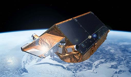
CryoSat’s unparalleled record of global ice continues to 2025
CryoSat, ESA’s ice mission, has been a key to what the cryosphere community regards as a golden era for satellite altimetry.
News - Spotlight on EO community

Introducing the Aeolus and CryoSat Mission Manager
In this video, Tommaso Parrinello - CryoSat Mission Manager - talks about ESA's ice mission and some of its achievements after more than 10 years of operations.
News - Data Release news
New CryoTEMPO-EOLIS baseline 2 point and gridded products
New CryoTEMPO EOLIS baseline 2 point and gridded products are now available monthly as of January 2023.
Document - Algorithms Theoretical Baseline Document

CryoTEMPO-EOLIS-Algorithm-Theoretical-Basis-Document
This document contains the Algorithm Theoretical Basis for the ESA CryoTEMPO-EOLIS project. The ATBD describes the scientific background and principle of the algorithms, their expected or known accuracy and performance, the input and output data, as well as capabilities and limitations. The CryoTEMPO-EOLIS consists of two distinct products: 1) A point product containing elevation point measurements with an associated uncertainty 2) A gridded product containing a spatial interpolation of the point product onto a uniform grid of elevations and corresponding uncertainty. This product covers three main regions: Antarctic ice sheet, Greenland ice sheet and the glacier regions, as defined by IMBIE (The IMBIE Team, 2018; The IMBIE Team, 2020) and RGI 7.0 (RGI Consortium, 2017). The glacier regions include Iceland, Svalbard, Arctic Canada, Russian Arctic, Alaska, Southern Andes.
News - Data Release news
Brand new Cryo-TEMPO Baseline-B boosts CryoSat research
New datasets have been released for the Cryo-TEMPO thematic products.