- All Categories (85)
- Data (2)
- News (52)
- Missions (4)
- Events (8)
- Tools (6)
- Campaigns (8)
- Documents (5)
Document - General Reference

Envisat-ASAR-science-and-applications.pdf
This document describes the technical specifications of the Envisat ASAR instrument and its operations and objectives.
Event - Workshop

CryoSat 2005 Workshop
The workshop provided new and familiar users of the mission with a detailed understanding of the mission status and projected performance at launch, and provided the first presentation to users of the processing algorithms.
Event - Conference

15 Years of Progress in Radar Altimetry Symposium
A Symposium on "15 Years of Progress in Radar Altimetry" and the annual meeting of the Ocean Surface Topography Science Team, the International Doris Service Workshop and the ARGO Workshop.
Event - Training

Advanced Training Course on Ocean Remote Sensing 2006
The objective of the course was to provide first-hand information on a broad range of ocean research topics including key principles of SAR, Radar Altimetry, Ocean Colour and Sea Surface Temperature measurements, processing algorithms, data products and their use in oceanographic applications.
Event - Training
Advanced Training Course in Ocean Remote Sensing 2011
Within the framework of the Dragon Programme, a joint collaboration between the European Space Agency (ESA) and the Chinese Ministry of Science and Technology (MOST), ESA and NRSCC are providing a series of advanced thematic training courses on remote sensing applications hosted by university and research institutions in P.R. China.
News - Events and Proceedings

Seventh CryoSat Quality Working Group meeting - final report
The 7th CryoSat Quality Working Group (QWG) meeting Summary and Recommendation Report are available to download.
Event - Conference
Living Planet Symposium 2019
ESA's Living Planet Symposia are amongst the biggest Earth observation conferences in the world. Scientists present their latest findings on Earth's environment and climate.
Event - Conference
CryoSat 10th Anniversary Science Conference
The conference focussed on the latest scientific results from the mission, it was also a celebration of the remarkable contribution CryoSat has made to our understanding of the cryosphere.
Campaign
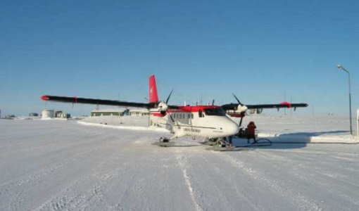
CryoVEx 2003
The CryoVEx (CryoSat Validation EXperiment) 2003 campaign was a first comprehensive Arctic Ocean airborne and surface campaign, in support of the ESA satellite CryoSat, planned for launch late 2004.
Campaign

LaRA
To improve our knowledge of how best to measure ice thickness, the airborne Laser and Radar Altimeter campaign (LaRA) was carried out over the frozen expanses of northern Greenland.
Mission - Heritage Missions

ERS
The ERS programme was composed of two missions, ERS-1 and ERS-2, which together observed the Earth for 20 years, from 1991 to 2011.
Mission - Heritage Missions

Envisat
Envisat was ESA's successor to ERS. Envisat carried ten instruments aboard for a wide range of Earth observing fields. The mission was operational from 2002 to 2012.
Mission - Earth Explorers

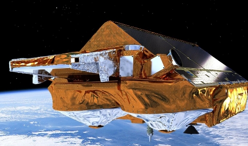
CryoSat
CryoSat determines variations in the thickness of continental ice sheets and marine ice cover. Europe's first ice mission is an advanced radar altimeter specifically designed to monitor the most dynamic sections of Earth's cryosphere.
News - Data Release news

Updated CryoSat magnetometer data now available
An improved version of the CryoSat magnetic field data (version 0102) is now available in the "#CryoSat-2" folder of the ESA FTP server.
News - Success Stories
CryoSat still cool at 10
Today marks 10 years since a Dnepr rocket blasted off from an underground silo in the remote desert steppe of Kazakhstan
News - Data Release news

Systematic swath elevation and monthly DEMs over the Greenland Ice Sheet margin from CryoSat
The CryoTEMPO-EOLIS (Elevation Over Land Ice from Swath), the first of the CryoTEMPO products, is now available.
Document - Product Handbook

CryoTEMPO-Thematic-Product-Handbook.pdf
The CryoTEMPO Product Handbook describes the operational products, a point cloud product containing the elevations derived using a swath processing algorithm and a gridded product with elevations at regularly spaced points on a grid.
News - Data Release news

New CryoSat BUFR products for the meteorological community
From 11 May new CryoSAT NOP data will be disseminated by ESA to the Italian MetOffice.
News - Data Release news

2015 CryoSat Ice Baseline D reprocessed data now available
The reprocessed CryoSat Ice Baseline D data for all of 2015 has now been published on the Science Server.
News - Data Release news

2016 CryoSat Ice Baseline D reprocessed data now available
The reprocessed CryoSat Ice Baseline D data for 2016 has now been published on the Science Server.