- All Categories (21)
- Data (1)
- News (2)
- Missions (2)
- Documents (16)
News - Success Stories
New cross-calibration readies PROBA-1 data for climate research
While PROBA-1 has already exceeded expectations by suppling over 21 years of Earth observation hyperspectral data, recent cross-calibration activities are aiming to ensure the data will robustly serve long time-series research, even when the satellite ends operations.
News - Infographics

PROBA-1 - From technology demonstration to long-term Earth observation
Learn about ESA's PROBA-1 (Project for On-Board Autonomy) mission in our new infographic.
Data - Fast Registration with approval (Restrained)
IKONOS ESA archive
ESA maintains an archive of IKONOS Geo Ortho Kit data previously requested through the TPM scheme and acquired between 2000 and 2008, over Europe, North Africa and the Middle East. The imagery products gathered from IKONOS are categorised according to positional accuracy, which is determined by the reliability of an object in the image to be within the specified accuracy of the actual location of the object on the ground. Within each IKONOS-derived product, location error is defined by a circular error at 90% confidence (CE90), which means that locations of objects are represented on the image within the stated accuracy 90% of the time. There are six levels of IKONOS imagery products, determined by the level of positional accuracy: Geo, Standard Ortho, Reference, Pro, Precision and PrecisionPlus. The product provided by ESA to Category-1 users is the Geo Ortho Kit, consisting of IKONOS Black-and-White images with radiometric and geometric corrections (1-metre pixels, CE90=15 metres) bundled with IKONOS multispectral images with absolute radiometry (4-metre pixels, CE90=50 metres). IKONOS collects 1m and 4m Geo Ortho Kit imagery (nominally at nadir 0.82m for panchromatic image, 3.28m for multispectral mode) at an elevation angle between 60 and 90 degrees. To increase the positional accuracy of the final orthorectified imagery, customers should select imagery with IKONOS elevation angle between 72 and 90 degrees. The Geo Ortho Kit is tailored for sophisticated users such as photogrammetrists who want to control the orthorectification process. Geo Ortho Kit images include the camera geometry obtained at the time of image collection. Applying Geo Ortho Kit imagery, customers can produce their own highly accurate orthorectified products by using commercial off the shelf software, digital elevation models (DEMs) and optional ground control. Spatial coverage: Check the spatial coverage of the collection on a map available on the Third Party Missions Dissemination Service.
Mission - Third Party Missions

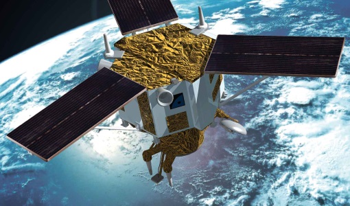
PROBA-1
PROBA-1 is a technology demonstration satellite that later became an operational Earth observation mission.
Document - Proceedings

Hyperspectral Workshop 2010
Proceedings of the Hyperspectral Workshop 2010 held on 17-18 March 2010 in ESA-ESRIN, Frascati, Italy. This workshop was organised by the European Space Agency (ESA), the German Aerospace Center (DLR)/the German Research Center for Geosciences (GFZ) and the Italian Space Agency (ASI).
Document - General Reference

Overview of an Intelligent Sensorweb for Integrated Earth Sensing Project
Mission - Heritage Missions
IKONOS-2
At the time of its launch, IKONOS-2 brought imagery rivalling that of military satellites to the commercial market.
Document - General Reference
Autonomy-in-action-Ten-years-of-Proba-1.pdf
This is an article extracted from the ESA Bulletin Nr.148.
Document - General Reference
Big-year-for-small-satellite-ESAs-second-in-orbit-technology-demonstration-mission-Proba-2.pdf
This is an article extracted from the ESA Bulletin Nr.144.
Document - General Reference
BIOMASS-Report-for-Mission-Selection-An-Earth-Explorer-to-observe-forest-biomass.pdf
The objective of the BIOMASS Mission is to determine the global distribution of forest biomass by reducing the uncertainty in the calculation of carbon stock and fluxes associated with the terrestrial biosphere.
Document - General Reference
Earth-from-Space-Deserts.pdf
This brochure is a collection of Envisat MERIS, Envisat ASAR, Proba and Landsat mosaics of desert areas on our planet.
Document - General Reference
Earth-from-Space-Deltas-and-Lakes.pdf
This brochure is a collection of Envisat MERIS, Envisat ASAR, ERS, Proba and Landsat mosaics.
Document - General Reference
Earth-from-Space-China.pdf
This brochure is a collection of Envisat MERIS, Envisat ASAR and PROBA mosaics of China. The attached CD-rom contains the same images in electronic version.
Document - General Reference
Earth-from-Space-Africa.pdf
This brochure is a collection of Envisat MERIS, Envisat ASAR and Proba HRC mosaics of Africa.
Document - General Reference
Earth-from-Space-Russia-and-Ukraine.pdf
This brochure is a collection of KOMPSAT EOC; ERS-2 SAR; Envisat ASAR, MERIS and Proba CHRIS, HRC mosaics.
Document - General Reference
Earth-from-Space-South-America.pdf
This brochure is a collection of Envisat MERIS, Envisat ASAR and PROBA CHRIS mosaics of South America. The attached CD-rom contains the same images in electronic version.
Document - General Reference
Correction-of-systematic-spatial-noise-in-push-broom-hyperspectral-sensors.pdf
We present a new technique that faces the problem of removing the spatiallycoherent noise known as vertical striping, usually found in images acquired by push-broom sensors.
Document - Product Readme Note

Retrieving-Canopy-Structure-from-Hyperspectral-Multi-Angular-Satellite-Data.pdf
This article was presented at the 5th EARSeL SIG IS workshop Imaging Spectroscopy : Innovation in Environmental Research held on 23-25 April 2007 in Bruges, Belgium, ed. By I. Reusen and J. Cools. EARSEL, 2007. 7 p.
Document - User Guide

Third Party Missions, Cat-1 Data Availability
This brochure gives a quick overview on the availability of the Third Party Missions IRS-P3, JERS-1, NIMBUS, Proba, Landsat, KOMPSAT-1, SCISAT-1, Terra/Aqua, NOAA, QSCAT, OrbView, SPOT-1,-2,-3,-4, ALOS.