- All Categories (25)
- Data (3)
- News (3)
- Missions (3)
- Documents (16)
News - Thematic area articles
Cloud-free collections key for land monitoring
Satellite imagery is a crucially important tool for monitoring the land, but cloud cover can often block parts of Earth’s surface from view, limiting subsequent analyses.
News - Success Stories
New cross-calibration readies PROBA-1 data for climate research
While PROBA-1 has already exceeded expectations by suppling over 21 years of Earth observation hyperspectral data, recent cross-calibration activities are aiming to ensure the data will robustly serve long time-series research, even when the satellite ends operations.
News - Infographics
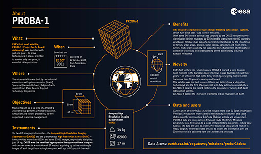
PROBA-1 - From technology demonstration to long-term Earth observation
Learn about ESA's PROBA-1 (Project for On-Board Autonomy) mission in our new infographic.
Data - EO Sign In Authentication (Open)
SPOT 4-5 Take5 ESA archive
At the end of SPOT-4 mission, the Take5 experiment was launched and the satellite was moved to a lower orbit to obtain a 5 day repeat cycle, same repetition of Sentinel-2. Thanks to this orbit, from 1 February to 19 June 2013 a time series of images acquired every 5 days with constant angle and over 45 different sites were observed. In analogy to the previous SPOT-4 Take-5 experiment, also SPOT-5 was placed in a 5 days cycle orbit and 145 selected sites were acquired every 5 days under constant angles from 8 April to 31 August 2015. With a resolution of 10 m, the following processing levels are available: Level 1A: reflectance at the top of atmosphere (TOA), not orthorectified products Level 1C: data orthorectified reflectance at the top of atmosphere (TOA) Level 2A: data orthorectified surface reflectance after atmospheric correction (BOA), along with clouds mask and their shadow, and mask of water and snow. Spatial coverage: Check the spatial coverage of the collection on a map available on the Third Party Missions Dissemination Service.
Data - Fast Registration with approval (Restrained)
SPOT 1-5 ESA archive
The ESA SPOT 1-5 collection is a dataset of SPOT 1 to 5 Panchromatic and Multispectral products that ESA collected over the years. The HRV(IR) sensor onboard SPOT 1-4 provides data at 10 m spatial resolution Panchromatic mode (-1 band) and 20 m (Multispectral mode -3 or 4 bands). The HRG sensor on board of SPOT-5 provides spatial resolution of the imagery to < 3 m in the panchromatic band and to 10 m in the multispectral mode (3 bands). The SWIR band imagery remains at 20 m. The dataset mainly focuses on European and African sites but some American, Asian and Greenland areas are also covered. Spatial coverage: Check the spatial coverage of the collection on a map available on the Third Party Missions Dissemination Service. The SPOT Collection
Data - Fast Registration with approval (Restrained)
Image 2006 European coverage
The Image 2006 collection is a SPOT-4, SPOT-5 and ResourceSat-1 (also known as IRS-P6) cloud free coverage over 38 European countries in 2006 (from February 2005 to November 2007). The Level 1 data provided in this collection originate from the SPOT-4 HRVIR instrument (with 20 m spatial resolution), from SPOT-5 HRG (with 10 m spatial resolution resampled to 20 m) and IRS-P6 LISS III (with 23 m spatial resolution), each with four spectral bands. The swath is of about 60 km for the SPOT satellites and 140 km for the IRS-P6 satellite. In addition to the Level 1, the collection provides the same data geometrically corrected towards a European Map Projection with 25 m resolution. Spatial coverage: Check the spatial coverage of the collection on a map available on the Third Party Missions Dissemination Service.
Mission - Third Party Missions
PROBA-1
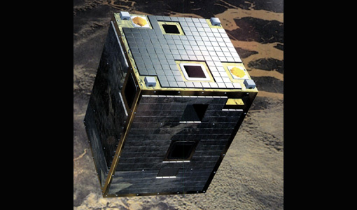
PROBA-1 is a technology demonstration satellite that later became an operational Earth observation mission.
Mission - Heritage Missions
SPOT
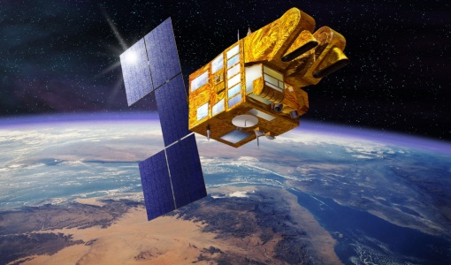
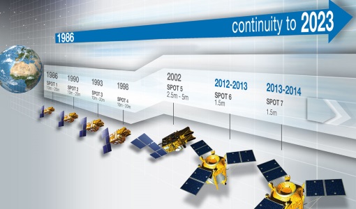
The SPOT (from French "Satellite pour l'Observation de la Terre") series of missions has been supplying high-resolution, wide-area optical imagery since 1986.
Document - Proceedings
Hyperspectral Workshop 2010
Proceedings of the Hyperspectral Workshop 2010 held on 17-18 March 2010 in ESA-ESRIN, Frascati, Italy. This workshop was organised by the European Space Agency (ESA), the German Aerospace Center (DLR)/the German Research Center for Geosciences (GFZ) and the Italian Space Agency (ASI).
Document - General Reference
Overview of an Intelligent Sensorweb for Integrated Earth Sensing Project
Mission - Heritage Missions
SPOT 4
SPOT 4, like all the SPOT missions, was aimed at supplying high-resolution, wide-area optical imagery.
Document - Product Readme Note
Retrieving-Canopy-Structure-from-Hyperspectral-Multi-Angular-Satellite-Data.pdf
This article was presented at the 5th EARSeL SIG IS workshop Imaging Spectroscopy : Innovation in Environmental Research held on 23-25 April 2007 in Bruges, Belgium, ed. By I. Reusen and J. Cools. EARSEL, 2007. 7 p.
Document - User Guide
Third Party Missions, Cat-1 Data Availability
This brochure gives a quick overview on the availability of the Third Party Missions IRS-P3, JERS-1, NIMBUS, Proba, Landsat, KOMPSAT-1, SCISAT-1, Terra/Aqua, NOAA, QSCAT, OrbView, SPOT-1,-2,-3,-4, ALOS.
Document - General Reference
Earth-from-Space-Russia-and-Ukraine.pdf
This brochure is a collection of KOMPSAT EOC; ERS-2 SAR; Envisat ASAR, MERIS and Proba CHRIS, HRC mosaics.
Document - General Reference
Earth-from-Space-South-America.pdf
This brochure is a collection of Envisat MERIS, Envisat ASAR and PROBA CHRIS mosaics of South America. The attached CD-rom contains the same images in electronic version.
Document - Proceedings
3rd-CHRIS-Proba-Workshop.pdf
Proceedings of the 3rd CHRIS/Proba Workshop, held from 21-23 March 2005 at ESA-ESRIN in Frascati, Italy.
Document - General Reference
Correction-of-systematic-spatial-noise-in-push-broom-hyperspectral-sensors.pdf
We present a new technique that faces the problem of removing the spatiallycoherent noise known as vertical striping, usually found in images acquired by push-broom sensors.
Document - General Reference
BIOMASS-Report-for-Mission-Selection-An-Earth-Explorer-to-observe-forest-biomass.pdf
The objective of the BIOMASS Mission is to determine the global distribution of forest biomass by reducing the uncertainty in the calculation of carbon stock and fluxes associated with the terrestrial biosphere.
Document - General Reference
Autonomy-in-action-Ten-years-of-Proba-1.pdf
This is an article extracted from the ESA Bulletin Nr.148.
