- All Categories (151)
- Data (4)
- News (4)
- Missions (2)
- Events (2)
- Tools (2)
- Documents (137)
Tools - Visualisation
PROBA-V Mission Exploitation Platform (MEP)
The MEP PROBA-V addresses a broad vegetation user community with the final aim to ease and increase the use of PROBA-V data by any user.
News - Success Stories
PROBA-V data improve surface albedo products in Africa
As ESA’s PROBA-V satellite marks its 10-year launch milestone, data tasked during the mission’s lifetime are still being used to assess changes in land cover.
News - Data Release news
PROBA-V ‘Collection 2’ - Reprocessed Dataset available
The improved PROBA-V data (Collection 2) has been released. Data is available via the PROBA-V MEP and Terrascope platforms so users can freely exploit the data using Virtual machines, Jupyter Notebooks, and the new viewing application.
News - Thematic area articles
Global understanding of Earth's land surfaces greatly boosted by satellite data
ESA perform land surface monitoring with a range of instruments onboard satellites acquiring optical and radar data. Collections of data from these missions are freely available for research purposes.
News - Thematic area articles
Satellite data boost global understanding of land surface
Understanding our changing land surface is essential in the study of climate change. Satellites are used to monitor changes to the material that covers Earth’s surface, so-called land cover, such as vegetation and water.
Event - Workshop
Fringe 2003 Workshop
The third ESA International Workshop on ERS SAR Interferometry and its first Workshop on ASAR interferometry: Advances in SAR interferometry from ERS and Envisat missions.
Tools - Other
Forestry TEP
The Forestry Thematic Exploitation Platform (TEP) enables users in the forestry sector to access satellite data based processing services and tools for generating value-added forest information products.
Data - External Data (Restrained)
PROBA-V 1 km, 333 m, and 100 m products
The PROBA-V VEGETATION Raw products and Synthesis products provided coverage of all significant landmasses worldwide with, in the case of a 10-day synthesis product, a minimum effect of cloud cover, resulting from selection of cloud-free acquisitions during the 10-day period. It provided a daily coverage between Latitudes 35°N and 75°N, and between 35°S and 56°S, and a full coverage every two days at the equator. The VEGETATION instrument was pre-programmed with an indefinite repeated sequence of acquisitions. This nominal acquisition scenario allowed a continuous series of identical products to be generated, with the goal to map land cover and vegetation growth across the entire planet every two days. Level Synthesis Resolution resolution (m) Reflectance Level-1C n/a TOA Level-2A n/a 100 m TOA 333 m TOA 1 km TOA Level-3 S1 100 m TOA TOC TOC NDVI 333 m TOA TOC 1 km TOA TOC S5 100 m TOA TOC TOC NDVI S10 333 m TOC TOC NDVI 1 km TOC TOC NDVI Raw Products Overview Product Description Level-1C Level-1C segments (P – product): Radiometrically corrected Level-1B data, in raw sensor geometry (unprojected) Contains: - Top Of Atmosphere reflectance in the four spectral bands - Longitude/latitude information for every pixel - Geometric viewing conditions - Information on the status map (indicating missing and interpolated measurements). Format: HDF5 & GeoTiFF Level-2A Level-2A segment: projected Level-1C (P–product) data, radiometrically and geometrically corrected. Contains: - TOA reflectance values in the four spectral bands without atmospheric correction being performed - Information on the status map (containing identification of radiometric quality, snow, ice, shadow, clouds, land/sea for every pixel) - Geometric viewing conditions Plate carrée projection (EPSG:4326) with spatial resolution of 100 m, 333 m and 1 km Format: HDF5 & GeoTiFF Synthesis Products Overview Level-3 S1 = daily, S5 = 5 days, S10 = decade Different spatial resolution: 100 m, 333 m and 1 km Divided into so called granules, each measuring 10 degrees x 10 degrees, each granule being delivered as a single file Plate carrée projection (EPSG:4326) Format: HDF5 & GeoTiFF Products Content TOA - Top Of Atmosphere reflectance in the four spectral bands (no atmospheric correction applied) - Normalized Difference Vegetation Index (NDVI) -Information on the composite status map (containing identification of snow, ice, shadow, clouds, land/sea for every pixel) - Geometric viewing conditions & date and time of selected measurement TOC Level-2A segment: projected Level-1C (P–product) data, radiometrically and geometrically corrected. Contains: - Top Of Canopy (ground surface) reflectance in the four spectral bands, the atmospheric correction being performed using the SMAC (Simplified Method for Atmospheric Corrections) algorithm - Normalized Difference Vegetation Index (NDVI) - Information on the composite status map (containing identification of snow, ice, shadow, clouds, land/sea for every pixel) Normalized Difference Vegetation Index (NDVI) from Top Of Canopy product (SMAC algorithm for atmospheric corrections applied) - Geometric viewing conditions & date and time of selected measurement TOC NDVI Normalized Difference Vegetation Index (NDVI) from Top Of Canopy product (SMAC algorithm for atmospheric corrections applied)
Data - EO Sign In Authentication (Open)
JERS-1 OPS (Optical Sensor) Very Near Infrared Radiometer (VNIR) System Corrected Products level 1
The JERS-1 Optical System (OPS) is composed of a Very Near Infrared Radiometer (VNIR) and a Short Wave Infrared Radiometer (SWIR). The instrument has 8 observable spectral bands from visible to short wave infrared. Data acquired by ESA ground stations The JERS-1 OPS products are available in GeoTIFF format. These products are available only for the VNIR sensor. All four bands are corrected. The correction consists in a vertical and horizontal destriping, the radiometry values are expanded from the range [0.63] to the range [0.255]. No geometrical correction is applied on level 1. The pixel size of approximately 18 x 24.2 metres for raw data is newly dimensioned to 18 x 18 metres for System Corrected data using a cubic convolution algorithm. Disclaimer: Cloud coverage for JERS OPS products has not been computed using an algorithm. The cloud cover assignment was performed manually by operators at the acquisition stations. Due to missing attitude information, the Nadir looking band (band 3) and the corresponding forward looking band (band 4) are not well coregistered, resulting in some accuracy limitations. The quality control was not performed systematically for each frame. A subset of the entire JERS Optical dataset was selected and manually checked. As a result of this, users may occasionally encounter issues with some of the individual products. Spatial coverage: Check the spatial coverage of the collection on a map available on the Third Party Missions Dissemination Service.
Data - EO Sign In Authentication (Open)
JERS-1 SAR Level 1 Precision Image
The JSA_PRI_1P product is comparable to the ESA PRI/IMP images generated for Envisat ASAR and ERS SAR instruments. It is a ground range projected detected image in zero-Doppler SAR coordinates, with a 12.5 metre pixel spacing. It has four overlapping looks in Doppler covering a total bandwidth of 1000Hz, with each look covering a 300Hz bandwidth. Sidelobe reduction is applied to achieve a nominal PSLR of less than -21dB. The image is not geocoded, and terrain distortion (foreshortening and layover) has not been removed. Data acquired by ESA ground stations. Spatial coverage: Check the spatial coverage of the collection on a map available on the Third Party Missions Dissemination Service.
Data - EO Sign In Authentication (Open)
JERS-1 SAR Level 1 Single Look Complex Image
The JSA_SLC_1P product is comparable to the ESA SLC/IMS images generated for Envisat ASAR and ERS SAR instruments. It is a slant-range projected complex image in zero-Doppler SAR coordinates. The data is sampled in natural units of time in range and along track, with the range pixel spacing corresponding to the reciprocal of the platform ADC rate and the along track spacing to the reciprocal of the PRF. Data is processed to an unweighted Doppler bandwidth of 1000Hz, without sidelobe reduction. The product is suitable for interferometric, calibration and quality analysis applications. Data acquired by ESA ground stations. Spatial coverage: Check the spatial coverage of the collection on a map available on the Third Party Missions Dissemination Service.
Mission - Earth Watch
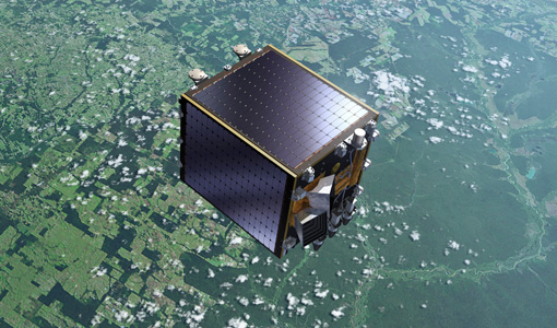
PROBA-V
The PROBA-V mission provides multispectral images to study the evolution of the vegetation cover on a daily and global basis.
Event - Conference
Living Planet Symposium 2019
ESA's Living Planet Symposia are amongst the biggest Earth observation conferences in the world. Scientists present their latest findings on Earth's environment and climate.
Mission - Heritage Missions
JERS-1
The overall objectives of JERS-1 (Japanese Earth Resources Satellite) were the generation of global data sets with SAR and OPS sensors aimed at surveying resources, establishing an integrated Earth observation system
Document - Quality Report
Proba-V VGT Quarterly Report 16 Sep 2022
Proba-V Quarterly Operations Report
Document - Quality Report
Proba-V VGT Quarterly Report 16 Dec 2022
Proba-V Quarterly Operations Report


