- All Categories (771)
- Data (5)
- News (7)
- Missions (13)
- Events (10)
- Tools (7)
- Activities (7)
- Campaigns (2)
- Documents (720)
Event - Workshop
URBIS24
URBan Insights from Space (URBIS24) Workshop will offer an insightful exploration of urban challenges and innovative EO-integrated solutions.
Event - Meeting

PROBA-V QWG meeting 16
The Proba-V QWG meeting 16 – Hybrid Event: VITO (Mol) and Microsoft Teams held on 22-23 March 2023
Mission - Third Party Missions
FSSCat
The FSSCat mission was an innovative concept that consisted of two federated 6-Unit Cubesats, called ³Cat-5/A and ³Cat-5/B, which operated in support of the Copernicus Land and Marine Environment services.
Activity - General activities
EO Summer Schools
ESA's series of summer schools, on Monitoring of the Earth System, aims to promote the exploitation of Earth observation (EO) data.
News - Thematic area articles

Transforming space data into climate action
ESA’s Earth observation activities are playing a key role in the revitalised global drive to combat climate change.
News - Data Release news

SMOS L2 Sea Surface Salinity products documentation updates
SMOS L2 Sea Surface Salinity product validation report is now available.
News - General News

Updated SMOS documentation available
Updated versions of several SMOS data documents are now available.
Event - Training

2nd Advanced Training Course on Ocean Remote Sensing 2009
This advanced training course focused on ocean remote sensing theory and applications.
News - Success Stories

ERS Heritage Data allow for 30 years of science
At their time of launch thirty years ago, the two ERS satellites were the most sophisticated Earth observation spacecraft ever developed and launched by Europe.
Tools - Apps

Heritage Missions app for iOS
Download the Heritage Missions application to discover what the missions were about, how it worked and what the elements of the space and ground segment that make these missions unique.
Tools - Apps

Heritage Missions app for Android
Download the Heritage Missions application to discover what the missions were about, how it worked and what the elements of the space and ground segment that make these missions unique.
Document - Product Handbook

Envisat-SCIAMACHY-product-handbook.pdf
The handbook version 1.0 is based in parts on the SCIAMACHY book (Gottwald etal. 2006) and has been updated to cover the Level 1 version 8, and the Level 2 version 6 SCIAMACHY operational processors.
Document - General Reference

The Soil Moisture and Ocean Salinity Mission - SMOS
This document outlines the SMOS mission objectives and the derived scientific mission requirements.
Document - Product Cal/Val Plan/Report

1st-Final-report-Long-term-validation-of-SCIAMACHY-Data.pdf
This document describes the work packages, and focusses on the newer results obtained in the second half of phase A of ESRIN contract No. 18809/05-I-LG. This work is focussing on the SCIAMACHY instrument aboard Envisat.
Mission - Third Party Missions
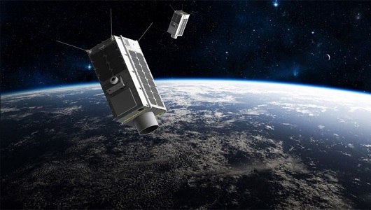
GHGSat
The GHGSat mission is dedicated to measuring emissions of greenhouse gases.
Data - Data Service Request (Restrained)
ERS-1/2 SAR IM L0 [SAR_IM__0P]
This SAR Level 0 product is acquired in Image Mode. The products consist of the SAR telemetry data and are supplied as standard scenes. It also contains all the required auxiliary data necessary for data processing. The product serves two main purposes: For testing ERS SAR processors independently from the HDDR system For users interested in full SAR data processing. Product characteristics: Scene area: 100 km (range - across track) x full segment length (azimuth - along track) Scene size: 5616 samples (range) x full segment length (azimuth) Pixel depth: 10 bits signed integer (5 bits I, 5 bits Q) Projection: Slant range.
Data - EO Sign In Authentication (Open)
ERS-1/2 SAR IM Medium Resolution L1 [SAR_IMM_1P]
This ERS Medium Resolution stripline product is generated from the Image Mode Level 0 Product. Stripline image products contain image data for an entire segment, up to a maximum size of 10 minutes per product for IM mode. The processor concatenates together several sub-images called "slices" that were processed separately on a dataset-by-dataset basis in order to form the entire stripline image. The product is processed to an approximately 150 m x 150 m resolution and has a radiometric resolution that is good enough for ice applications. This product has a lower spatial resolution than the SAR_IMP_1P and SAR_IMS_1P products. Product Characteristics: Pixel size: 5 m (ground range – across track) x 75 m (azimuth – along track) Scene area: 100 km (range) x at least 102.5 km Scene Size: 1300 pixels (range) x at least 1350 lines (azimuth) Pixel depth: 16 bits unsigned integer- Total product volume: at least 3.5 MB Projection: Ground-range Number of looks: 8 (azimuth) x 7 (range).
Data - EO Sign In Authentication (Open)
ERS-1/2 SAR IM Single Look Complex L1 [SAR_IMS_1P]
The SAR SLC product is a single look complex acquired in Image Mode. It is a digital image, with slant range and phase preserved, generated from raw SAR data using up-to-date auxiliary parameters. The products are intended for use in SAR quality assessment, calibration and interferometric applications. A minimum number of corrections and interpolations are performed on the data. Absolute calibration parameters (when available) are provided in the product annotation. Product characteristics: Pixel size: 8 m (range - across track) x 4 m (azimuth - along track – varying slightly depending on acquisition Pulse Repetition Frequency) Scene area: 100 km (range) x at least 102.5 km (azimuth) Scene size: 5000 samples (range) x at least 30000 lines (azimuth) Pixel depth: 32 bits signed integer (16 bits I, 16 bits Q) Total product volume: 575 MB Projection: Slant range- Number of looks: 1.