- All Categories (3645)
- Data (8)
- News (17)
- Missions (4)
- Events (11)
- Tools (2)
- Activities (3)
- Campaigns (1)
- Documents (3599)
Document - User Guide
User Manual - LEDA 13 Landsat
This infosheet describes the Landsat databank. The databank is a catalogue of imagery remotely sensed by the Landsat series of satellites (Landsat l to 5) available at ESA/Earthnet and acquired at Fucino (Italy), Kiruna (Sweden) and Maspalomas (Canaries).
News - Thematic area articles
Transforming space data into climate action
ESA’s Earth observation activities are playing a key role in the revitalised global drive to combat climate change.
Document - General Reference
TIGER Initiative - Looking After Water in Africa
This brochure presents images from the second TIGER Workshop, held in Pretoria from 08 to 10 November 2004. The images show locations in Africa acquired by Meteosat-8, Envisat's ASAR and MERIS instruments and Proba-1's HRC instrument.
Document - User Guide
Third Party Missions, Cat-1 Data Availability
This brochure gives a quick overview on the availability of the Third Party Missions IRS-P3, JERS-1, NIMBUS, Proba, Landsat, KOMPSAT-1, SCISAT-1, Terra/Aqua, NOAA, QSCAT, OrbView, SPOT-1,-2,-3,-4, ALOS.
Data - Campaigns (Open)
THERMOPOLIS
The THERMOPOLIS 2009 campaign mainly served the DUE “Urban Heat islands (UHI) and Urban Thermography (UT) Project”
Campaign
THERMOPOLIS
The THERMOPOLIS 2009 campaign mainly served the DUE “Urban Heat islands (UHI) and Urban Thermography (UT) Project”
Document - General Reference
The-Changing-Earth-New-Scientific-Challenges-for-ESAs-Living-Planet-Programme.pdf
This article is extracted from ESA Bulletin Nr. 129.
Document - General Reference
The Science and Research Elements of ESA Living Planet Programme
This document presents the plans for the Earth Explorer element of the European Space Agency's 'Living Planet' Programme for Earth Observation.
Document - Technical Note
The RA-2 On-Board Tracker and its Autonomous Adaptable Resolution
This technical note describes the complete functionality of the RA-2 on-board Tracker and how its Resolution Selection Logic (RSL) works. It gives a detailed analysis of the algorithm and its configuration parameters.
Document - General Reference
The Nine Candidate Earth Explorer Missions - Topography Mission
This report for assessment addresses the Topography mission when it was selected with other nine Earth Explorer missions as a potential candidate for Phase A study.
Document - General Reference
The Nine Candidate Earth Explorer Missions - Land-Surface Processes and Interactions Mission
This report for assessment addresses the Land-Surface Processes and Interactions mission when it was selected with other nine Earth Explorer missions as a potential candidate for Phase A study.
Document - General Reference
The four Candidate Earth Explorer Core Missions - Land-Surface Processes and Interactions Mission
This report describes the Land-Surface Processes and Interactions Mission, one of the four Candidate Earth Explorers in 1999.
Document - General Reference
The Earth Observation Handbook, 2010 Update - Key Tables
This is the 2010 update of the CEOS Earth Observation Handbook. You can browse the live database at http://database.eohandbook.com/ or download the printable PDF of key tables based on the 2010 database contents for a handy reference.
News - Operational News
Temporary interruption to Envisat AATSR dissemination service
A planned downtime will affect the access to the ftp dissemination server for the Envisat AATSR data during the period 13-15 February 2024.
News - Success Stories
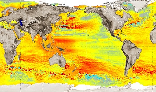
Spotlight on sea-level rise
Scientists to share findings on how satellite has revealed changes in the height of the sea, ice, inland bodies of water and more.
Document - General Reference
SPECTRA-Surface-Processes-and-Ecosystem-Changes-Through-Response-Analysis.pdf
This report describes the SPECTRA mission, one of the candidate Earth Explorers in the second cycle in 2001.
Document - General Reference
Space-Technologies-for-Water-Resources-Management-in-Africa.pdf
This brochure presents images from Envisat's MERIS and ASAR instruments of locations in Africa, as presented at the TIGER Workshop in Rabat, Morocco, from 06 to 08 October 2003.
Document - General Reference
SMOS-ESAs-Water-Mission-Fact-sheet.pdf
This document provided a series of information on the SMOS mission.
Activity - Quality
SLAP
The SLAP (Systematic Landsat Archive Processing) project covers the MSS, TM and ETM+ products from Landsat missions 1 – 7, and is the first systematic reprocessing of the ESA Landsat archive.
Data - EO Sign In Authentication (Open)
Sea Ice Thematic Data Product [ALT_TDP_SI]
This is the Sea Ice Thematic Data Product (TDP) V1 resulting from the ESA FDR4ALT project and containing the sea ice related geophysical parameters, along with associated uncertainties: snow depth, radar and sea-ice freeboard, sea ice thickness and concentration. The collection covers data for the ERS-1, ERS-2 and Envisat missions, and bases on Level 1 data coming from previous reprocessing (ERS REAPER and the Envisat V3.0) but taking into account the improvements made at Level 0/Level 1 in the frame of FDR4ALT (ALT FDR). The Sea Ice TDP provides data from the northern or southern hemisphere in two files corresponding to the Arctic and Antarctic regions respectively for the winter periods only, i.e., October to June for the Arctic, and May to November for the Antarctic. For many aspects, the Sea Ice TDP is very innovative: First time series of sea-ice thickness estimates for ERS Homogeneous calibration, allowing the first Arctic radar freeboard time series from ERS-1 (1991) to CryoSat-2 (2021) Uncertainties estimated along-track with a bottom-up approach based on dominant sources ERS pulse blurring error corrected using literature procedure [Peacock, 2004] The FDR4ALT products are available in NetCDF format. Free standard tools for reading NetCDF data can be used. Information for expert altimetry users is also available in a dedicated NetCDF group within the products. Please consult the FDR4ALT Product User Guide before using the data. The FDR4ALT datasets represent the new reference data for the ERS/Envisat altimetry missions, superseding any previous mission data. Users are strongly encouraged to make use of these datasets for optimal results.


