- All Categories (7)
- Data (1)
- News (4)
- Missions (2)
Data - Sample Data (Open)
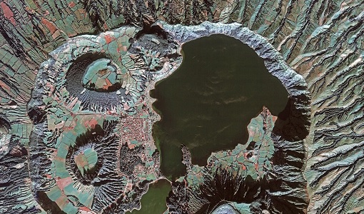
GEOSAT-2 Sample Data
Download free GEOSAT-2 sample datasets to preview products available for this mission.
News - Thematic area articles
Remote sensing data map impacts of natural hazards
As climate change increases the frequency and severity of natural disasters, remote sensing data can warn about extreme events and help tackle emergency situations.
News - Success Stories

New open-source Python library improves rapid mapping services
In emergency services, rapid response is paramount. ICube-SERTIT’s Rapid Mapping Service provides near real-time delivery of geo-information to help emergency services respond quickly to disasters such as flooding, fires and landslides. A new Python open-source library, called EOReader, speeds up this mapping response by enabling the easy opening of imagery from multiple satellite sensors, both optical and synthetic aperture radar (SAR).
News - Success Stories

How GEOSAT helps to unlock the potential of Earth observation data
High-resolution imagery delivered by a privately-owned system of European satellites is facilitating international efforts to boost prosperity, protect the environment, and tackle urgent global challenges.
News - Infographics

An overview of ESA's Third Party Missions programme
ESA’s Third Party Missions programme consists of almost 50 satellite missions, which are owned by organisations around the world. ESA has agreements with these organisations to acquire, process, and distribute data from their missions
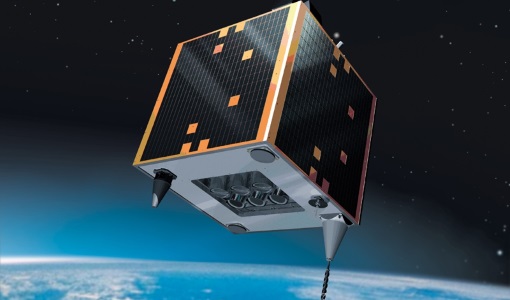
Mission - Heritage Missions
GEOSAT
The GEOSAT series consists of GEOSAT-1 and GEOSAT-2 missions. They are Earth imaging satellites. GEOSAT-2, a high resolution satellite, became the first European fully-private satellite capable of providing sub-metric multi-spectral imagery.
Mission - Heritage Missions
GEOSAT-1
GEOSAT-1 is part of a group of satellites collectively known as the Disaster Monitoring Constellation (DMC).