- All Categories (9977)
- Data (6)
- News (21)
- Missions (6)
- Events (17)
- Tools (1)
- Activities (13)
- Campaigns (3)
- Documents (9910)
News - Success Stories

How scientists are unlocking the potential of SAOCOM
A team of scientists has drawn on SAOCOM data to measure the heights of forests in Argentina, marking the first time that tree canopies have been mapped using the two-satellite constellation.
News - Infographics
Showcasing the NovaSAR-1 radar satellite
Learn about the NovaSAR-1 mission in our new infographic.
News - Announcement of Opportunity updates
ESA encourages S-band applications with NovaSAR-1 Announcement of Opportunity
ESA is offering possibilities to develop new applications in the S-band microwave frequency range, with a new Announcement of Opportunity for NovaSAR-1 data, via ESA’s Third Party Mission programme.
Mission - Third Party Missions
NovaSAR-1
Launched on 16 September 2018, NovaSAR-1 features an S-band synthetic aperture radar (SAR) instrument offering a variety of modes with different resolutions and swath widths.
Data - Announcement of Opportunity (Restrained)
Announcement of Opportunity for NovaSAR-1
ESA is launching an Announcement of Opportunity for the international scientific community to access data from the NovaSAR-1 mission for science and EO-based applications development.
News - Thematic area articles
Tracking the world’s forests from space
As human activities continue to threaten the planet’s forests, data delivered by satellites are boosting global efforts to conserve these crucial natural resources.
News - Spotlight on EO community
An overview of the Biomass mission
In this video, Klaus Scipal - Biomass and SMOS Mission Manager - talks about ESA's upcoming Biomass mission.
Activity - Projects
ESA's multi-level global thermosphere data products consistent with Swarm and GRACE (-FO)
In this project, the possibility of using the space-based along-track Thermospheric Neutral Density (TND) estimates for generating the European Space Agency (ESA)'s Level 3 (L3) global multi-level TND data products is assessed.
Activity - Projects

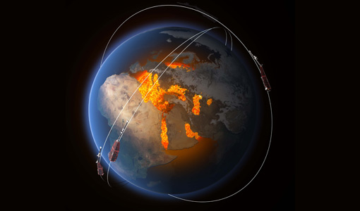
Swarm Ionospheric Polar Electrodynamics
The goal of the Swarm ionospheric polar electrodynamics (SWIPE) project is to create and disseminate the most advanced models of high-latitude Joule dissipation, ionospheric convection, and ionospheric conductances.
Data - Announcement of Opportunity (Restrained)

Announcement of Opportunity for S3VT (Sentinel-3 Validation Team)
In the framework of a Copernicus collaborative agreement ESA and EUMETSAT invite interested groups and individuals to support the Sentinel-3 Validation Team (S3VT).
News - Data Release news
New BorealScat campaign dataset released
A new dataset has been released for the BorealScat campaign, which took place between 2017 and 2021 in Sweden.
Activity - Projects
Swarm Ion Temperature Estimation
The main objective of Swarm Ion Temperature Estimation (SITE) project is to estimate ion temperatures along the orbits of Swarm satellites using available LP electron density and temperature measurements, and numerical models.
Activity - Projects

Swarm LP Ion Drift and Effective Mass
The Swarm LP Ion Drift and Effective Mass (SLIDEM) project will augment Swarm's ability to measure the along-track component of ion drift, and assess the composition of ionospheric ions.
Activity - Projects
Plasmapause Related boundaries in the topside Ionosphere as derived from Swarm Measurements
In the project, Plasmapause Related boundaries in the topside Ionosphere as determined from Swarm Measurements (PRISM), the team develop products that characterise position of the plasmapause related phenomena in the topside ionosphere.
Activity - Projects
ESC Geomagnetic Conditions
The objective of the Expert Service Centre Geomagnetic Conditions - definition and development activities work is to ensure operational and development activities within the Geomagnetic Conditions Expert Service Centre of ESA's Space Situational Awareness Space Weather network.
Activity - Projects

Contribution of Swarm data to the prompt detection of Tsunamis and other natural hazards
The main objective of COSTO (Contribution of Swarm data to the prompt detection of Tsunamis and other natural hazards) project is to better characterise, understand and discover coupling processes and interactions.
News - Spotlight on EO community
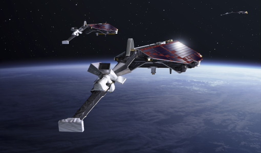
Meet ESA's Swarm Mission Manager
Anja Strømme, ESA's Swarm Mission Manager, describes in detail the wonders of the Swarm mission.
News - Data Release news
New Swarm Ion Temperature Estimation (SITE) data product released
A new dataset of Swarm Ion Temperature Estimation (SITE) is now available for the three Swarm spacecraft.
Document - General Reference

spaceborne-radar-applications-in-geology-an-introduction.pdf
This document is intended for geologists who are interested in broadening their knowledge of interpretation of imaging radar data. It introduces imaging radar as it may be used by technicians and image interpreters. Interferometric SAR is briefly treated, with some basic and practical hints. An illustrated application study on land subsidence is included.
Document - Software Verification Plan/Report

GUT2-Final-Project-Report.pdf
This document is the Final Report of the project carried out by a consortium led by DTU, "GUTS Phase 3" Development and Supporting Scientific Studies" in response to Statement of Work XGCE, DTEX, EOPSSW & 090001.