- All Categories (2309)
- Data (36)
- News (43)
- Missions (5)
- Events (31)
- Tools (12)
- Activities (19)
- Campaigns (2)
- Documents (2161)
Document - General Reference
WATS - Water Vapour and Temperature in the Troposphere and Stratosphere.pdf
This report describes the WATS mission, one of the candidate Earth Explorers in the second cycle in 2001.
Document - Technical Note
WALES - Water Vapour Lidar Experiment in Space
This report describes the WALES mission, one of the candidate Earth Explorers in the second cycle in 2001.
Document - Product Cal/Val Plan/Report
Validation Report following the 3rd MERIS data reprocessing
This document prepared by the MERIS Quality Working Group (QWG) corresponds to the Validation Report following the 3rd MERIS data reprocessing. It aims at qualifying and quantifying the accuracy of the MERIS L2 products generated with the version 8.0 of MERIS Ground Segment prototype (MEGS), delivered to the whole community through the ODESA software (http://earth.eo.esa.int/odesa/). It is equivalent to version 6.0 of the Instrument Processing Facilities (IPF) at ESRIN.
Document - User Guide
User Documentation for (A)ATSR 4th Reprocessing Level 1B Products
This document provides a guide for users of (A)ATSR 4th reprocessing products, giving easily viewed format details, highlighting differences from previous reprocessed products, noting technical features inherent in the products, and giving notification of remaining Open Issues.User Documentation for (A)ATSR 4th Reprocessing Level 1B Products
News - Operational News
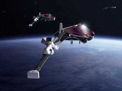
Update on Swarm Field-Aligned Current Dual (FAC_AC) data missing from 7 November 2021
As a follow-up of the news published on 23 November 2021, we want to update Swarm users about the missing Field-Aligned Current Dual (FAC_TMS_2F) data since 7 November 2021.
News - Operational News
Update on Swarm Field-Aligned Current Dual (FAC_AC) data issue
As a follow-up of the news published on 23 November 2021 and on 16 December 2021, we want to update Swarm users about the issue affecting Field-Aligned Current Dual (FAC_TMS_2F) data.
Document - General Reference
Understanding climate change from space
This document describes ESA's Climate Change Initiative, and how it is intended to contribute towards monitoring and understanding the Earth's climate.
Document - General Reference
Two Years of ERS-1 Data Exploitation
This bulletin reports on the first two years of the ERS-1 satellite.
News - Thematic area articles
Transforming space data into climate action
ESA’s Earth observation activities are playing a key role in the revitalised global drive to combat climate change.
News - Thematic area articles
Tracking the world’s forests from space
As human activities continue to threaten the planet’s forests, data delivered by satellites are boosting global efforts to conserve these crucial natural resources.
Document - General Reference
Towards More Efficient Use of Radar-Altimeter Data
Twenty years ago, experimental altimeters on NASA's Skylab and Geos-3 were already demonstrating the potential of such instrumentation. This led in turn to the development and launch by NASA in July 1978 of the Seasat oceanographic satellite mission. Both Geos-3 and Seasat were very successful in their pioneering missions, but were limited somewhat by poor coverage in the case of Geos-3 and an abnormally short mission duration in Seasat's case.
Activity - Projects
TOLEOS
The TOLEOS (Thermosphere Observations from Low-Earth Orbiting Satellites) project will produce thermosphere mass density observations from the accelerometer measurements of the GRACE, GRACE-FO, and CHAMP satellites.
Activity - Projects
TIRO
Topside Ionosphere Radio Observations from multiple LEO-missions (TIRO) project will provide two measurements from onboard instruments of LEO satellite missions: TEC (Total Electron Content) derived from GNSS signals, and electron density derived from KBR (K-Band Ranging) system observations.
Document - General Reference
TIGER Initiative - Looking After Water in Africa
This brochure presents images from the second TIGER Workshop, held in Pretoria from 08 to 10 November 2004. The images show locations in Africa acquired by Meteosat-8, Envisat's ASAR and MERIS instruments and Proba-1's HRC instrument.


