- All Categories (43)
- Data (3)
- News (28)
- Missions (1)
- Tools (3)
- Activities (1)
- Documents (7)
Document - User Guide
Planet-Explorer-User-Guide.pdf
This document is designed as a general guideline for customers interested in acquiring Planet Explorer Lab products and services.
Document - Technical Note
Technical Note on Quality Assessment for PlanetScope (DOVE-R)
Technical Note on Quality Assessment for PlanetScope (DOVE-R)
Mission - Third Party Missions
PlanetScope
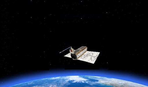
The PlanetScope satellite constellation consists of multiple launches of groups of individual cubesats (Doves and SuperDoves).
News - Data Release news
PlanetScope and SkySat data now available
PlanetScope and SkySat missions under evaluation. Interested users can investigate suitability of the data for scientific and R&D activities.
News - General News
Three new Third Party Missions under evaluation
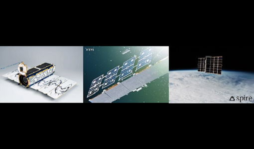
ICEYE, PlanetScope and Spire under evaluation. Interested users can investigate suitability of the data for scientific and R&D activities.
Activity - Quality
EDAP
The ESA Earthnet Data Assessment Pilot (EDAP) project will perform assessments for various missions to ensure the delivered data is fit for purpose.
Tools - Analysis
Sentinel-2 Toolbox
The Toolbox consists of a rich set of visualisation, analysis and processing tools for the exploitation of optical high-resolution products including the Sentinel-2 MSI sensor.
Data - Fast Registration with approval (Restrained)
PlanetScope Full Archive
The PlanetScope Level 1B Basic Scene and Level 3B Ortho Scene full archive products are available as part of Planet imagery offer. The Unrectified Asset: PlanetScope Basic Analytic Radiance (TOAR) product is a Scaled Top of Atmosphere Radiance (at sensor) and sensor corrected product, without correction for any geometric distortions inherent in the imaging processes and is not mapped to a cartographic projection. The imagery data is accompanied by Rational Polynomial Coefficients (RPCs) to enable orthorectification by the user. This kind of product is designed for users with advanced image processing and geometric correction capabilities. Basic Scene Product Components and Format Product Components Image File (GeoTIFF format) Metadata File (XML format) Rational Polynomial Coefficients (XML format) Thumbnail File (GeoTIFF format) Unusable Data Mask UDM File (GeoTIFF format) Usable Data Mask UDM2 File (GeoTIFF format) Bands 4-band multispectral image (blue, green, red, near-infrared) or 8-band (coastal-blue, blue, green I, green, yellow, red, Rededge, near-infrared) Ground Sampling Distance Approximate, satellite altitude dependent Dove-C: 3.0 m-4.1 m Dove-R: 3.0 m-4.1 m SuperDove: 3.7 m-4.2 m Accuracy <10 m RMSE The Rectified assets: The PlanetScope Ortho Scene product is radiometrically-, sensor- and geometrically- corrected and is projected to a UTM/WGS84 cartographic map projection. The geometric correction uses fine Digital Elevation Models (DEMs) with a post spacing of between 30 and 90 metres. Ortho Scene Product Components and Format Product Components Image File (GeoTIFF format) Metadata File (XML format) Thumbnail File (GeoTIFF format) Unusable Data Mask UDM File (GeoTIFF format) Usable Data Mask UDM2 File (GeoTIFF format) Bands 3-band natural colour (red, green, blue) or 4-band multispectral image (blue, green, red, near-infrared) or 8-band (coastal-blue, blue, green I, green, yellow, red, RedEdge, near-infrared) Ground Sampling Distance Approximate, satellite altitude dependent Dove-C: 3.0 m-4.1 m Dove-R: 3.0 m-4.1 m SuperDove: 3.7 m-4.2 m Projection UTM WGS84 Accuracy <10 m RMSE PlanetScope Ortho Scene product is available in the following: PlanetScope Visual Ortho Scene product is orthorectified and colour-corrected (using a colour curve) 3-band RGB Imagery. This correction attempts to optimise colours as seen by the human eye providing images as they would look if viewed from the perspective of the satellite. PlanetScope Surface Reflectance product is orthorectified, 4-band BGRN or 8-band Coastal Blue, Blue, Green I, Green, Yellow, Red, RedEdge, NIR Imagery with geometric, radiometric and corrected for surface reflection. This data is optimal for value-added image processing such as land cover classifications. PlanetScope Analytic Ortho Scene Surface Reflectance product is orthorectified, 4-band BGRN or 8-band Coastal Blue, Blue, Green I, Green, Yellow, Red, RedEdge, NIR Imagery with geometric, radiometric and calibrated to top of atmosphere radiance. As per ESA policy, very high-resolution imagery of conflict areas cannot be provided.
Document - Product Specifications
Planet-combined-imagery-product-specs-2020.pdf
This document describes Planet satellite imagery products.
News - General News
ESA’s Earth Observation Catalogue and its services
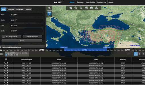
EO-CAT is the EO Catalogue tool allowing users to search ESA and Third Party Mission collections.
News - General News
ESA's new DataCube service is now available
ESA is pleased to announce the deployment of a new service, called ESA PDGS-DataCube, enabling multi-temporal and pixel-based access to a subset of the data available in the European Space Agency dissemination services.
Tools - Analysis
ESA PDGS Jupyter Notebook
A series of Jupyter Notebooks are available, in order to understand how to exploit the API that provides the data access service for different types of datasets included in the ESA PDGS datacube.
Tools - Other
Forestry TEP
The Forestry Thematic Exploitation Platform (TEP) enables users in the forestry sector to access satellite data based processing services and tools for generating value-added forest information products.
News - Infographics
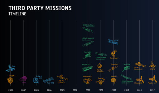
ESA Third Party Missions timeline
We've released a new timeline to illustrate the history of the ESA Third Party Missions.
News - Infographics
An overview of ESA's Third Party Missions programme
ESA’s Third Party Missions programme consists of almost 50 satellite missions, which are owned by organisations around the world. ESA has agreements with these organisations to acquire, process, and distribute data from their missions
Document - Technical Note
Technical Note on Quality Assessment for PlanetScope (SuperDOVE)
Technical Note on Quality Assessment for PlanetScope (SuperDOVE)
Document - Technical Note
Visual Inspection Report for PlanetScope (SuperDOVE)
Visual Inspection Report for PlanetScope (SuperDOVE)
News - Thematic area articles
Satellite data boost global understanding of land surface
Understanding our changing land surface is essential in the study of climate change. Satellites are used to monitor changes to the material that covers Earth’s surface, so-called land cover, such as vegetation and water.
News - Success Stories
New open-source Python library improves rapid mapping services
In emergency services, rapid response is paramount. ICube-SERTIT’s Rapid Mapping Service provides near real-time delivery of geo-information to help emergency services respond quickly to disasters such as flooding, fires and landslides. A new Python open-source library, called EOReader, speeds up this mapping response by enabling the easy opening of imagery from multiple satellite sensors, both optical and synthetic aperture radar (SAR).
News - Infographics
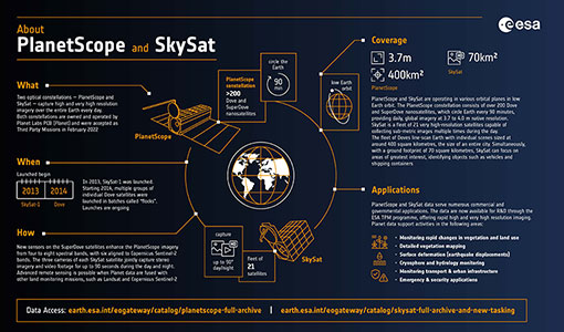
PlanetScope and SkySat - The high-resolution nanosatellite constellation
Find out more about the PlanetScope and SkySat missions in our new infographic.
