- All Categories (16)
- Data (1)
- News (4)
- Missions (2)
- Events (5)
- Activities (1)
- Documents (3)
News - Thematic area articles
Remote sensing data map impacts of natural hazards
As climate change increases the frequency and severity of natural disasters, remote sensing data can warn about extreme events and help tackle emergency situations.
News - Infographics
Showcasing the atmosphere-studying Odin mission
Learn about the Odin mission in our new infographic.
News - Success Stories

Atmosphere-studying Odin mission enjoys ongoing success
More than two decades after it began operations, the Odin remote sensing satellite is continuing to make strong contributions to high-impact atmospheric science.
Event - Conference

Dragon 3 2014 Symposium
The Dragon 3 2014 Symposium was part of the Dragon 3 Programme, focussed on exploitation of ESA, ESA's Third Party Missions and Chinese Earth observation data for geo-science and applications development in land, ocean and atmospheric applications.
Event - Conference
Dragon 3 2015 Symposium
The Dragon 3 2015 Symposium was part of the Dragon 3 Programme, focussed on exploitation of ESA, ESA's Third Party Missions and Chinese Earth observation data for geo-science and applications development in land, ocean and atmospheric applications.
Event - Conference

Dragon 3 2016 Symposium
The Dragon 3 2016 Symposium served as the close of the Dragon 3 Cooperation Programme (2012 to 2016) and formal kick off for Dragon 4 Cooperation projects.
Activity - Projects
Dragon 3 Cooperation Programme
The Dragon 3 Programme focussed on the exploitation of ESA, ESA's Third Party Missions and Chinese Earth observation data for geo-science and applications development in land, ocean and atmospheric applications.
Data - External Data (Restrained)
Odin OSIRIS data products
The Odin OSIRIS (Optical Spectrograph and Infra-Red Imaging System) data provides vertical profiles measures of spectrally dispersed, limb scattered sunlight from the upper troposphere into the lower mesosphere. The data products are regularly processed and provide Ozone density vertical profiles (both Level 2 and Level 3), vertical profiles of stratospheric Aerosol (both Level 2 and Level 3), slant column densities of nitrogen dioxide NO2 profiles (Level 2), stratospheric BrO profiles (Level 2).
News - Success Stories

Odin celebrates 18 years in orbit
ESA is proud to celebrate the excellent long-lasting performance of the Swedish-led Odin mission.
Mission - Meteorological Missions

MetOp
MetOp is a mission dedicated to improving weather forecasts and monitoring Earth's climate.
Mission - Third Party Missions
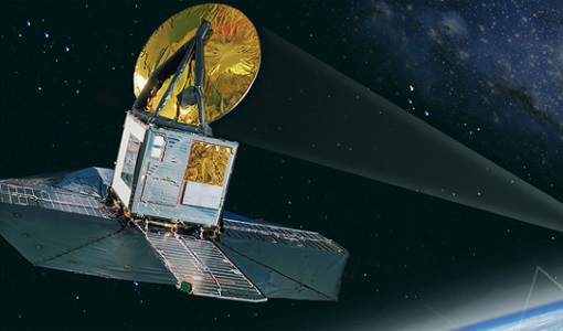
Odin
Odin is an atmosphere-studying satellite mission from Sweden, Canada, France and Finland.
Event - Training

Advanced Training Course in Land Remote Sensing 2012
The 2012 advanced training course focused on land remote sensing theory and applications.
Event - Training
3rd Advanced Training Course on Land Remote Sensing 2011
This 2011 advanced ESA training course focused on land remote sensing theory and applications.
Document - General Reference

MetOp-Monitoring-the-Weather-from-Polar-Orbit.pdf
This brochure describes in details the MetOp mission, the satellite and its instruments.
Document - General Reference
MetOp-A-Truly-Global-Picture-About-MetOp-mission-and-its-instruments.pdf
This flyer describes the MetOp mission and its instruments.
Document - Conference Presentation - Poster

8-Use_SAR_observing_Polar_lows.pdf
Use of SAR in observing Polar lows Birgitte Furevik (Norwegian Meteorological Inst., Norway)