- All Categories (69)
- Data (3)
- News (28)
- Missions (2)
- Events (9)
- Tools (5)
- Activities (1)
- Documents (21)
Document - Conference Presentation - Poster

1-SAR-Derived High-Res-Operational-Wind-Products.pdf
SAR-Derived High-Resolution Operational Wind Products within NOAA CoastWatch William Pichel (NOAA/NESDIS, US)
Document - Conference Presentation - Poster
2-ITCG_integrated_maritime_surveillance.pdf
Italian Coast Guard integrated maritime surveillance in the framework of security, anti-pollution and fisheries control activities Luigia Caiazzo(Italian Coast Guard, Italy)
Document - Conference Presentation - Poster
2_POLinSAR2013_Hannevik_presentation.pdf
Combining polarimetric channels for better ship detection results T.N.A. Hannevik [Norwegian Defence Research Establishment - Norway]
Document - Conference Presentation - Poster
2_ppt_POLINSAR2013_dmonells_std.pdf
Performance Comparison between Dual Polarimetric and Fully Polarimetric data for DInSAR Subsidence monitoring D. Monells [Universitat Politecnica de Catalunya, UPC - Spain]
Event - Training

2nd Advanced Training Course on Land Remote Sensing 2009
This 2009 advanced ESA training course focused on land remote sensing theory and applications.
Document - Conference Presentation - Poster
3-Validation_SAR-WindRetrieval_X-BAND.pdf
Validation of SAR Wind Retrieval at X-BAND using TERRASAR-X and COSMO-SKYMED data Jochen Horstmann (NATO Undersea Research Center, Italy)
Document - Conference Presentation - Poster
4_LTT_POLINSAR2013_VFINAL.pdf
Schatten Matrix Norm based Polarimetric SAR Data Regularisation Application over Chamonix Mont-Blanc T.T. Le [University of Savoie, Polytech Annecy - France]
Document - Conference Presentation - Poster
4_POL_rig_dmon_polinsar.pdf
Phase Quality Optimisation Techniques and Limitations in Polarimetric Differential SAR Interferometry R. Iglesias [Universitat Politecnica de Catalunya, UPC - Spain]
Document - Conference Presentation - Poster
7-Clean_Sea_Net.pdf
The "New Generation" of CleanSeaNet: the EU Remote Sensing Based Monitoring System for Oil Spill and Vessel Detection Sonia Pellizzari (European Maritime Safety Agency)
Document - Conference Presentation - Poster
7_POLinSAR2013_LiuM.pdf
A Modified Wishart Distance Measure and Its Application to PolSAR Change Detection M. Liu [Center for Earth Observation and Digital Earth, CAS - China]
Document - Conference Presentation - Poster
8-Ship-Detection-High-Res-Satellite-Imagery.pdf
Ship Detection using High Resolution Satellite Imagery and Space-Based AIS Tonje Nanette Hannevik (FFI, Norway)
News - Infographics

A summary of ESA Third Party Mission collections
A new summary is available, showcasing the ESA archives for Third Party Mission collections.
News - Infographics

An overview of ESA's Third Party Missions programme
ESA’s Third Party Missions programme consists of almost 50 satellite missions, which are owned by organisations around the world. ESA has agreements with these organisations to acquire, process, and distribute data from their missions
News - Success Stories
Commercial and international data for fire monitoring
As climate change sparks a surge in the frequency and intensity of wildfires, satellite data disseminated through ESA’s Third Party Missions (TPM) programme are helping scientists to track and investigate these potentially damaging natural events.
Mission - Third Party Missions

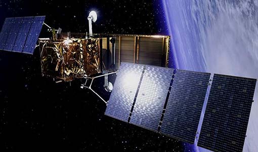
COSMO-SkyMed
COSMO-SkyMed is an Italian Earth-imaging constellation consisting of four identical satellites which launched between 2007 and 2010.
Data - Project Proposal (Restrained)
COSMO-SkyMed ESA archive
The COSMO-SkyMed archive collection consists of COSMO-SkyMed products requested by ESA supported projects over their areas of interest around the world. The dataset regularly grows as ESA collects new products over the years. The following list delineates the characteristics of the SAR measurement modes that are disseminated under ESA Third Party Missions (TPM). STRIPMAP HIMAGE (HIM): Achieving medium resolution (3 m x 3 m single look), wide swath imaging (swath extension ≥40 km). STRIPMAP PINGPONG (SPP): Achieving medium resolution (15 m), medium swath imaging (swath ≥30 km) with two radar polarization's selectable among HH, HV, VH and VV. SCANSAR WIDE (SCW): Achieving radar imaging with swath extension of 100 x 100 km2 and a spatial resolution of 30 x 30 m2. SCANSAR HUGE (SCH): Achieving radar imaging with swath extension of 200 x 200 km2 and a spatial resolution selectable of 100 x 100 m2. Processing Levels: Level 1A - Single-look Complex Slant - (SCSB and SCSU): RAW data focused in slant range-azimuth projection, that is the sensor natural acquisition projection; product contains In-Phase and Quadrature of the focused data, weighted and radiometrically equalised.The processing of the 1A_SCSU product differs from that of the 1A_SCSB product for the following features:a non-weighted processing is performed, which means that windowing isn't applied on the processed bandwidth; radiometric equalisation (in terms of compensation of the range antenna pattern and incidence angle) is not performed; hence only compensation of the antenna transmitter gain and receiver attenuation and range spreading loss is applied. Level 1B - Detected Ground Multi-look (DGM): Product obtained detecting, multi-looking and projecting the Single-look Complex Slant data onto a grid regular in ground. Spotlight Mode products are not multi-looked. Level 1C - Geocoded Ellipsoid Corrected (GEC) and Level 1D - Geocoded Terrain Corrected (GTC): Obtained projecting the Level 1A product onto a regular grid in a chosen cartographic reference system. In case of Lev 1C the surface is the earth ellipsoid while for the Lev 1D a DEM (Digital Elevation Model) is used to approximate the real earth surface. Spatial coverage: Check the spatial coverage of the collection on a map available on the Third Party Missions Dissemination Service. As per ESA policy, very high-resolution data over conflict areas cannot be provided.
News - Data Release news

COSMO-SkyMed ESA archive online dataset available
ESA is pleased to announce the on-line availability of a new dataset: COSMO-SkyMed data for ESA Category-1 users.
Data - Project Proposal (Restrained)
COSMO-SkyMed full archive and tasking
The archive and new tasking X-band SAR products are available from COSMO-Skymed (CSK) and COSMO-SkyMed Second Generation (CSG) missions in ScanSAR and Stripmap modes, right and left looking acquisition (20 to 60° incidence angle). COSMO-SkyMed modes: Acquisition Mode Single look Resolution [Az. X. Rg, SCS] (m) Scene size [Az. X. Rg] (km) Polarisation Scene duration (seconds) Number of looks Multilook resolution (m) Geolocation accuracy ±3 s (m) [DGM, GEC, GTC] Stripmap Himage 2.6 x 3 40 x 40 Single: HH, HV, VH, VV 7 3 5 25 Stripmap PingPong 9.7 x 11 30 x 30 Alternate: HH/VV, HH/HV, VV/VH 6 3 20 25 ScanSAR Wide 23 x 13.5 100 x 100 Single: HH, HV, VH, VV 15 4 - 9 30 30 ScanSAR Huge 38 x 13.5 200 x 200 Single: HH, HV, VH, VV 30 25 - 66 100 100 COSMO-Skymed Second Generation Modes: Acquisition Mode Single look Resolution [Az. X. Rg, SCS] (m) Scene size [Az. X. Rg] (km) Polarisation Scene duration (seconds) Number of looks Multilook resolution (m) Geolocation accuracy ±3σ (m) [DGM, GEC, GTC] Stripmap 3 x 3 40 x 40 Single (HH, VV, HV, VH) or Dual (HH+HV, VV+VH) 7 2 x 2 4 x 4 6 x 7 11 x 14 3.75 Stripmap PingPong 12 x 5 30 x 30 Alternate (HH/VV, HH/HV+VV/VH) 6 1 x 2 2 x 5 12 x 10 23 x 26 12 QuadPol 3 x 3 40 x 15 Quad (HH+HV+VV+VH) N/A 2 x 2 4 x 4 6 x 7 11 x 14 3.75 ScanSAR 1 20 x 4 100 x 100 Single (HH, VV, HV, VH) or Dual (HH+HV, VV+VH) 15 1 x 3 1 x 5 2 x 8 20 x 14 23 x 27 35 x 40 12 ScanSAR 2 40 x 6 200 x 200 Single (HH, VV, HV, VH) or Dual (HH+HV, VV+VH) 30 1 x 4 1 x 7 3 x 16 40 x 27 47 x 54 115 x 135 12 Following Processing Levels are available, for both CSK and CSG: SCS (Level 1A, Single-look Complex Slant): Data in complex format, in slant range projection (the sensor's natural acquisition projection) and zero doppler projection, weighted and radiometrically equalised; the coverage corresponds to the full resolution area illuminated by the SAR instrument DGM (Level 1B, Detected Ground Multi-look): Product obtained detecting, multi-looking and projecting the Single-look Complex Slant data onto a grid regular in ground: it contains focused data, amplitude detected, optionally despeckled by multi-looking approach, radiometrically equalised and represented in ground/azimuth projection GEC (Level 1C, Geocoded Ellipsoid Corrected): Focused data, amplitude detected, optionally despeckled by multi-looking approach, geolocated on the reference ellipsoid and represented in a uniform preselected cartographic presentation. Any geometric correction derived by usage of terrain model isn't applied to this product by default GTC (Level 1D, Geocoded Terrain Corrected): Focused data, fully calibrated with the usage of terrain model, amplitude detected, optionally despeckled by multi-looking approach, geolocated on a DEM and represented in a uniform preselected cartographic presentation. The image scene is located and accurately rectified onto a map projection, through the use of Ground Control Points (GCPs) and Digital Elevation Model (DEM); it differs from GEC for the use of the DEM (instead of reference ellipsoid) for the accurate conversion from slant to ground range and to approximate the real earth surface. The list of available data can be retrieved using the CLEOS COSMO-SkyMed products catalogue. User registration is required to use the catalogue. As per ESA policy, very high-resolution data over conflict areas cannot be provided.
Data - Sample Data (Open)
COSMO-SkyMed Sample Data
Download free COSMO-SkyMed sample datasets to preview products available for this mission.
News - General News
COSMO-SkyMed Second Generation ready for take-off
The first COSMO-SkyMed Second Generation (CSG) satellite is ready to join the other four COSMO-SkyMed (CSK) satellites already in orbit