- All Categories (1030)
- Data (14)
- News (184)
- Missions (3)
- Events (41)
- Tools (11)
- Activities (41)
- Documents (736)
DATA
Discover and download the Earth observation data you need from the broad catalogue of missions the European Space Agency operate and support.
Data - Announcement of Opportunity (Restrained)
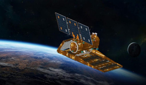
Announcement of Opportunity for SAOCOM
In cooperation with CONAE (Comisión Nacional de Actividades Espaciales), ESA is launching an Announcement of Opportunity for the international scientific community to access data from the SAOCOM mission for science and EO-based applications development.
Data - External Data (Restrained)
SAOCOM Europe data products
This collection provides access to the SAOCOM products acquired in the ASI Zone of Exclusivity, that correspond mainly to the European territory plus the international waters in front of North Africa and the Middle East, archived and catalogued in the ASI/CONAE dissemination system. ASI Zone of Exclusivity Platform SAOCOM 1A only (in future SAOCOM-1B will be added) Instrument L-Band SAR, 1.275 GHz Sensor mode STRIPMAP for data acquired at fixed azimuth steering (beam from S1 up to S10) TOPSAR for data acquired in ScanSAR like mode (Mode A, Mode B or Wide) Processing level L1A - SLC (single look complex, slat range), L1B - DI (detected image, ground range), L1C - GEC (geocoded on ellipsoid), L1D - GTC (geocoded on DEM) Resolution STRIPMAP: 10m TOPSAR Narrow: 30 - 50m TOPSAR WIDE: 50 - 100m Swath Width STRIPMAP: 20 - 40 km TOPSAR Narrow: 100 - 150 km TOPSAR Wide: 220 - 350 km Polarization Single polarization (HH or VV) only for STRIPMAP Double polarization (HHHV or VHVV) for both STRIPMAP and TOPSAR Quad Polarization for both STRIPMAP and TOPSAR
Data - Open access (Open)
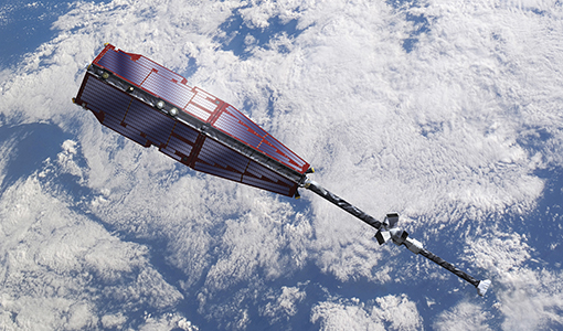
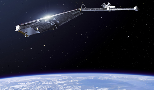
Swarm Level 1B
The Level 1b products of the Swarm mission contains time-series of quality-screen, calibrated, and corrected measurements given in physical, SI units in geo-localized reference frames. Level 1b products are provided individually for each of the three satellites Swarm A, Swarm B, and Swarm C on a daily basis.
Data - Open access (Open)
Swarm Geodesy/Gravity
Monthly gravity field of the Earth, non-gravitational accelerations.
Data - Open access (Open)
Swarm Ionosphere/Magnetosphere
Spherical harmonic model of the large-scale magnetospheric field and its Earth-induced counterpart, spherical harmonic model of the daily geomagnetic variation at middle latitudes and low latitudes, Ionospheric bubble index, ionospheric total electron content, ionosphericfield-aligned currents, dayside ionospheric equatorial electric field, ionospheric plasma density and plasma irregularities.
Data - Open access (Open)
Swarm Level 2 daily
The Swarm Level 1b data products are the corrected and formatted output from each of the three Swarm satellites. By a complex assimilation of these individual satellite measurements into one set of products for the satellite constellation, the Swarm Level 2 Processor ensures a very significant improvement of the quality of the final scientific data products.
Data - Open access (Open)
Swarm Core
Spherical harmonic model of the main (core) field and its temporal variation.
Data - Open access (Open)
Swarm Space Weather
Environmental conditions in Earth's magnetosphere, ionosphere and thermosphere due to the solar activity that drive the Sun-Earth interactions.
Data - Open access (Open)
Swarm Level 2 longterm
The Swarm Level 2 Long Term data products are the corrected and formatted output from each of the three Swarm satellites. By a complex assimilation of these individual satellite measurements into one set of products for the satellite constellation, the Swarm Level 2 Processor ensures a very significant improvement of the quality of the final scientific data products.
Data - Announcement of Opportunity (Restrained)
Closed ESA announcement of opportunities
Find out about closed ESA announcement of opportunities and what these opportunities involved, for historical reference.


