- All Categories (108)
- Data (7)
- News (11)
- Missions (3)
- Events (14)
- Tools (3)
- Activities (3)
- Campaigns (1)
- Documents (66)
DATA
Discover and download the Earth observation data you need from the broad catalogue of missions the European Space Agency operate and support.
Data - Project Proposal (Restrained)
WorldView-4 Full Archive
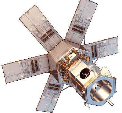
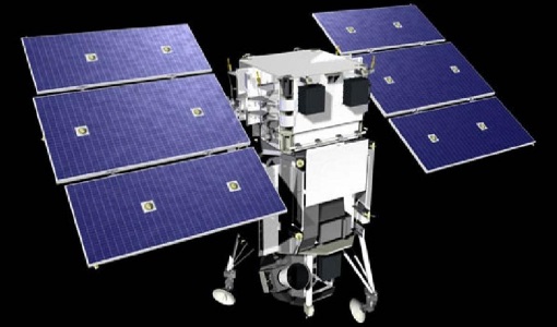
WorldView-4 high resolution optical products are available as part of the Maxar Standard Satellite Imagery products from the QuickBird, WorldView-1/-2/-3/4, and GeoEye-1 satellites. All details about the data provision, data access conditions and quota assignment procedure are described into the Terms of Applicability available in Resources section. In particular, WorldView-4 offers archive panchromatic products up to 0.31 m GSD resolution, and 4-Bands Multispectral products up to 1.24 m GSD resolution. Band Combination Data Processing Level Resolution Panchromatic and 4-bands Standard (2A) / View Ready Standard (OR2A) 15 cm HD, 30 cm HD, 30 cm, 40 cm, 50/60 cm View Ready stereo 30 cm, 40 cm, 50/60 cm Map Ready (Ortho) 1:12.000 Orthorectified 15 cm HD, 30 cm HD, 30 cm, 40 cm, 50/60 cm The options for 4-Bands are the following: 4-Band Multispectral (BLUE, GREEN, RED, NIR1) 4-Band Pan-sharpened (BLUE, GREEN, RED, NIR1) 4-Band Bundle (PAN, BLUE, GREEN, RED, NIR1) 3-Bands Natural Colour (pan-sharpened BLUE, GREEN, RED) 3-Band Colored Infrared (pan-sharpened GREEN, RED, NIR1) Native 30 cm and 50/60 cm resolution products are processed with MAXAR HD Technology to generate respectively the 15 cm HD and 30 cm HD products: the initial special resolution (GSD) is unchanged but the HD technique increases the number of pixels and improves the visual clarity achieving aesthetically refined imagery with precise edges and well-reconstructed details.
Data - Fast Registration with approval (Restrained)
WorldView ESA archive
The WorldView ESA archive is composed of products acquired by WorldView-1, -2, -3 and -4 satellites and requested by ESA supported projects over their areas of interest around the world Panchromatic, 4-Bands, 8-Bands and SWIR products are part of the offer, with the resolution at Nadir depicted in the table. Band Combination Mission GSD Resolution at Nadir GSD Resolution (20° off nadir) Panchromatic WV-1 50 cm 55 cm WV-2 46 cm 52 cm WV-3 31 cm 34 cm WV-4 31 cm 34 cm 4-Bands WV-2 1.84 m 2.4 m WV-3 1.24 m 1.38 m WV-4 1.24 m 1.38 m 8-Bands WV-2 1.84 m 2.4 m WV-3 1.24 m 1.38 m SWIR WV-3 3.70 m 4.10 m The 4-Bands includes various options such as Multispectral (separate channel for Blue, Green, Red, NIR1), Pan-sharpened (Blue, Green, Red, NIR1), Bundle (separate bands for PAN, Blue, Green, Red, NIR1), Natural Colour (pan-sharpened Blue, Green, Red), Coloured Infrared (pan-sharpened Green, Red, NIR). The 8-Bands being an option from Multispectral (COASTAL, Blue, Green, Yellow, Red, Red EDGE, NIR1, NIR2) and Bundle (PAN, COASTAL, Blue, Green, Yellow, Red, Red EDGE, NIR1, NIR2). The processing levels are: Standard (2A): normalised for topographic relief View Ready Standard: ready for orthorectification (RPB files embedded) View Ready Stereo: collected in-track for stereo viewing and manipulation (not available for SWIR) Map Scale (Ortho) 1:12,000 Orthorectified: additional processing unnecessary Spatial coverage: Check the spatial coverage of the collection on a map available on the Third Party Missions Dissemination Service. The following table summarises the offered product types EO-SIP Product Type Band Combination Processing Level Missions WV6_PAN_2A Panchromatic (PAN) Standard/View Ready Standard WorldView-1 and 4 WV6_PAN_OR Panchromatic (PAN) View Ready Stereo WorldView-1 and 4 WV6_PAN_MP Panchromatic (PAN) Map Scale Ortho WorldView-1 and 4 WV1_PAN__2A Panchromatic (PAN) Standard/View Ready Standard WorldView-2 and 3 WV1_PAN__OR Panchromatic (PAN) View Ready Stereo WorldView-2 and 3 WV1_PAN__MP Panchromatic (PAN) Map Scale Ortho WorldView-2 and 3 WV1_4B__2A 4-Band (4B) Standard/View Ready Standard WorldView-2, 3 and 4 WV1_4B__OR 4-Band (4B) View Ready Stereo WorldView-2, 3 and 4 WV1_4B__MP 4-Band (4B) Map Scale Ortho WorldView-2, 3 and 4 WV1_8B_2A 8-Band (8B) Standard/View Ready Standard WorldView-2 and 3 WV1_8B_OR 8-Band (8B) View Ready Stereo WorldView-2 and 3 WV1_8B_MP 8-Band (8B) Map Scale Ortho WorldView-2 and 3 WV1_S8B__2A SWIR Standard/View Ready Standard WorldView-3 WV1_S8B__MP SWIR Map Scale Ortho WorldView-3 As per ESA policy, very high-resolution imagery of conflict areas cannot be provided.
Data - Announcement of Opportunity (Restrained)
Announcement of Opportunity for G-POD
ESA is offering all scientists the possibility to perform bulk processing and/or validation of their own algorithms exploiting the large ESA Earth-observation archive.
Data - Data Description
ERS-1/2 Radar Altimeter REAPER METEO Product - [ERS_ALT_2M]
This is a RA Meteo product containing only the 1 Hz parameters for altimeter (surface range, satellite altitude, wind speed and significant wave height at nadir) and ATSR/MWR data (brightness temperature at 23.8 GHz and 36.5 GHz, water vapour content, liquid water content) used to correct altimeter measurements. It also contains the full geophysical corrections. This product corresponds to a subset of the REAPER GDR product (ERS_ALT_2_). The REAPER (REprocessing of Altimeter Products for ERS) product is generated by applying a similar processing as for Envisat RA-2 on the Level 1b consolidated waveforms using 4 different re-trackers, RA calibration improvement, new precise orbit solution (POD), new ionospheric corrections (NICO09 until 1998 and GIM up to 2003), ECMWF ERA-interim model and updated SSB tables. This product contains only the low rate of 1 Hz data. The REAPER Meteo (ERS_ALT_2M) is a global product including data over ocean, ice and land. It should be noted that this product differs from the Envisat RA2 in the following ways: The product format; which is NetCDF (more details can be found in the Product Handbook), and not PDS The product is delivered based on orbit acquisition and not per pass (pole-to-pole). This product is extended through Envisat RA-2 data.
Data - Fast Registration with immediate access (Open)
ERS-1/2 Radar Altimeter REAPER Geophysical Data Record - GDR [ERS_ALT_2]
This is a RA Geophysical Data Record (GDR) product containing radar range, orbital altitude, wind speed, wave height and water vapour from the ATSR/MWR as well as geophysical corrections. The REAPER (REprocessing of Altimeter Products for ERS) product is generated by applying a similar processing as for Envisat RA-2 on the Level 1b consolidated waveforms using 4 different re-trackers, RA calibration improvement, new precise orbit solution (POD), new ionospheric corrections (NICO09 until 1998 and GIM up to 2003), ECMWF ERA-interim model and updated SSB tables. This product contains two data rates: a low rate of 1 Hz and a high rate of 20 Hz. Most 1 Hz data is also represented at 20 Hz, while microwave radiometer (ATSR/MWR) data and the atmospheric and geophysical corrections are only given at 1 Hz. The REAPER GDR (ERS_ALT_2_) is a global product including data over ocean, ice and land. It should be noted that this product differs from the Envisat RA2 in the following ways: The product format; which is NetCDF (more details can be found in the Product Handbook, and not PDS The product is delivered based on orbit acquisition and not per pass (pole-to-pole). This product is extended through Envisat RA-2 data.
Data - Fast Registration with immediate access (Open)
ERS-1/2 Radar Altimeter REAPER Sensor Geophysical Data Record - SGDR [ERS_ALT_2S]
This is a RA Geophysical Data Record (GDR) product containing radar range, orbital altitude, wind speed, wave height and water vapour from the ATSR/MWR as well as geophysical corrections. The REAPER (REprocessing of Altimeter Products for ERS) product is generated by applying a similar processing as for Envisat RA-2 on the Level 1b consolidated waveforms using 4 different re-trackers, RA calibration improvement, new precise orbit solution (POD), new ionospheric corrections (NICO09 until 1998 and GIM up to 2003), ECMWF ERA-interim model and updated SSB tables. This product contains two data rates: a low rate of 1 Hz and a high rate of 20 Hz. Most 1 Hz data is also represented at 20 Hz, while microwave radiometer (ATSR/MWR) data and the atmospheric and geophysical corrections are only given at 1 Hz. The REAPER GDR (ERS_ALT_2_) is a global product including data over ocean, ice and land. It should be noted that this product differs from the Envisat RA2 in the following ways: The product format; which is NetCDF (more details can be found in the Product Handbook, and not PDS The product is delivered based on orbit acquisition and not per pass (pole-to-pole). This product is extended through Envisat RA-2 data.
Data - Campaigns (Open)
THERMOPOLIS
The THERMOPOLIS 2009 campaign mainly served the DUE “Urban Heat islands (UHI) and Urban Thermography (UT) Project”


