- All Categories (29367)
- Data (99)
- News (154)
- Missions (29)
- Events (58)
- Tools (9)
- Activities (3)
- Campaigns (42)
- Documents (28973)
DATA
Discover and download the Earth observation data you need from the broad catalogue of missions the European Space Agency operate and support.
Data - Campaigns (Open)
SARSimHT
The main objective of “SARSimHT – Airborne SAR experiment to simulate Hydroterra data” was to demonstrate the image formation process of Hydroterra through the exploitation of a repeat-pass hyper-temporal airborne SAR image stack acquired over short time intervals representative of the Hydroterra mission.
Data - Campaigns (Open)
POLARIS Proof of Concept 2008
The POLARIS Proof-of-Concept (PoC) 2008 campaign primarily aimed to verify the usefulness of the system for glaciological applications.
Data - Campaigns (Open)
POLARIS 2011
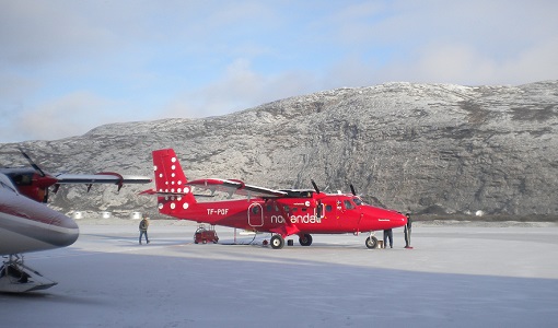
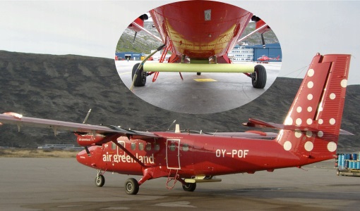
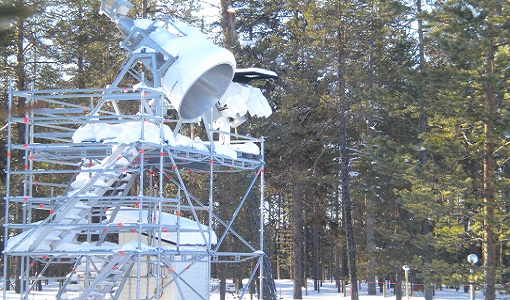
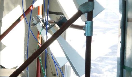
In February 2011, ESA's POLarimetric Airborne Radar Ice Sounder (POLARIS) system was flown for the first time in the Antarctic, as part of the POLARIS IceGrav Antarctic Campaign 2011, ICEGRAV project.
Data - Campaigns (Open)
POLARIS - Proof of Concept 2009
POLARIS - Proof of Concept (PoC) 2009 is a follow on campaign from POLARIS - PoC 2008. It focused on an additional POLARIS test with the objective to system test after system upgrade and the acquisition of fully polarimetric data of glaciological interest.
Data - Campaigns (Open)

PolarGap
The primary objective of the PolarGap campaign was to carry out an airborne gravity survey covering the southern polar gap of the gravity field mission GOCE, beyond the coverage of the GOCE orbit.
Data - Campaigns (Open)
SnowLab-NG
The overall objective of the SnowLab-NG activity was to provide a comprehensive multi-frequency, multi-polarisation, multi-temporal dataset and active and passive microwave measurements over snow-covered grounds.
Data - Campaigns (Open)
SnowLab
The aim of the SnowLab campaign was to provide a comprehensive multi-frequency, multi-polarisation, multi-temporal dataset of active and passive microwave measurements over snow-covered grounds to investigate the relationship between effective snow and ground parameters and the resultant signals detected by microwave radars and radiometers.
Data - Campaigns (Open)

AROMAT-II
This campaign covers the fields of atmospheric composition: NO2, SO2, aerosols, over Romania (Bucharest and Turceni) and Germany (Berlin).
Data - Campaigns (Open)

SMOSice
The ESA SMOSice study has demonstrated for the first time the potential to retrieve sea ice thickness from SMOS data.
Data - Campaigns (Open)
AfriSAR 2015
During the AfriSAR 2015 campaign, shared between ONERA (dry season, July 2015) and DLR (wet season 2016), Pol-InSAR and TomoSAR airborne data set were collected over four test sites over Africa, therefore covering different forest structures.
Data - Campaigns (Open)

BelSAR 2018
The BelSAR project intended to carry out an airborne campaign for SAR bistatic interferometric measurements at L-band and full polarisation, over a test site in Belgium.
Data - Campaigns (Open)

WISE
The objective of WInd and Salinity Experiment 2001 (WISE 2001) was to get more data points and better wind speed (WS) measurements so as to reduce the sensitivity to WS uncertainty.
Data - Campaigns (Open)
AlpTomoExp
The AlpTomoSAR experiment has been conceived to support studies related to SAOCOMCS tomography for mapping the 3D internal structure of glaciers.
Data - Campaigns (Open)

AquiferEx
The AquiferEx Optical and Radar Campaign was in support of information product generation based on satellite data, harmonisation of satellite data acquisition performed among Aquifer and AquiferEx project partners.
Data - Campaigns (Open)
SnowSum
The SnowSum experiment is designed to support the development of future concepts to monitor the cryosphere.
Data - Campaigns (Open)
SnowSAR Proof Of Concept
The main objective of the SnowSAR campaign was the provision of radiometric calibrated airborne SAR data needed to characterise the backscattering signatures of snow and other terrain types (e.g. trees).
Data - Campaigns (Open)
SnowSAR (NOSREX, TVCEXP and ALPSAR)
As a candidate of the Earth Explorer Programme, the European Space Agency proposed the (CoReH2O) mission, consisting of a satellite mission for the monitoring of snow, glaciers and surface water, based on a dual frequency SAR sensor.
Data - Campaigns (Open)
CoSMOS 2006
ESA conducted an airborne campaign to map sea surface salinity named "CoSMOS-OS" that took place in April 2006 over the Norway Sea off the coast of Stavenger.
Data - Campaigns (Open)
CryoVEx 2003
The CryoVEx (CryoSat Validation EXperiment) 2003 campaign was a first comprehensive Arctic Ocean airborne and surface campaign, in support of the ESA satellite CryoSat, planned for launch late 2004.
Data - Campaigns (Open)
CryoVEx 2005
CryoVEx 2005 was the third combined airborne and surface campaign for the preparation of the CryoSat mission. It followed the 2004 campaign, which first utilised the new ASIRAS radar.