- All Categories (60814)
- Data (81)
- News (242)
- Missions (31)
- Events (82)
- Tools (11)
- Activities (36)
- Campaigns (31)
- Documents (60300)
CAMPAIGNS
Learn about the ground-based, ship-borne, balloon-borne, and airborne campaigns and small satellite field experiments that validate orbiting ESA EO satellites and support future mission development.
Campaign
 1998 - 2000
CLARE
CLARE 2000: Cloud Lidar and Radar Experiments were to provide an extended data base and develop new analysis methods.
Campaign
 2000 - 2001
WISE
The objective of WInd and Salinity Experiment 2001 (WISE 2001) campaign was to get more data points and better wind speed measurements.
Campaign
 2003 - 2004
SPARC
ESA's SPectra bARrax Campaign (SPARC) activity was part of the preparatory study for a proposed ESA Earth Explorer mission called SPECTRA. The objective was to collect a CHRIS/PROBA reference dataset for SPECTRA-related studies.
Campaign
 2002 - 2005
WALEX
The objective of the airborne campaign Water Vapour Lidar Experiment (WALEX) is to collect valuable data to provide representative lidar measurements of water vapour and aerosol properties in different climatic zones.
Campaign
 2005
2005BACCHUS-DOC
The BACCHUS-DOC Radar and Optical Campaign was an area mapping project of vineyards near Frascati (Italy). ESA required high resolution geo-referenced airborne SAR data of different wavelength and polarisation (preferably polarimetric).
Campaign
 2006
2006CoSMOS 2006
ESA conducted an airborne campaign to map sea surface salinity named "CoSMOS-OS" that took place in April 2006 over the Norway Sea off the coast of Stavenger.
Campaign
 2007
2007CEFLES2
The objective of the CEFLES2 campaigns was to provide key reference data and background knowledge for the preparatory phases of the Sentinel‐2 and FLEX missions.
Campaign
 2007
2007BioSAR 2007
The BioSAR campaign aimed to support geophysical algorithm development, calibration/validation and the simulation of future spaceborne Earth Observation missions.
Campaign
 2008
2008BioSAR 2008
The main objective of BioSAR-2 (BioSAR 2008) campaign was to record SAR data over boreal forests with topographic effects to investigate the effect on biomass retrieval.
Campaign
 2008
2008DESIREX 2008
DESIREX 2008 (Dual-use European Security IR Experiment 2008) was conceived as an experimental campaign in the city of Madrid (Spain).
Campaign
 2009
2009AgriSAR 2009
The AgriSAR 2009 campaign was defined to leverage the RADARSAT-2 mission to better understand and demonstrate the potential for GMES land monitoring user services, particularly in agriculture.
Campaign
 2010
2010BioSAR 2010
The BioSAR-3 (BioSAR 2010) campaign was specifically planned and implemented to investigate possibilities for a future spaceborne P-band polarimetric and interferometric SAR with a life-time of multiple years.
Campaign
 2009 - 2010
PremierEX
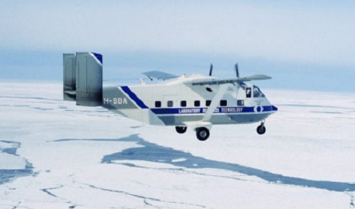
The campaign was based in the Arena Arctica in Kiruna (Sweden). The science campaign has addressed the science objectives and was part of the airborne campaign of the EU project RECONCILE.
Campaign
 2005 - 2010
CoSMOS 2005, 2007, 2008, 2010
The Campaign for Validating the Operation of SMOS (coSMOS) was designed to acquire SMOS-like data so that the algorithms were fine-tuned and properly validated before the launch of SMOS mission in 2007.
Campaign
 2011
2011ESSenCe
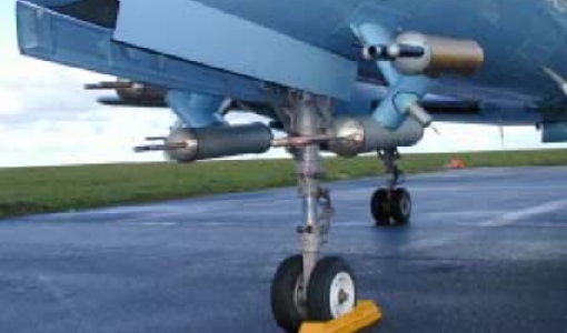
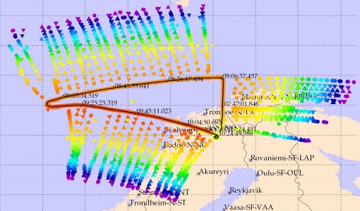
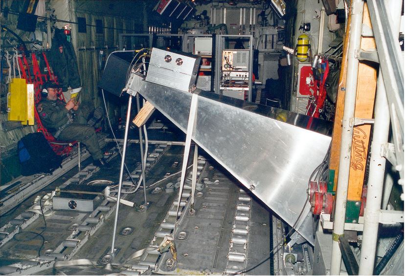
The ESA Sounder Campaign 2011 (ESSenCe) conducted field measurements utilising the high-altitude research aircraft Geophysica to quantify processes that control the composition and structure of the mid to upper troposphere and lower stratosphere.
Campaign
 2012
2012C-MAPExp
The C‐MAPExp campaign was planned and executed to support the demonstration of CarbonSat capabilities.
Campaign
 2014
2014COMEX
The COMEX campaign supports the mission definition of CarbonSat and HyspIRI by providing representative airborne remote sensing data ‐ MAMAP for CarbonSat.
Campaign
 2014
2014CHARADMexp
The ESA CHARADMExp campaign focuses on marine and marine-dust aerosol mixture characterisation.
Campaign
 2014
2014AROMAT-I
The main objective of this AROMAT-I campaign was to test newly developed airborne sensors and to evaluate their capabilities as validation tools for future air quality space borne sensors, in particular TROPOMI.
Campaign
 2015
2015AirScatterGNSS
In this project an Airborne Wind Vector Scatterometer (AWVS) system was designed and built for measurements of sea surface backscattering from an aircraft.