- All Categories (23412)
- Data (118)
- News (166)
- Missions (57)
- Events (66)
- Tools (10)
- Activities (10)
- Campaigns (40)
- Documents (22945)
CAMPAIGNS
Learn about the ground-based, ship-borne, balloon-borne, and airborne campaigns and small satellite field experiments that validate orbiting ESA EO satellites and support future mission development.
Campaign
 2002
2002SIFLEX
The Solar Induced Fluorescence Experiment (SIFLEX) 2002 campaign was to understand whether solar-induced fluorescence measurements might someday be used to monitor and map the photochemical activity of boreal forests from space.
Campaign
 2003
2003TerraSARSIM
The objectives of the TerraSAR SIM project were to quantify the impact of the time intervals between SAR acquisitions at different wavelengths on agricultural applications.
Campaign
 2003 - 2004
SPARC
ESA's SPectra bARrax Campaign (SPARC) activity was part of the preparatory study for a proposed ESA Earth Explorer mission called SPECTRA. The objective was to collect a CHRIS/PROBA reference dataset for SPECTRA-related studies.
Campaign
 2004
2004INDREX-2
ESA and Indonesian Ministry of Forest Study was a 2004 follow-up campaign to the INDREX project which was to generate a digital elevation model over a non-accessible region in order to model environmental changes.
Campaign
 2004
2004DOMEX-1
The purpose of the DOMEX experiment was to acquire the first combined, in-situ microwave emission measurements using C- and L-band radiometers.
Campaign
 2005
2005AquiferEx
The AquiferEx Optical and Radar Campaign was in support of information product generation based on satellite data, harmonisation of satellite data acquisition performed among Aquifer and AquiferEx project partners.
Campaign
 2005
2005SEN2FLEX
SENtinel-2 and FLuorescence EXperiment (SEN2FLEX) campaign combines different activities in support of initiatives related both to fluorescence experiments and Sentinel-2 initiative for prototyping of resolutions to meet mission requirements.
Campaign
 2005
2005BACCHUS-DOC
The BACCHUS-DOC Radar and Optical Campaign was an area mapping project of vineyards near Frascati (Italy). ESA required high resolution geo-referenced airborne SAR data of different wavelength and polarisation (preferably polarimetric).
Campaign
 2006
2006AGRISAR 2006
The AGRISAR 2006 campaign, carried out between 18 April and 2 August 2006, was established to address important specific programmatic needs of Sentinel-1 and -2.
Campaign
 2006
2006EAGLE
The general purpose of the EAGLE2006 campaign was: Acquisition of simultaneous multi-angular and multi-sensor (from visible to microwave domain) data over a grassland and a forest.
Campaign
 2006
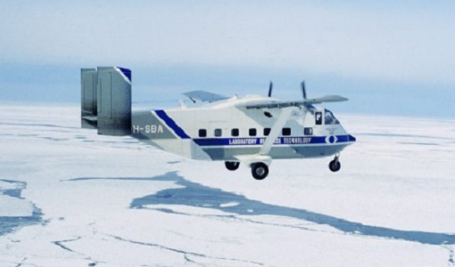
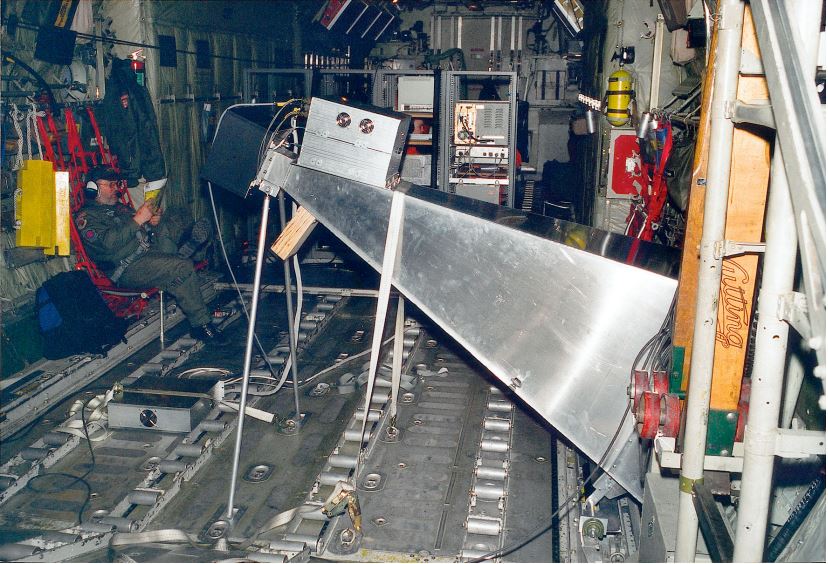
2006CoSMOS 2006
ESA conducted an airborne campaign to map sea surface salinity named "CoSMOS-OS" that took place in April 2006 over the Norway Sea off the coast of Stavenger.
Campaign
 2006
2006AIRFIRE
The fires observational campaign was performed during summer 2006 and dedicated to the study of fire emission in the spectral region VNIR-SWIR.
Campaign
 2007
2007CEFLES2
The objective of the CEFLES2 campaigns was to provide key reference data and background knowledge for the preparatory phases of the Sentinel‐2 and FLEX missions.
Campaign
 2007
2007BioSAR 2007
The BioSAR campaign aimed to support geophysical algorithm development, calibration/validation and the simulation of future spaceborne Earth Observation missions.
Campaign
 2008
2008BioSAR 2008
The main objective of BioSAR-2 (BioSAR 2008) campaign was to record SAR data over boreal forests with topographic effects to investigate the effect on biomass retrieval.
Campaign
 2009
2009AgriSAR 2009
The AgriSAR 2009 campaign was defined to leverage the RADARSAT-2 mission to better understand and demonstrate the potential for GMES land monitoring user services, particularly in agriculture.
Campaign
 2009
2009TropiSAR 2009
The TropiSAR campaign objectives were the evaluation of P-Band radar imaging over tropical forests for biomass and forest height estimation.
Campaign
 2010
2010BioSAR 2010
The BioSAR-3 (BioSAR 2010) campaign was specifically planned and implemented to investigate possibilities for a future spaceborne P-band polarimetric and interferometric SAR with a life-time of multiple years.
Campaign
 2005 - 2010
CoSMOS 2005, 2007, 2008, 2010
The Campaign for Validating the Operation of SMOS (coSMOS) was designed to acquire SMOS-like data so that the algorithms were fine-tuned and properly validated before the launch of SMOS mission in 2007.
Campaign
 2011 - 2012
TropiScat
The major objectives of the experiment were the temporal survey of the variation of the measurements in time scales ranging from diurnal, weekly, monthly, up to 12 months of observation.