- All Categories (43520)
- Data (167)
- News (343)
- Missions (69)
- Events (107)
- Tools (30)
- Activities (25)
- Campaigns (86)
- Documents (42693)
ACTIVITIES
Find the activities you need.
Activity - General activities
EO Summer Schools
ESA's series of summer schools, on Monitoring of the Earth System, aims to promote the exploitation of Earth observation (EO) data.
Activity - General activities

MUltisource data package tools and SErvices (MUSE)
The MUSE project aims to develop and integrate a tool to simultaneously manipulate geospatial data products, satellite, model and in-situ data.
Activity - General activities

International Charter Space and Major Disasters
Learn about the International Charter Space and Major Disasters, which ESA participate in disaster monitoring.
Activity - Projects
ESC Geomagnetic Conditions
The objective of the Expert Service Centre Geomagnetic Conditions - definition and development activities work is to ensure operational and development activities within the Geomagnetic Conditions Expert Service Centre of ESA's Space Situational Awareness Space Weather network.
Activity - Projects

Contribution of Swarm data to the prompt detection of Tsunamis and other natural hazards
The main objective of COSTO (Contribution of Swarm data to the prompt detection of Tsunamis and other natural hazards) project is to better characterise, understand and discover coupling processes and interactions.
Activity - Projects

3D mantle conductivity
The 3D mantle conductivity project is part of the Swarm DISC (Data, Innovation and Science Cluster).
Activity - Projects
Dragon Cooperation Programme
The Dragon Programme focussed on science and applications development in China using mainly data from the ERS and Envisat missions. The Prgramme was a cooperation between ESA and the National Remote Sensing Centre of China.
Activity - Projects
Dragon 2 Cooperation Programme
The Dragon 2 Programme focussed on the exploitation of ESA, ESA's Third Party Missions and Chinese Earth observation data for science and applications development in land, ocean and atmospheric applications.
Activity - General activities
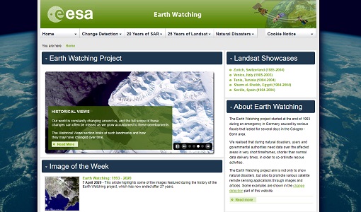
Earth Watching
The Earth Watching project began in 1993 to assist local authorities and to promote the benefits of remote sensing data during natural disasters, but also to promote various satellite remote sensing applications through images and articles.
Activity - General activities

EO Science for Society
ESA's Earth Observation Science for Society programme aims to promote scientific exploitation of satellite data, forges new scientific discoveries and pioneers new services, stimulating downstream industrial and economic growth.
Activity - Quality
Swarm DISC
The Swarm DISC (Swarm Data, Innovation, and Science Cluster) is an international consortium to enhance the scientific return of the Swarm satellite mission.
Activity - Projects
Swarm - Spherical Elementary Current System
The Swarm-SECS project investigated how the method of Spherical Elementary Current Systems can be applied to Swarm magnetic and electric field data in order to create new data products.
Activity - Fiducial Reference Measurements
FRM4ALT: Fiducial Reference Measurements for Altimetry
The aim of the FRM4ALT Project. precise measurements of the surface topography of the ocean, and of continental waters are made through satellite altimetry missions all over the globe.
Activity - Fiducial Reference Measurements
FRM4VEG: Fiducial Reference Measurements for Vegetation
Fiducial Reference Measurements for Vegetation (FRM4VEG) is an ESA managed project focused on establishing the protocols required for traceable in-situ measurements of vegetation
Activity - Quality

EDAP
The ESA Earthnet Data Assessment Pilot (EDAP) project will perform assessments for various missions to ensure the delivered data is fit for purpose.
Activity - Cal/Val activities
S2L8VegStruc
The Retrieval of vegetation structural variables from Sentinel-2/Landsat 8 time series study's objective is to test and validate the capabilities for the retrieval of structural variables.
Activity - Cal/Val activities
MBASSS
Mer Bleue Arctic Surrogate Simulation Site (MBASSS) Sentinel-2 and Landsat 8 Validation Project objectives are to develop capability to validate Landsat 8 Operational Land Imager land data products.
Activity - Instrument characterisation and algorithm studies
PV-LAC-ATMO
The objective of PV-LAC-ATMO Activity is to investigate the added value of a joint surface reflectance.
Activity - Instrument characterisation and algorithm studies
PV-CDRR
The objective of the Proba-V Cloud Detection Round Robin (PV-CDRR) is to learn advantages and drawbacks of the different approaches for various cloud and surface conditions.