- All Categories (337)
- Data (1)
- News (28)
- Missions (13)
- Events (11)
- Tools (4)
- Activities (5)
- Documents (275)
Document - Conference Presentation - Poster

Global-Surface-Geostrophic-Currents-From-Satellite-Altimetry-and-GOCE
Global Surface Geostrophic Currents from Satellite Altimetry and GOCE J.M. Sánchez-Reales, I. Vigo, S.G. Sin & B.F. Chao
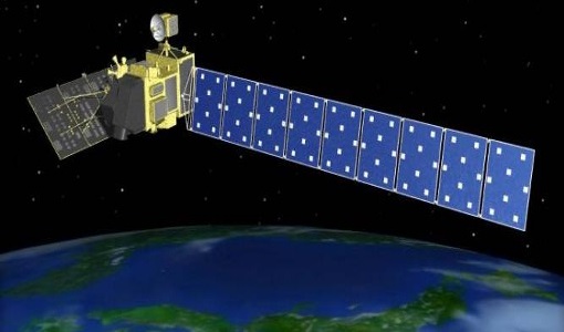
Mission - Earth Explorers

GOCE
Explorer (GOCE) mission mapped Earth's geoid very accurately, opening a window into Earth's interior structure as well as the currents
News - Success Stories

Long-term satellite data show wind farms can affect local air currents
Long-term measurements allow before and after comparison Data from the heritage Envisat satellite currently maintained accessible
Document - General Reference

Earth-Explorers-Satellites-to-understand-our-changing-Earth.pdf
This eight-page brochure provides an overview of the Earth Explorers currently in orbit and those under development.
News - General News
Go-to guide to Third Party Mission data offering
Data Access Guide has been published, providing technical details and information on available data collections for all current
Document - Proceedings

First-International-GOCE-Workshop-GOCE-Germany-Oceanography.pdf
describes using data from the GOCE satellite mission in order to determine structure and transport of the Antarctic Circumpolar Current
Event - Meeting

VH-RODA and CEOS SAR workshop
The workshop provided an open forum for the presentation and discussion of current status and future developments related
Document - Software Verification Plan/Report

GUT2-WP6000-Final-Report.pdf
combined to models of the marine geoid to estimate the ocean Mean Dynamic Topography, and, by geostrophy, the ocean mean currents
Activity - Quality

EDAP
The following missions are currently being considered as part of the Automatic Identification System (AIS) and Radio Frequency
Tools - Analysis

GOCE User Toolbox
Data output formats The current data formats that GUT can provide in output are: netCDF (Climate and Forecast Metadata Convention
Event - Workshop

GOCE - 4th International User Workshop 2011 sessions
On the Current Status of the Cooperative Research Project Real Data Analysis GOCE (REAL GOCE) W.-D. Schuh & B.
Event - Workshop

SEASAR 2012
Aouf 14:00 - 14:20 Towards consistent inversion of wind, waves and surface current from SAR Bertrand Chapron (IFREMER, France
News - Thematic area articles

How satellite data help to shape society
Title: Current drought situation in Ebro basin Description: The SMOS soil-moisture-based drought monitor is updated monthly
Event - Workshop
VH-RODA 2021 Workshop
the Workshop will provide an open forum (new space, commercial and institutional) for the presentation and discussion of current
Mission - Heritage Missions
PALSAR
A small percentage of ALOS-1 PALSAR products processed by the current installed ESA IPF are affected by a known quality issue
Mission - Heritage Missions

PALSAR Processor Releases
The current ALOS-1 PALSAR IPF integrated within the ESA On-The-Fly system is v4.16p9, installed on 24 January 2017.
News - Events and Proceedings

Φ-Week Triumphs
Opening Session Title: Φ-Week's Opening Session Description: During the fourth edition of ESA’s Φ -Week, Josef Aschbacher, current
Document - Conference Presentation - Poster
7-Highres-Surface-Velocity-Monitoring-Wide-Swath-SAR.pdf
High resolution Surface Velocity Monitoring with Wide Swath SAR: A User´s Guide to the Range Doppler Method Johnny Johannessen (NERSC, Norway)
Document - Conference Presentation - Poster
Estimating-North-Atlantic-Mean-Dynamic-Topography-R-J-Bingham.pdf
GOCE - 4th International User Workshop 2011 sessions presentation
Document - Proceedings
First-International-GOCE-Workshop-Geoid-Scales-from-Altimetry-and-In-Situ-Observations.pdf
This presentation from ESA's First International GOCE Workshop describes a method that can be used to derive independent Geoid estimates from a combination of altimetry and in situ data.