- All Categories (80)
- Data (3)
- News (36)
- Missions (4)
- Events (1)
- Tools (5)
- Activities (7)
- Campaigns (1)
- Documents (23)
News - General News
Earth scientists better exploit Swarm data with virtual workspace
The ESA-funded Swarm virtual workspace is helping scientists make the most of a decade of valuable magnetic field data.
News - General News

New Swarm Field Aligned Current web tool available
We are pleased to announce that a new Field Aligned Currents (FAC) web tool is available
News - How to guides
HEDAVI Discover: a step-by-step guide
The Heritage Data Visualisation tool (HEDAVI) is a platform developed by the French Science Consulting for Earth Observation group, VisioTerra, which allows users to freely access over 40 years of ESA Earth Observation Heritage data, Third Party Missions and some Copernicus data.
News - Success Stories
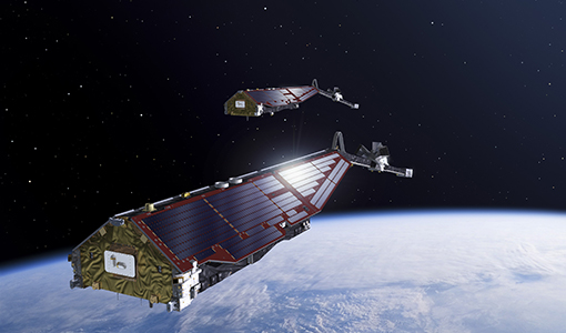
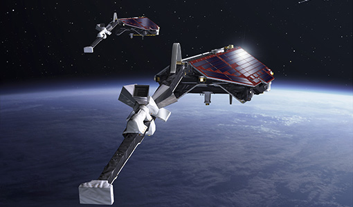
Ten years of Swarm data help reveal processes in Earth’s core
The tenth birthday of ESA’s three-satellite Swarm constellation has been a game changer for research into Earth’s magnetic field and core dynamics, as set out by an ESA-funded project.
News - Success Stories
Magnetic magic: 10 reasons to be excited about Swarm
In November 2023, Swarm celebrated an impressive ten years in orbit. In that time, ESA’s magnetic mission has honed in on all sorts of mysteries - from tussling magnetic blobs to animal migration.
News - Data Release news
New version release of Swarm Level 2 EEF data
An updated version of the Swarm Level 2 product Equatorial Electric Field (EEF) v0304 is now available on Swarm dissemination server.
News - Thematic area articles
Cloud-free collections key for land monitoring
Satellite imagery is a crucially important tool for monitoring the land, but cloud cover can often block parts of Earth’s surface from view, limiting subsequent analyses.
News - Success Stories
Commercial and international data for fire monitoring
As climate change sparks a surge in the frequency and intensity of wildfires, satellite data disseminated through ESA’s Third Party Missions (TPM) programme are helping scientists to track and investigate these potentially damaging natural events.
Activity - Projects
Swarm DISC pre-study 5.1
Understanding the complex dynamics of neutral winds in the upper atmosphere is crucial for understanding thermosphere-ionosphere interactions. However, the limited availability of measurements and data coverage has hindered the comprehensive characterization of these winds.
Activity - Projects
SWESMAG
The project SWESMAG relies on magnetic field data from Swarm to investigate Space Weather (SWE) effects related to Geomagnetic Induced Currents (GICs), driven mainly by rapid variations of the ionospheric Polar Electrojet (PEJ) currents and quantified (loosely) by the variation of the horizontal ground magnetic field component dH/dt.
Activity - Projects
Monitoring of Ionospheric Gradients At Swarm (MIGRAS)
Precision and safety of life applications using trans-ionospheric signals require key information on space weather conditions in particular on the perturbation degree of the ionosphere.
News - General News
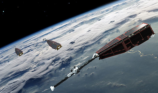
Big ambitions as Swarm mission soars on
For nearly a decade ESA’s magnetic field mission has taken us on a journey from Earth’s core to the magnetosphere, and almost everything in between.
News - General News

New Swarm Product Data Handbook available
We are pleased to announce that a new Swarm Product Data Handbook page is now available.
Activity - Projects
ESA's multi-level global thermosphere data products consistent with Swarm and GRACE (-FO)
In this project, the possibility of using the space-based along-track Thermospheric Neutral Density (TND) estimates for generating the European Space Agency (ESA)'s Level 3 (L3) global multi-level TND data products is assessed.
Activity - Projects

Swarm-SWITCH
Space weather in the thermosphere-ionosphere can have a variety of adverse effects on technological systems, for example by affecting radio signals and satellite orbits.
Mission - Earth Explorers
Swarm Product Data Handbook
The Swarm Product Data Handbook provides a detailed description of Level 1b and Level 2 products derived from Swarm data.
News - Data Release news

Additional EFI TII Cross Track Flow dataset 0302 available for Swarm
Additional TII cross-track flow data is now available on the Swarm dissemination server for all the Swarm satellites.
News - Data Release news
Additional EFI TII Raw And Corrected Imagery and Spectra (TRACIS) dataset 0102 available for Swarm
Additional EFI TII Raw And Corrected Imagery and Spectra (TRACIS) data is now available on the Swarm dissemination server for all the Swarm satellites.
News - General News
ESA's excellent Earth Explorer missions extended to 2025
Since 2009, ESA’s Earth Explorer missions have pioneered breakthrough technologies and transformed our understanding of Earth’s system, from its core to the outer stretches of the atmosphere.
Data - EO Sign In Authentication (Open)
Landsat 5 TM European and Mediterranean Countries Cloud Free Collection
This dataset contains the cloud-free products from Landsat 5 Thematic Mapper collection acquired over Europe, North Africa and the Middle East; for each scene only one product is selected, with the minimal cloud coverage. The acquired Landsat TM scene covers approximately 183 x 172.8 km. A standard full scene is nominally centred on the intersection between a path and row (the actual image centre can vary by up to 100 m). The data are system corrected.