- All Categories (90)
- News (5)
- Events (6)
- Tools (3)
- Activities (1)
- Documents (75)
Event - Training
EO Summer School 3
ESA's series of summer schools, on Monitoring of the Earth System, aims to promote the exploitation of Earth observation data.
News - Thematic area articles
Transforming space data into climate action
ESA’s Earth observation activities are playing a key role in the revitalised global drive to combat climate change.
News - Events and Proceedings
Data preservation takes centre stage at Living Planet Symposium
Against the backdrop of the famed Rhine River, world-class scientists and Earth observation data-users are gathered this week in the historical city of Bonn, at the Living Planet Symposium (LPS).
News - Spotlight on EO community
Interviewing Mirko Albani
ESA’s Heritage Space Programme Manager describes the goals of the programme, some of the challenges involved in preserving and improving 40 years of historical Earth observation data, and his passion for curating this long-term archive.
News - Spotlight on EO community
Introducing Mirko Albani
In this short introduction, ESA's Heritage Missions Programme Manager describes what he likes most about ESA's long term archive of satellite mission data and his role in the programme.
Event - Workshop
Fringe 2003 Workshop
The third ESA International Workshop on ERS SAR Interferometry and its first Workshop on ASAR interferometry: Advances in SAR interferometry from ERS and Envisat missions.
Activity - Projects
Dragon 2 Cooperation Programme
The Dragon 2 Programme focussed on the exploitation of ESA, ESA's Third Party Missions and Chinese Earth observation data for science and applications development in land, ocean and atmospheric applications.
Document - General Reference
Spacelab-in-context.pdf
This document provides an overview of Spacelab, a joint ESA-NASA laboratory that was carried aboard space shuttles from 1981 to 2000.
Tools - Apps
Heritage Missions app for iOS
Download the Heritage Missions application to discover what the missions were about, how it worked and what the elements of the space and ground segment that make these missions unique.
Tools - Apps
Heritage Missions app for Android
Download the Heritage Missions application to discover what the missions were about, how it worked and what the elements of the space and ground segment that make these missions unique.
Document - General Reference
In-action-around-the-world-the-International-Charter-Space-and-Major-Disasters.pdf
This is an article extracted from the ESA Bulletin Nr.143.
Document - General Reference
ARTEMIS-Paving-the-way-for-Europes-future-data-relay-land-mobile-and-Navigation-Services.pdf
This brochure provides an overview of Artemis, ESAs telecommunications satellite.
Document - General Reference
Understanding climate change from space
This document describes ESA's Climate Change Initiative, and how it is intended to contribute towards monitoring and understanding the Earth's climate.
Tools - Other
Geohazards TEP
The Geohazards Thematic Exploitation Platform (TEP) aims to provide Earth observation data for supporting geohazards applications.
Event - Workshop
SEASAR 2012
The European Space Agency and the Norwegian Space Centre jointly organised the fourth SAR oceanography workshop, 'SEASAR 2012', entitled 'Advances in SAR Oceanography'.
Event - Workshop
Fringe 2011 Workshop
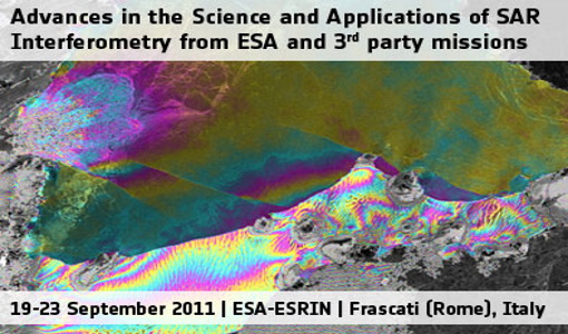
Fringe 2011 was the 8th International Workshop on "Advances in the Science and Applications of SAR Interferometry".
Document - Technical Note
Quality Assessment of CERSAT Altimeter Products
The first results of the CERSAT QIP and QPR quality assessments are presented in this report.
Document - User Guide
DMC-Product-Manual-for-the-DMC-Europe-2007-Coverage
The data products supplied by DMCII are derived from images acquired by the DMC satellites. The primary payload on the DMC satellites is the SLIM-6 imager manufactured by SSTL, UK. This manual will aid users in their analysis of the data products to maximise the information they can extract from the DMC images by providing a thorough description of the data products, the imaging payload, the calibration procedure and the orthorectification process.
Document - General Reference
Global Earth Observation System of Systems (GEOSS) - 10-Year Implementation Plan Reference Document
The Global Earth Observation System of Systems (GEOSS) 10-Year Implementation Plan, endorsed by nearly 60 governments and the European Commission on 16 February 2005, is designed to qualitatively improve our understanding of the Earth system, markedly enhancing global policy- and decision-making abilities to promote the environment, human health, safety, and welfare.
Document - Product Document
Earth Images Catalogue - 13 LEDA
The Earth Images Catalogue (LEDA - on-Line Earthnet Data Availability) is a catalogue of remotely-sensed satellite imagery. It consists of four general series of images: LANDSAT, NOAA/TIROS, Marine Observation Satellites series (MOS), and Nimbus-7. This guide describes the catalogue and how to use it.


