- All Categories (25)
- Data (4)
- News (4)
- Missions (1)
- Events (8)
- Tools (1)
- Activities (2)
- Campaigns (3)
- Documents (2)
News - Thematic area articles
Cloud-free collections key for land monitoring
Satellite imagery is a crucially important tool for monitoring the land, but cloud cover can often block parts of Earth’s surface from view, limiting subsequent analyses.
News - Success Stories
Commercial and international data for fire monitoring
As climate change sparks a surge in the frequency and intensity of wildfires, satellite data disseminated through ESA’s Third Party Missions (TPM) programme are helping scientists to track and investigate these potentially damaging natural events.
Event - Training

EO Summer School 3
ESA's series of summer schools, on Monitoring of the Earth System, aims to promote the exploitation of Earth observation data.
Event - Conference

Living Planet Symposium 2022
Learn about the 2022 edition of ESA's Living Planet Symposium.
News - Success Stories
Ground-based campaigns support NO2 monitoring in Po Valley
The Po Valley in Italy is one of the most polluted regions in Europe. High NO2 concentrations often occur due to industrial and urban activities and the topography of the Po River basin, where the Alps and Apennines limit the dispersal of pollutants.
Event - Workshop

Insurance Industry Workshop on Earth Observation
This ESA workshop examined the potential value of satellite Earth Observation data to the insurance industry.
News - Infographics

An overview of ESA's Third Party Missions programme
ESA’s Third Party Missions programme consists of almost 50 satellite missions, which are owned by organisations around the world. ESA has agreements with these organisations to acquire, process, and distribute data from their missions
Activity - General activities

EO Science for Society
ESA's Earth Observation Science for Society programme aims to promote scientific exploitation of satellite data, forges new scientific discoveries and pioneers new services, stimulating downstream industrial and economic growth.
Mission - Copernicus Sentinels

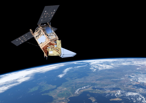
Copernicus Sentinel-5P
The Copernicus Sentinel-5 Precursor mission is the first Copernicus mission dedicated to monitoring our atmosphere.
Event - Workshop
CEOS-WGCV ACIX II CMIX Atmospheric Correction Inter-comparison Exercise Cloud Masking Inter-comparison Exercise 2nd workshop
The CEOS-WGCV ACIX II 2nd workshop took place at Esrin, Rome in Italy from 3 December - 5 December 2019.
Data - Announcement of Opportunity (Restrained)
CLOSED - Announcement of Opportunity for S5PVT (Sentinel-5 Precursor Calibration and Validation Team)
In the framework of the Copernicus programme, ESA offered an announcement of opportunity to support the Sentinel-5 Precursor Calibration and Validation Team Call.
Data - Campaigns (Open)

BACCHUS-DOC
The BACCHUS-DOC Radar and Optical Campaign was an area mapping project of vineyards near Frascati (Italy). ESA required high resolution geo-referenced airborne SAR data of different wavelength and polarisation (preferably polarimetric).
Data - Campaigns (Open)

AROMAT-II
This campaign covers the fields of atmospheric composition: NO2, SO2, aerosols, over Romania (Bucharest and Turceni) and Germany (Berlin).
Data - Campaigns (Open)

AROMAT-I
The main objective of this AROMAT-I campaign was to test newly developed airborne sensors and to evaluate their capabilities as validation tools for future air quality space borne sensors, in particular TROPOMI.
Campaign
BACCHUS-DOC
The BACCHUS-DOC Radar and Optical Campaign was an area mapping project of vineyards near Frascati (Italy). ESA required high resolution geo-referenced airborne SAR data of different wavelength and polarisation (preferably polarimetric).
Campaign
AROMAT-I
The main objective of this AROMAT-I campaign was to test newly developed airborne sensors and to evaluate their capabilities as validation tools for future air quality space borne sensors, in particular TROPOMI.
Activity - Fiducial Reference Measurements
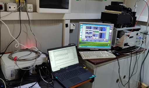
FRM4GHG: Reference Measurements for Ground-Based FTIR Greenhouse Gas Observation
Fiducial Reference Measurements for Ground-Based Infrared Greenhouse Gas Observations (FRM4GHG) is a European Space Agency (ESA) funded project.
Tools - Processing
Atmospheric Toolbox
The Atmospheric Toolbox (previously known as BEAT) is a collection of executable tools and API, developed to facilitate the utilisation, viewing and processing of e.g. GOMOS, MIPAS, SCIAMACHY and GOME data.
Event - Workshop
IDEAS+ Cal/Val Workshop 7
The 7th IDEAS+ Cal/Val Workshop took place on 4 and 5 June 2019 and it was hosted at the Wageningen University and Research (WUR) in The Netherlands.
Event - Workshop
Copernicus Sentinel-5 Precursor Validation Team Workshop
The purpose of the workshop was to gather feedback from the Sentinel-5P Validation Team (S5PVT) about the uncertainty characterisation of all Copernicus Sentinel-5P products.