- All Categories (125)
- Data (18)
- News (43)
- Missions (3)
- Events (14)
- Tools (13)
- Activities (4)
- Campaigns (15)
- Documents (15)
DATA
Discover and download the Earth observation data you need from the broad catalogue of missions the European Space Agency operate and support.
Data - Sample Data (Open)
SkySat Sample Data
Download free SkySat sample datasets to preview products available for this mission.
Data - Announcement of Opportunity (Restrained)
Announcement of Opportunity for S3VT (Sentinel-3 Validation Team)
In the framework of a Copernicus collaborative agreement ESA and EUMETSAT invite interested groups and individuals to support the Sentinel-3 Validation Team (S3VT).
Data - Fast Registration with approval (Restrained)
SkySat ESA archive
The SkySat ESA archive collection consists of SkySat products requested by ESA supported projects over their areas of interest around the world and that ESA collected over the years. The dataset regularly grows as ESA collects new products. Two different product types are offered, Ground Sampling Distance at nadir up to 65 cm for panchromatic and up to 0.8m for multi-spectral. EO-SIP Product Type Product Description Content SSC_DEF_SC Basic and Ortho scene Level 1B 4-bands Analytic /DN Basic scene Level 1B 4-bands Panchromatic /DN Basic scene Level 1A 1-band Panchromatic DN Pre Sup resolution Basic scene Level 3B 3-bands Visual Ortho Scene Level 3B 4-bands Pansharpened Multispectral Ortho Scene Level 3B 4-bands Analytic/DN/SR Ortho Scene Level 3B 1-band Panchromatic /DN Ortho Scene SSC_DEF_CO Ortho Collect Visual 3-band Pansharpened Image Multispectral 4-band Pansharpened Image Multispectral 4-band Analytic/DN/SR Image (B, G, R, N) 1-band Panchromatic Image The Basic Scene product is uncalibrated, not radiometrically corrected for atmosphere or for any geometric distortions inherent in the imaging process: Analytic - unorthorectified, radiometrically corrected, multispectral BGRN Analytic DN - unorthorectified, multispectral BGRN Panchromatic - unorthorectified, radiometrically corrected, panchromatic (PAN) Panchromatic DN - unorthorectified, panchromatic (PAN) L1A Panchromatic DN - unorthorectified, pre-super resolution, panchromatic (PAN) The Ortho Scene product is sensor and geometrically corrected, and is projected to a cartographic map projection: Visual - orthorectified, pansharpened, and colour-corrected (using a colour curve) 3-band RGB Imagery Pansharpened Multispectral - orthorectified, pansharpened 4-band BGRN Imagery Analytic SR - orthorectified, multispectral BGRN. Atmospherically corrected Surface Reflectance product. Analytic - orthorectified, multispectral BGRN. Radiometric corrections applied to correct for any sensor artifacts and transformation to top-of-atmosphere radiance. Analytic DN - orthorectified, multispectral BGRN, uncalibrated digital number imagery product Radiometric corrections applied to correct for any sensor artifacts Panchromatic - orthorectified, radiometrically correct, panchromatic (PAN) Panchromatic DN - orthorectified, panchromatic (PAN), uncalibrated digital number imagery product The Ortho Collect product is created by composing SkySat Ortho Scenes along an imaging strip. The product may contain artifacts resulting from the composing process, particular offsets in areas of stitched source scenes. Spatial coverage: Check the spatial coverage of the collection on a map available on the Third Party Missions Dissemination Service. As per ESA policy, very high-resolution imagery of conflict areas cannot be provided.
Data - Project Proposal (Restrained)
SkySat Full Archive and New Tasking
The SkySat Level 2B Basic Scene, Level 3B Ortho Scene and Level 3B Consolidated full archive and new tasking products are available as part of Planet imagery offer. The SkySat Basic Scene product is uncalibrated and in a raw digital number format, not corrected for any geometric distortions inherent in the imaging process. Rational Polynomial Coefficients (RPCs) is provided to enable orthorectification by the user. Basic Scene Product Components and Format Processing Levels Analytic (unorthorectified, radiometrically corrected, multispectral BGRN) Analytic DN (unorthorectified, multispectral BGRN) Panchromatic DN (unorthorectified, panchromatic) Product Components and Format Image File (GeoTIFF format) Metadata File (JSON format) Rational Polynomial Coefficients (Text File) UDM File (GeoTIFF format) Image Configuration 4-band Analytic DN Image (Blue, Green, Red, NIR) 1-band Panchromatic DN Image (Pan) Ground Sampling Distance 3.7 m at nadir (average at reference altitude 475 km) Ground Sampling Distance (nadir) Panchromatic 0.86m and Multispectral 1.0m for SkySat-1&2 Panchromatic 0.65m and Multispectral 0.8m for SkySat-3 to 13 (0.72 m and 1.0m for data acquired before 30/06/2020) Accuracy <50 m RMSE The SkySat Ortho Scene is sensor- and geometrically-corrected (by using DEMs with a post spacing of between 30 and 90 meters) and is projected to a cartographic map projection; the accuracy of the product will vary from region to region based on available GCPs. Different products are available: The SkySat Visual Ortho Scene product is orthorectified, pansharpened, and color-corrected (using a color curve) 3-band RGB Imagery The SkySat Pansharpened Multispectral Scene product is orthorectified, pansharpened 4-band BGRN Imagery The SkySat Analytic DN Ortho Scene product is orthorectified, multispectral BGRN, uncalibrated, digital number imagery product. The product has been processed to remove distortions caused by terrain; It eliminates the perspective effect on the ground (not on buildings), restoring the geometry of a vertical shot. Transformation to at-sensor radiance is not included The SkySat Panchromatic DN Ortho Scene product is orthorectified, panchromatic, uncalibrated, digital number imagery product. It has a finer GSD than the Analytic Product. Transformation to at-sensor radiance is not included. The SkySat Analytic Ortho Scene are calibrated multispectral imagery products with radiometric corrections applied to correct for any sensor artifacts and transformation to top-of-atmosphere radiance. The SkySat Consolidated Product are Ortho Collect product created by composing ~60 SkySat Ortho Scenes (Visual, Pansharpened Multispectral, Analytic DN, Panchromatic DN) along an imaging strip into segments Ortho Scene Product Components and Format Visual Ortho Pansharpened Multispectral Analytic DN Ortho Panchromatic DN Ortho Analytic Ortho Product Components and Format Image File (GeoTIFF format) Metadata File (JSON format) Rational Polynomial Coefficients (Text File) UDM File (GeoTIFF format) Image File (GeoTIFF) Metadata File (JSON format) Rational Polynomial Coefficients (Text File) UDM File (GeoTIFF format) Image File (GeoTIFF format) Metadata File (JSON format) Rational Polynomial Coefficients (Text File) UDM File (GeoTIFF format) Image File (GeoTIFF format) Metadata File (JSON format) Rational Polynomial Coefficients (Text File) UDM File (GeoTIFF format) Image File (GeoTIFF format) Metadata File (JSON format) Rational Polynomial Coefficients (Text File) UDM File (GeoTIFF format) Image Configuration 3-band Pansharpened Image (PS Red, PS Green, PS Blue) 4-band Pansharpened Image (PS Blue, PS Green, PS Red, PS NIR) 4-band Analytic DN Image (B, G, R, N) 1-band Panchromatic Image 4-band Analytic Image (B, G, R, N) Ground Sampling Distance 50 cm 50 cm 50 cm 50 cm 50 cm Projection UTM WGS84 UTM WGS84 UTM WGS84 UTM WGS84 UTM WGS84 Accuracy <10 m RMSE <10 m RMSE <10 m RMSE <10 m RMSE radiometric accuracy: +/- 5% Relative accuracy at < 10 degrees off-nadir angle As per ESA policy, very high-resolution imagery of conflict areas cannot be provided.
Data - Campaigns (Open)
CEFLES2
The objective of the CEFLES2 campaigns was to provide key reference data and background knowledge for the preparatory phases of the Sentinel‐2 and FLEX missions.
Data - Campaigns (Open)
SoyFLEX 2015
SoyFLEX 2015 took place over the agricultural area around Jülich, Germany and Rzecin wetland site, Poland
Data - Campaigns (Open)
SoyFLEX II 2016
The SoyFLEX II experiment was a repetition of an experiment that took place during the 2015 campaign in Germany.
Data - Campaigns (Open)
SPARC
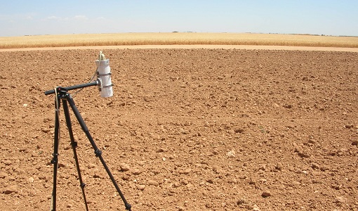
ESA's SPectra bARrax Campaign (SPARC) activity was part of the preparatory study for a proposed ESA Earth Explorer mission called SPECTRA. The objective was to collect a CHRIS/PROBA reference dataset for SPECTRA-related studies.
Data - Campaigns (Open)
FLEX EU 2014
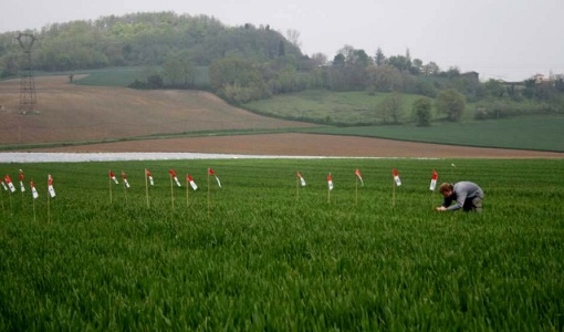
The FLEX-EU Campaign was carried out in 2014 over an agricultural area around Jülich, Germany, Latisana, Italy and forest sites in Czech Republic
Data - Campaigns (Open)
FLEX-US
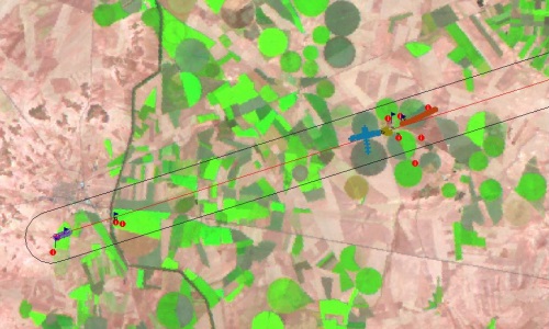
The primary goal of the 2013 joint ESA/NASA airborne campaign was to record an unprecedented FLEX-like dataset containing maps of sun-induced fluorescence, hyperspectral reflectance, surface temperature, and canopy structure.
Data - Campaigns (Open)
FLEXSense 2018
The 2018 Fluorescence Explorer Sense (FLEXSense) campaign combined various field activities in preparation for the FLEX satellite mission.
Data - Campaigns (Open)
FLEXSense 2019
The FLEXSense 2019 campaign activities were undertaken in Germany and Italy with the goal of providing a complete set of high-resolution experimental data, including all relevant elements required for the preparation of the FLEX satellite mission.
Data - Campaigns (Open)
SEN3EXP
The main objective of Sen3Exp (Sentinel-3 Experimental Campaign) was to provide a comprehensive dataset that covers all Sentinel-3 OLCI and SLSTR bands that is to be used for the algorithm prototype and ground segment processor development.
Data - Campaigns (Open)
HYFLEX
This HYFLEX campaign aimed to deliver maps of sun-induced fluorescence recorded from airborne measurements using the approaches of the spaceborne FLEX mission.
Data - Campaigns (Open)
Sentinel-3 OLCI Tandem 2018
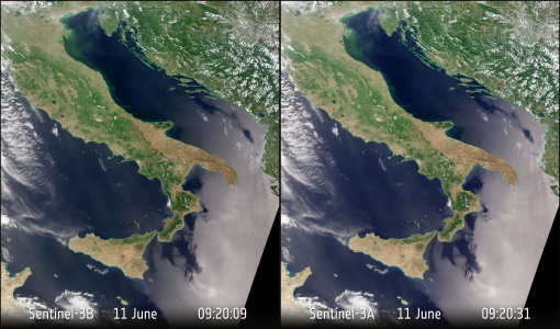
In 2018, a tandem campaign was conducted between the Sentinel-3A and 3B satellites to help test the future FLEX mission.
Data - Campaigns (Open)
PhotoProxy 2019
The Photosynthetic-Proxy Experiment campaign address relevant open aspects that are related to the quantitative assessment of vegetation photosynthesis and vegetation stress from space.
Data - Campaigns (Open)
SEN2EXP
In the SEN2EXP campaign, the data gap for broad leaf forests is addressed as suitable reference datasets of sufficient quality do not exist.
Data - Campaigns (Open)
SEN2FLEX
SENtinel-2 and FLuorescence EXperiment (SEN2FLEX) campaign combines different activities in support of initiatives related both to fluorescence experiments and Sentinel-2 initiative for prototyping of resolutions to meet mission requirements.

