- All Categories (4351)
- Data (47)
- News (130)
- Missions (8)
- Events (47)
- Tools (15)
- Activities (12)
- Campaigns (10)
- Documents (4082)
CAMPAIGNS
Learn about the ground-based, ship-borne, balloon-borne, and airborne campaigns and small satellite field experiments that validate orbiting ESA EO satellites and support future mission development.
Campaign
2019PhotoProxy 2019
The Photosynthetic-Proxy Experiment campaign address relevant open aspects that are related to the quantitative assessment of vegetation photosynthesis and vegetation stress from space.
Campaign
2017Cold atom gravimetry airborne campaign
The Iceland flight campaign was the first ever attempted airborne gravity survey using cold atom matter-wave gravimetry.
Campaign
2022WaddenSAR
The “WaddenSAR – Airborne bistatic C-band SAR experiment to demonstrate different acquisition geometries” was initiated to support the development of the Earth Explorer 10 Harmony mission.
Campaign
 2019
2019CIMREx
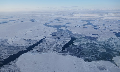
CIMREx airborne campaign aimed to sample the sea ice microwave emissions from various sea ice regimes around Svalbard and Greenland.
Campaign
 2015 - 2016
AfriScat
AfriScat campaign, a follow on to TropiSCAT campaign, was to acquire long-term P-Band radar data in an African tropical forest.
Campaign
 2015 - 2016
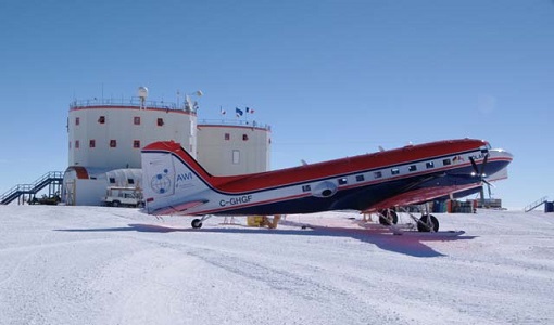
PolarGap
The primary objective of the PolarGap campaign was to carry out an airborne gravity survey covering the southern polar gap of the gravity field mission GOCE, beyond the coverage of the GOCE orbit.
Campaign
 2016
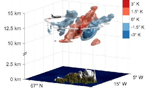
2016GWEX
The aim of this study was to perform Gravity Wave (GW) observations with the airborne IRLI GLORIA on board of HALO. In this way for a first time 3-D tomographic reconstructions of mesoscale GW events in the lower stratosphere were taken.
Campaign
 2015
2015AirScatterGNSS
In this project an Airborne Wind Vector Scatterometer (AWVS) system was designed and built for measurements of sea surface backscattering from an aircraft.
Campaign
 2013
2013DOMECair (GOCE)
The airborne survey DOMECair 2013 and its instrumentation was designed to obtain calibration and validation data for two different satellite missions of ESA’s Earth Explorer mission, for satellites SMOS and GOCE.
Campaign
 2002
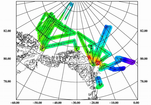
2002ESAG
The European Survey of Arctic Gravity (ESAG) campaign objective was to acquire measurements of the Arctic Ocean, in support of GOCE mission; and acquire scanning laser ranging data and profiling laser altimetry over sea-ice north of Greenland.