- News
- ALOS PALSAR WB1 Collection now...
ALOS PALSAR WB1 Collection now available online
24 Mar 2020
ESA is pleased to announce the online release of the ALOS Wide Area Observation Mode (Burst Mode 1) collection, which will complete the existing ALOS PALSAR data offer.
The Advanced Land Observing Satellite (ALOS) developed by the Japan Aerospace Exploration Agency (JAXA) was launched on 24 January 2006, with the aim of providing the user community with sufficient data to generate 1:25,000 scale maps, but also for regional observation for sustainable development, disaster monitoring and natural resources surveying.
ALOS suffered a power anomaly on 22 April 2011, bringing its operations to an end.
The satellite carried three instruments: the Panchromatic Remote-sensing Instrument for Stereo Mapping (PRISM) used for digital elevation mapping, the Advanced Visible and Near Infrared Radiometer type 2 (AVNIR-2) for precise land coverage observation, and the Phased Array type L-band Synthetic Aperture Radar (PALSAR), for day-and-night and all-weather land observation.
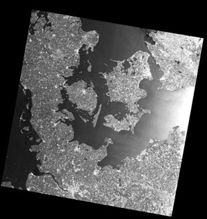
PALSAR had an active microwave sensor, which used L-band frequency with 10 and 100 m resolutions that were capable of achieving detailed, cloud-free, day-and-night land observation and repeat-pass interferometry. PALSAR had a ScanSAR observation mode, with a swath of 250-350 km that is three to five times wider than conventional SAR images - ideal for monitoring sea ice and rain forest extent.
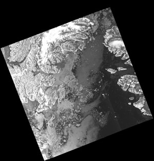
The newest ALOS PALSAR data release, the Wide Area Observation Mode (Burst mode 1) or WB1 collection, will complete the existing ALOS PALSAR data acquired in the ADEN zone (Europe, Africa and the Middle East) and collected by ESA over the past few years.
A background activity is also currently underway for all ESA collections of PALSAR data and will be performed on the WB1 collection as well. The activity's main aim is to add a browse image feature to the data. This will be done through the insertion of the EOSIP package of browse image, generated by the production of corresponding GDH upper level product into the RAW data and the modification of the V-OADS presentation view, to show the thumbnail and allow image download.
The activity is expected to last several months with all PALSAR data being progressively processed. As the browse feature will be generated, it will become immediately available on the dissemination server.