- Events
- LPVE 2018: Land Product Valida...
LPVE 2018: Land Product Validation and Evolution workshop
27-Feb - 01-Mar 2017
Italy
Retrieving land parameters globally from space 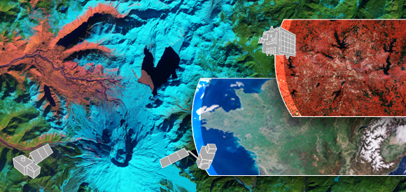 has a significant heritage, currently based on satellite missions across the visible and infrared spectral domain, including ERS, Envisat, SPOT-VGT, Landsat and Proba-V. The list of available sensors has recently been extended by the onset of the Copernicus Sentinel-2 and Sentinel-3 missions. In future, missions such as FLEX and BIOMASS, introducing also different observation techniques such as SAR, will complement the list of sensors contributing to the retrieval of land parameters.
Land parameters address surface characteristics across a wide spectrum, including information about vegetation, albedo, temperature, fires, inland waters and snow. To compare observations across different sensors common approaches and protocols for calibration and validation need to be defined, including standards for Fiducial Reference Measurements. With the long-term availability of some of these measurements also the option for climate relevant data series emerges and calls for data harmonisation across sensors.
Over the recent decade user requirements and needs have been further focused and refined through the onset of initiatives such as the European Commission's Copernicus Land Monitoring Services, FP7 and HR2020 projects and ESA's Data User Element (DUE) and Climate Change Initiative (CCI) projects. This calls for a dynamic approach to gather evolving and emerging user needs across the entire spectrum of land applications.
Therefore, following the success of LPVE 2014, the European Space Agency is inviting scientists and Cal/Val experts to present the latest results from their on-going research, including the evolution of products, the latest development in validation, the inter-comparison methodologies and the evolution of algorithms.
The 2018 Workshop on Land Product Validation and Evolution (LPVE 2018) took place in ESA/ESRIN (Magellan Room) on 27 February - 1 March 2018.
Objectives
The workshop intends to address the following objectives:
- Provide an overview on current land product Cal/Val approaches and protocols and their evolution
- Revisit existing calibration and validation protocols and standards in the light of newly available satellite data, including Sentinel-2 and Sentinel-3
- Present land product inter-comparison methodologies (in situ, satellite-satellite)
- Discuss data harmonisation approaches across sensors
- Identify key recommendations for ESA land product algorithm evolution
- Formulate recommendations for future land products and future Cal/Val activities
- Encourage close collaboration between Cal/Val and research groups
Proposed Theme
Product validation and methodologies
- Protocols for in-situ/satellite and satellite/satellite inter-comparison
- Radiometric and geometric validation
- Protocols for in-situ measurements (Fiducial Reference Measurements)
- Validation networks
- Products Validation Methods and Uncertainty Budget Estimation
- Data harmonisation across sensors
- Quality of Level 1 data
- Atmospheric correction approaches
- Albedo
- Vegetation parameters, including
- Fraction of Absorbed Photo synthetically Active Radiation (FAPAR)
- Leaf Area Index (LAI)
- Leaf chlorophyll content
- Leaf water content
- Fire and burned areas
- Land Surface Temperature (LST)
- Snow
- Inland water quality
Contact Information
| All Inquiries: | Local organisation | ||
| Susanne Mecklenburg, ESA-ESRIN Philippe Goryl, ESA-ESRIN Steffen Dransfeld, ESA-ESRIN Ferran Gascon, ESA-ESRIN Gareth Davies, ESA-ESRIN Fabrizio Niro, ESA-ESRIN Georgia Doxani, ESA-ESRIN Nils Schon, ESA-ESRIN Nikolina Mileva, ESA-ESRIN |