- Campaigns
- SnowSAR (NOSREX, TVCEXP and AL...
SnowSAR (NOSREX, TVCEXP and ALPSAR)
Overview
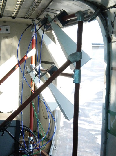
on the Cessna aircraft.
What was the purpose of SnowSAR (NOSREX, TVCEXP and ALPSAR)?
As a candidate of the Earth Explorer Programme, the European Space Agency proposed the (CoReH2O) mission, consisting of a satellite mission for the monitoring of snow, glaciers and surface water, based on a dual frequency SAR sensor at Ku- and X-band frequencies, VV and VH polarisations.
Following the proposal, in the last few years the development and testing of algorithms for retrieval of Snow Water Equivalent (SWE) characterised the efforts of the scientific community. Many dedicated field experiments have been performed in different snow-cover type environments over different regions of the world. In particular, between January 2011 and April 2013, four airborne campaigns were accomplished with the SnowSAR instrument, the ESA SAR sensor designed, manufactured and operated by MetaSensing BV and Sarmore GmbH for collecting airborne backscatter data with the CoReH2O characteristics. Repeat pass measurements have been executed in scientifically interesting areas of Finland, Austria, Canada and Alaska, concurrently with other parallel airborne and ground surveys based on different technologies.
What was the outcome of SnowSAR (NOSREX, TVCEXP and ALPSAR)?
The delivery of SnowSAR products has been recently finalised, consisting in a total of nearly 40 GBytes of calibrated polarimetric images at X- and Ku-band. The present report, together with the referenced documentation, provides end users with additional means for assessing SnowSAR data quality.
Download the SnowSAR (NOSREX, TVCEXP and ALPSAR) Final Report
| Data Coverage (Year) | 2011-2013 |
| Geographic Site | Finland, Canada, Alaska, Austria |
| Field of Application | Ku- and X-band dual frequency SAR for the monitoring of snow, glaciers and surface water |
| Data Size | 40 GB |
Digital Object Identifier: https://doi.org/10.5270/esa-a0l50j6 - SnowSAR (NOSREX, TVCEXP and ALPSAR): "Technical Assistance for the Development and Deployment of an X- and Ku-Band MiniSAR Airborne System (SnowSAR) "
Data
The campaign data is available online via FTPS upon submission of a data access request. An active EO Sign In account is required to submit the request.
The data can be downloaded via an FTP client (e.g., FileZilla or WinSCP) using the option "Implicit FTP over TLS".
For further information about the EO Sign In Service you can visit TellUs
Should you need support please contact EOHelp