- Campaigns
- POLARIS 2011
POLARIS 2011
Overview
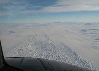
Glacier from 11,000 feet
What is the purpose of POLARIS?
In February 2011, ESA's POLarimetric Airborne Radar Ice Sounder (POLARIS) system was flown for the first time in the Antarctic, as part of the POLARIS IceGrav Antarctic Campaign 2011, ICEGRAV project.
POLARIS 2011 campaign objectives:
- The detection and mapping of deep ice layers and bedrock at up to 4 km depth in cold ice
- Sensitivity limit (depth) in warm ice
- Observability of radar reflection horizons under various conditions
- Potential of polarimetry for observing ice anisotropy in flowing ice and dynamical regions
- Acquisition of multiple phase-centre data in order to develop processing techniques for suppression of across-track surface clutter and enhancing shallow ice layers.
What was the outcome of POLARIS?
- POLARIS could detect bedrock at 3 km depth in the cold ice regions covered by the IceGrav tracks, although not consistently. Internal layers were consistently observed below 2 km depth.
- POLARIS was able to penetrate the major part of the warm ice test sites. At Adelaide Island the penetration limit seems to be around 500 m, whereas along Fimbulisen, the maximum observed penetration depth was 700 m. Internal layers in the warm ice regions were observed down to 400 m depth. The basal return from the 700 m thick ice Jutulstraumen glacier was easily detectable, even with a short pulse at high altitude, but no internal layers could be observed.
- At the EPICA/Kohnen drilling site, differences between HH and VV reflection horizons were clearly observed down to below 2 km depth.
- A preliminary analysis of the acquired clutter suppression data indicates they can indeed be used for investigating clutter suppression, despite a problem with the large antenna transmit pattern.
Download the POLARIS Final Report
| Data Coverage (Year) | 2011 |
| Geographic Site | Antarctica |
| Field of Application | P-Band ice-sheet sounding |
| Data Size | 2.8 GB |
Digital Object Identifier: https://doi.org/10.5270/esa-2w73vau - POLARIS: "POLARIS IceGrav Antarctic Campaign 2011: ESA Processed Data Inventory"
Data
The campaign data is available online via FTPS upon submission of a data access request. An active EO Sign In account is required to submit the request.
The data can be downloaded via an FTP client (e.g., FileZilla or WinSCP) using the option "Implicit FTP over TLS".
For further information about the EO Sign In Service you can visit TellUs
Should you need support please contact EOHelp