- Campaigns
- BelSAR 2018
BelSAR 2018
Overview
What was the purpose of the ESA BelSAR 2018 campaign?
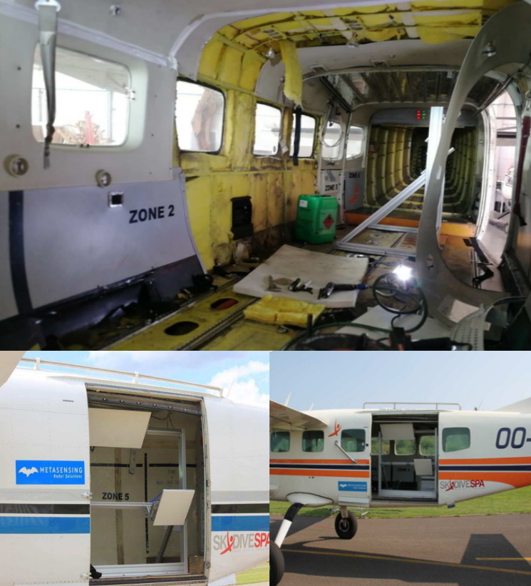
The BelSAR project intended to carry out an airborne campaign for SAR bistatic interferometric measurements at L-band and full polarisation, over a test site in Belgium.
The idea was to operate a flight campaign that fit as much as possible with the defunct SAOCOM/SAOCOM-CS configuration providing the opportunity to the science community to validate the capability of active-passive satellite configuration and to ensure the performances of Lband SAR bistatic or multistatic imagery. The intention was thus to assess the potential of SAR bistatic acquisitions in the particular domains of vegetation monitoring, soil moisture and bistatic SAR science, by the collection, over a selected test site in Belgium, of L-band full-polarimetric interferometric airborne SAR data to be associated with simultaneous field measurements.
In addition to bistatic, polarimetric data, the campaign enabled for the first time single-pass L-band interferometry based on the formation flying of two planes with separate L-band payloads.
What was the outcome of the ESA BelSAR 2018 campaign?
The targeted application fields of the BelSAR campaign were soil moisture, agriculture and bistatic SAR science. Five airborne missions allowed to acquired multi-temporal bistatic full-polarimetric SAR data. The data were acquired at L-band with a frequency bandwidth of 50MHz centred on 1.375 MHz, with two airplanes flying in both along-track and across-track interferometric configurations, over an area being part of the HESBANIA Belgian BELAIR supersite. In-situ ground measurements were done simultaneously or within a few days from each airborne campaign, to get information on soil roughness and moisture, as well as crop type and crop canopy properties in selected wheat and maize fields. Sentinel-1 data were also registered. The SAR data were successfully processed.
Download the BelSAR Final Report.
An updated version of the BelSAR 2018 campaign dataset, first released in November 2020, was published and replaced on the ESA server in November 2023.
Read more about the BelSAR campaign dataset in the paper: The BelSAR dataset: Mono- and bistatic full-pol L-band SAR for agriculture and hydrology - https://doi.org/10.48550/arXiv.2310.04423
| Data Coverage (Year) | 2018 |
| Release Date | November 2020, updated in November 2023 |
| Geographic Site | Hesbania BELAIR site, Belgium |
| Field of Application | Soil moisture, agriculture |
| Dataset Size | 1.13 TB |
Data Citation Users, who, in their research, use ESA Earth Observation data that have been assigned a Digital Object Identifier (DOI), are asked to use it when citing the data source in their publications:
Digital Object Identifier: https://doi.org/10.5270/ESA-bccf2d9 Technical Assistance for the Deployment of a L-Band SAR system to perform bistatic and interferometric SAR measurements during the ESA BelSAR Campaign.
Data
The campaign data is available online via FTPS upon submission of a data access request. An active EO Sign In account is required to submit the request.
The data can be downloaded via an FTP client (e.g., FileZilla or WinSCP) using the option "Implicit FTP over TLS".
For further information about the EO Sign In Service you can visit TellUs
Should you need support please contact EOHelp