- Campaigns
- AfriSAR 2016
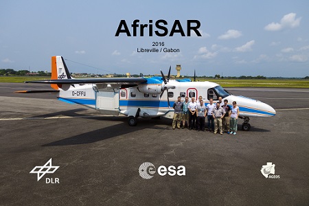
AfriSAR 2016
Overview

What was the purpose of AfriSAR 2016?
The ESA BIOMASS mission was selected in 2013 as the seventh Earth Explorer mission. BIOMASS will provide estimates of forest biomass and height with full coverage over the tropical areas exploiting the penetration capabilities of P-band. In order to further support the BIOMASS mission development, especially concerning the mission concept verification and the development of geophysical algorithms, ESA funded the AfriSAR campaign.
What was the outcome of AfriSAR 2016?
During the AfriSAR campaign, shared between ONERA (dry season, July 2015) and DLR (wet season 2016), Pol-InSAR and TomoSAR airborne data set were collected over four test sites in Gabon (Africa), therefore covering different forest structures, biomass levels and disturbances. Although the interferometric / tomographic baselines were optimised for P-band acquisitions, L-band data were collected simultaneously as well.
Download the AfriSAR Final Report
| Data Coverage (Year) | 2016 |
| Geographic Site | Gabon, Africa |
| Field of Application | Tropical forest biomass mapping using P and L-band SAR |
| Data Size | 1.5 TB |
| LIDAR data | Available |
Digital Object Identifier: https://doi.org/10.5270/esa-5c8sffb - AfriSAR 2016: Technical Assistance for the development of Airborne SAR and Geophysical measurements during the AfriSAR Experiment.
Data
The campaign data is available online via FTPS upon submission of a data access request. An active EO Sign In account is required to submit the request.
The data can be downloaded via an FTP client (e.g., FileZilla or WinSCP) using the option "Implicit FTP over TLS".
For further information about the EO Sign In Service you can visit TellUs.
Should you need support please contact EOHelp.