- Activities
- Contribution of Swarm data to ...
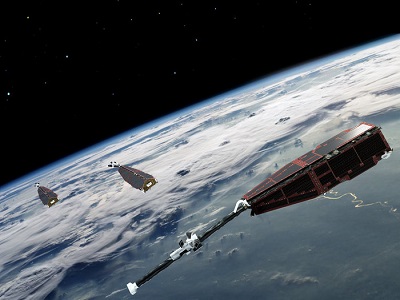
Contribution of Swarm data to the prompt detection of Tsunamis and other natural hazards
Overview
The COSTO (Contribution of Swarm data to the prompt detection of Tsunamis and other natural hazards) activity is an ESA EOSS (EO Science for Society) project. EOSS is one of the five EOEP (Earth Observation Envelope Programme) core activities (2017-2021).
The main objective of COSTO project is to better characterise, understand and discover coupling processes and interactions between the ionosphere/magnetosphere, the lower atmosphere and the Earth's surface and sea level vertical displacements. Natural Hazards induced by tsunamis, earthquakes and volcano eruptions occurring mostly around the areas with large human population have caused tragedies resulting in death of many people during and after these violent events, as well as inevitable environmental devastation. The proposed research effort targets to tsunamis that are the result of earthquakes, volcano eruptions or landslides.
An early warning for tsunami occurrence, and especially an estimation of the amplitude of a tsunami is still a challenge. In the range approximately between five and 15 minutes, the waves generated at the sea surface associated with tsunami can reach ionospheric altitudes, creating measurable fluctuations in the ionospheric plasma and consequently in Total Electron Content (TEC). At an altitude of about 300 km, the neutral atmosphere is strongly coupled with the ionospheric plasma producing perturbations in the electron density (ED). These perturbations are visible in the TEC parameter calculated from the data acquired from dual-frequency GNSS receivers, as well as in the ionograms and resulting ED profiles.
The COSTO project team will exploit existing modelling techniques for the identification and tracking of Travelling Ionospheric Disturbances (TIDs). Our methods are based on data assimilation methods using empirical models as background. These models based primarily on GNSS and ionosonde networks observations provide maps either of the TEC or of the ED at various altitudes. The less dense is the observing network, the highest is the uncertainty, which is the case over the oceans. The ionospheric-based tsunami detection method is much more accurate when based on the availability of dense networks of GNSS receivers and/or ionospheric sounders. These networks are sufficiently dense in the land, but there is a sparsity of observation points over the oceans. We believe that the use of Swarm data can shall improve the detection capability, especially over the oceans where the tsunami occurrence is expected. Therefore, TEC and ED models will be upgraded with the ingestion of dual-frequency onboard GNSS and Langmuir probe (LP) data from Swarm satellites, and advanced value-added products for tsunami early detection will be proposed. In the COSTO project, we will attempt to assimilate Swarm in situ LP ED data and TEC data into ED maps calculated from the 3D-TaD model at various heights. Ingesting in situ ED data from Swarm in the grids of TEC and ED, as well as taking into account the topside slant electron content observations from the POD GNSS antenna, will provide significant improvement in the temporal and spatial resolution of the ionospheric maps. Therefore, we expect to be able to specify more accurately the characteristics of TIDs triggered by the tsunamis.
One of the main targets of the project is to ingest the Swarm ionospheric measurements in an evolved version of different algorithms developed by authors of this proposal to detect Medium-Scale TIDs (MSTIDs) related with tsunamis. We will also try to identify the typology of tsunamis that give rise of effects on the ionosphere, and those that do not and focus on different coupling processes and interactions between the ionosphere/magnetosphere and the lower atmosphere.
More information about COSTO project
This project is funded by ESA.
Related Mission
find out more