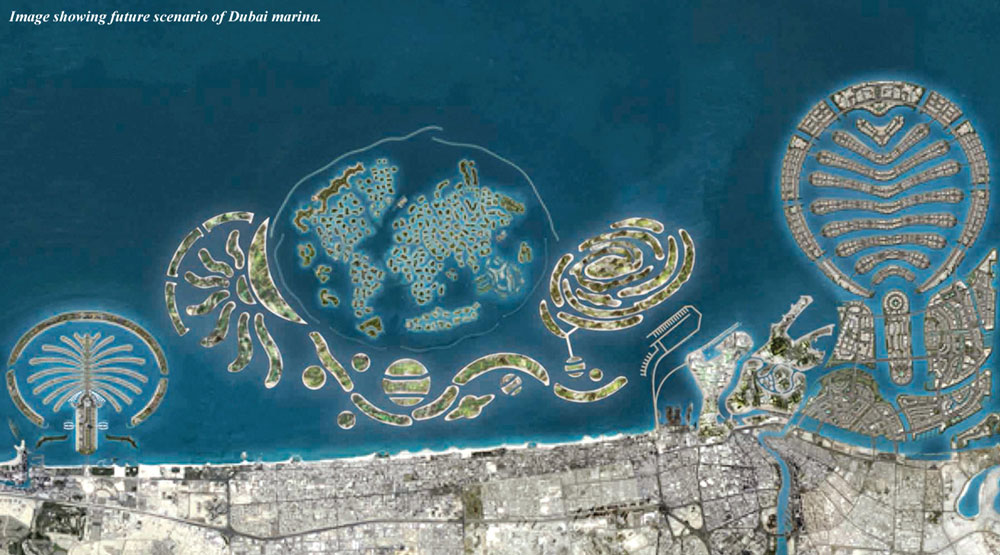
The image below shows the future concept of Dubai marina.
Dubai is a city in the United Arab Emirates, located within the emirate. The emirate of Dubai is located on the southeast coast of the Persian Gulf and is one of the seven emirates that make up the country. It has the largest population in the UAE (2,106,177) and the second-largest land territory by area (4,114 km2) after Abu Dhabi, the national capital.
The city of Dubai is located on the emirate's northern coastline and heads up the Dubai-Sharjah-Ajman metropolitan area. Today, Dubai has emerged as a cosmopolitan metropolis that has grown steadily to become a global city and a business and cultural hub of the Middle East and the Persian Gulf region. Although Dubai's economy was historically built on the oil industry, the emirate's Western-style model of business drives its economy with the main revenues now coming from tourism, real estate, and financial services.
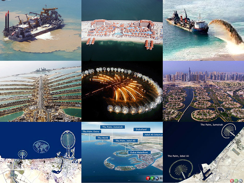
Dubai has recently attracted world attention through many innovative large construction projects and sports events. The city has become symbolic for its skyscrapers and high-rise buildings, such as the world's tallest building; the Burj Khalifa, in addition to ambitious development projects including man-made islands, hotels, and some of the largest shopping malls in the region and the world. This increased attention has also highlighted labour and human rights issues concerning the city's largely South Asian workforce. Dubai's property market experienced a major deterioration in 2008-2009 as a result of the worldwide economic downturn following the financial crisis of 2007-2008. However, a 2013 report by the Oxford Business Group said that Dubai was making a gradual recovery with help coming from neighbouring emirates.
As of 2012, Dubai is the 22nd most expensive city in the world, and the most expensive city in the Middle East. Dubai has also been rated as one of the best places to live in the Middle East, including by US America global consulting firm Mercer who rated the city as the best place to live in the Middle East in 2011.
|
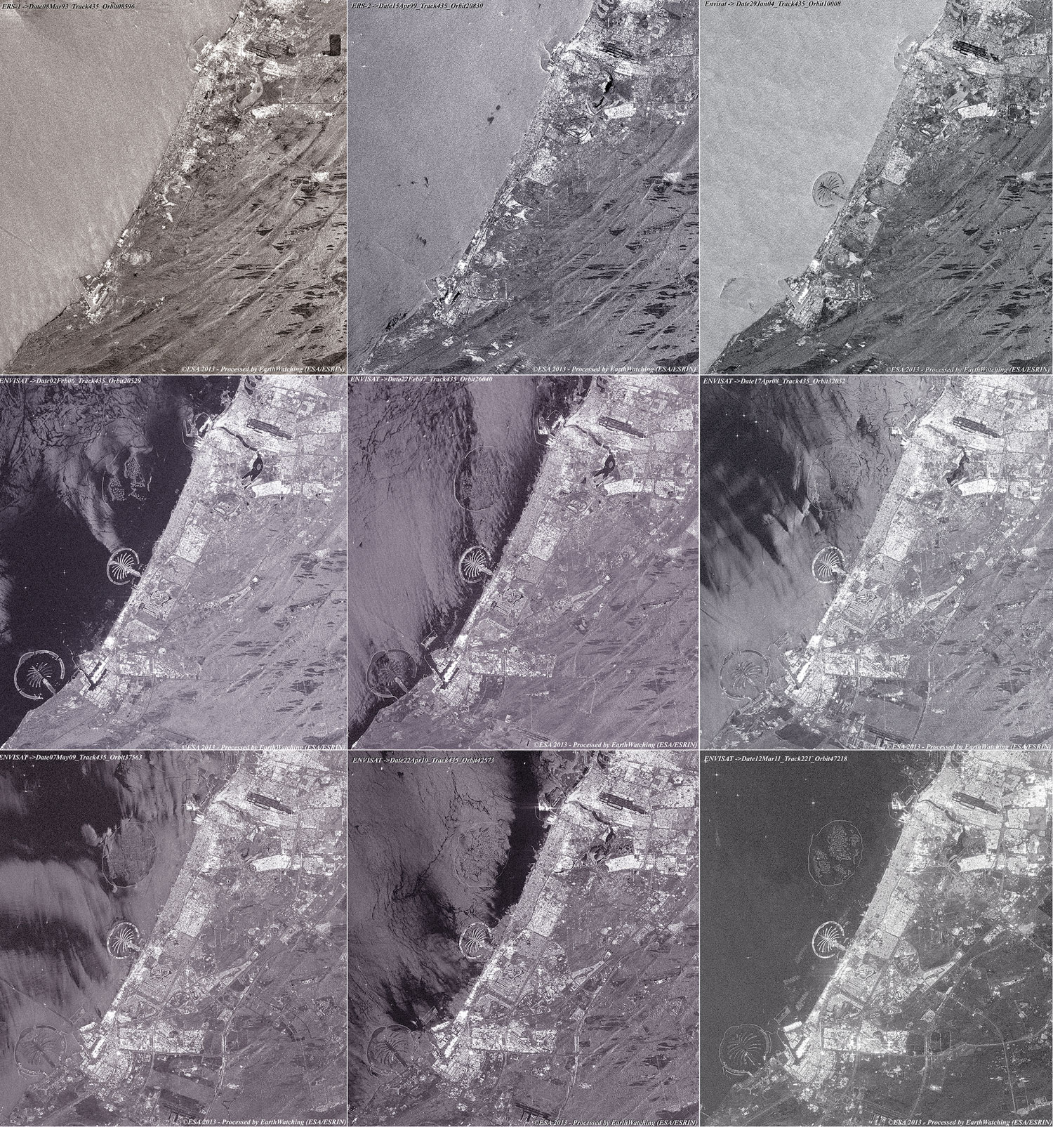
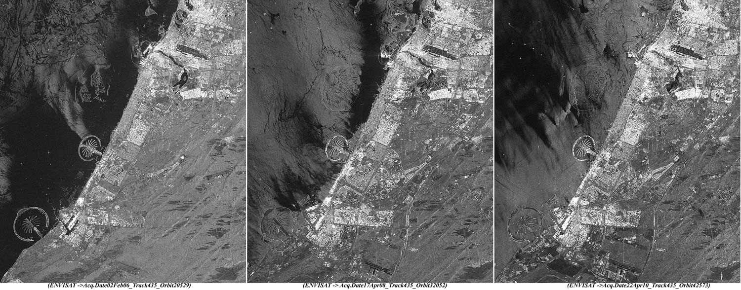
ERS-1/2 SAR & Envisat ASAR_IMP Swath2 animation |
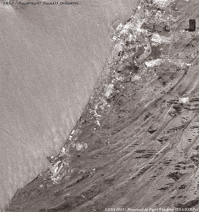
This animation, composed of images taken by the ERS and Envisat satellites, shows details of the area as it has changed over time. The animation features the phases of development starting from March 1993 to March 2011.
|
Images used to create the animation above |
|
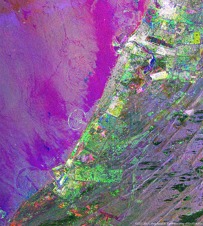
ERS/Envisat radar multi-layer image of the area |
This multi-layer image is a merge between different images from the ERS-1/2 and Envisat satellites utilising the SAR/ASAR radar instruments. The image shows the development along the Dubai coast over the years. Notable is the area highlighted in green (Envisat 22 April 2010), with the two artificial islands under construction.
|
Images used to create the multi-colour merge above |
|
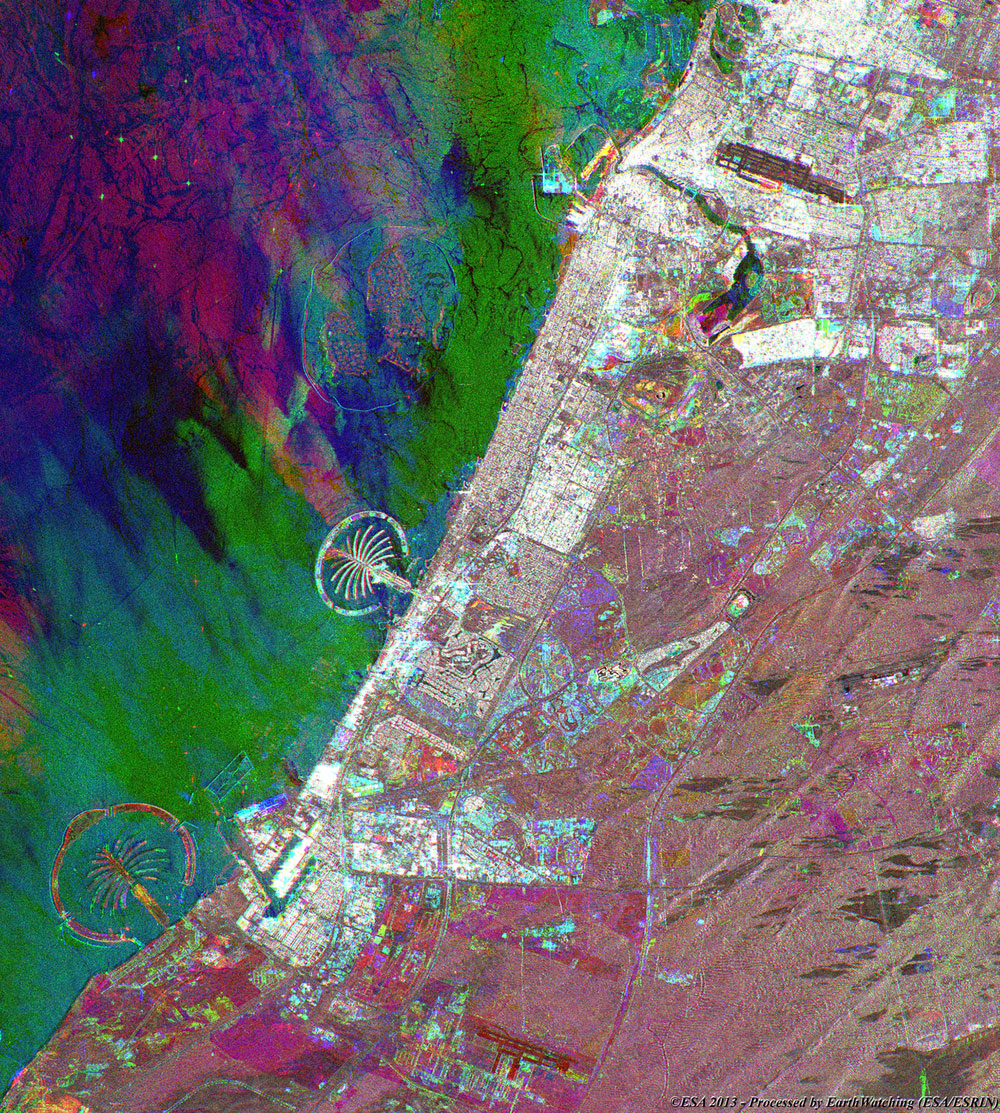
Envisat multi-layer merge of the area |
This multi-layer image is a merge between different images acquired by the Envisat satellite utilising the ASAR radar instrument. The image shows the development of Dubai over two year periods (between the dates of acquisition). Light blue (22 April 2010), highlights the development of the area.
|
Images used to create the multi-colour merge above |
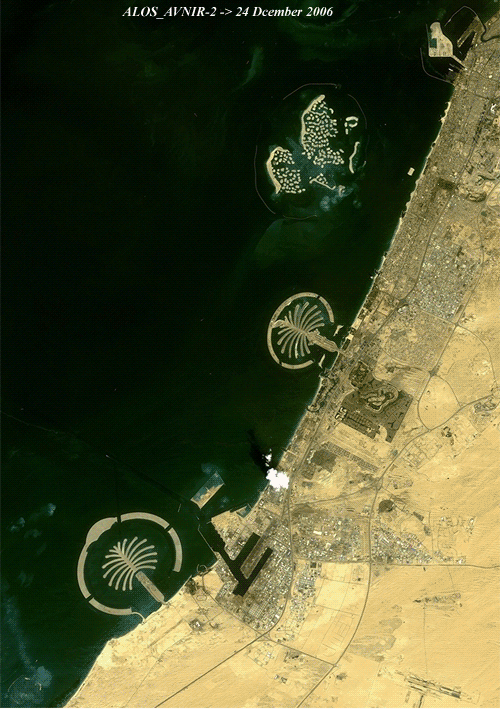
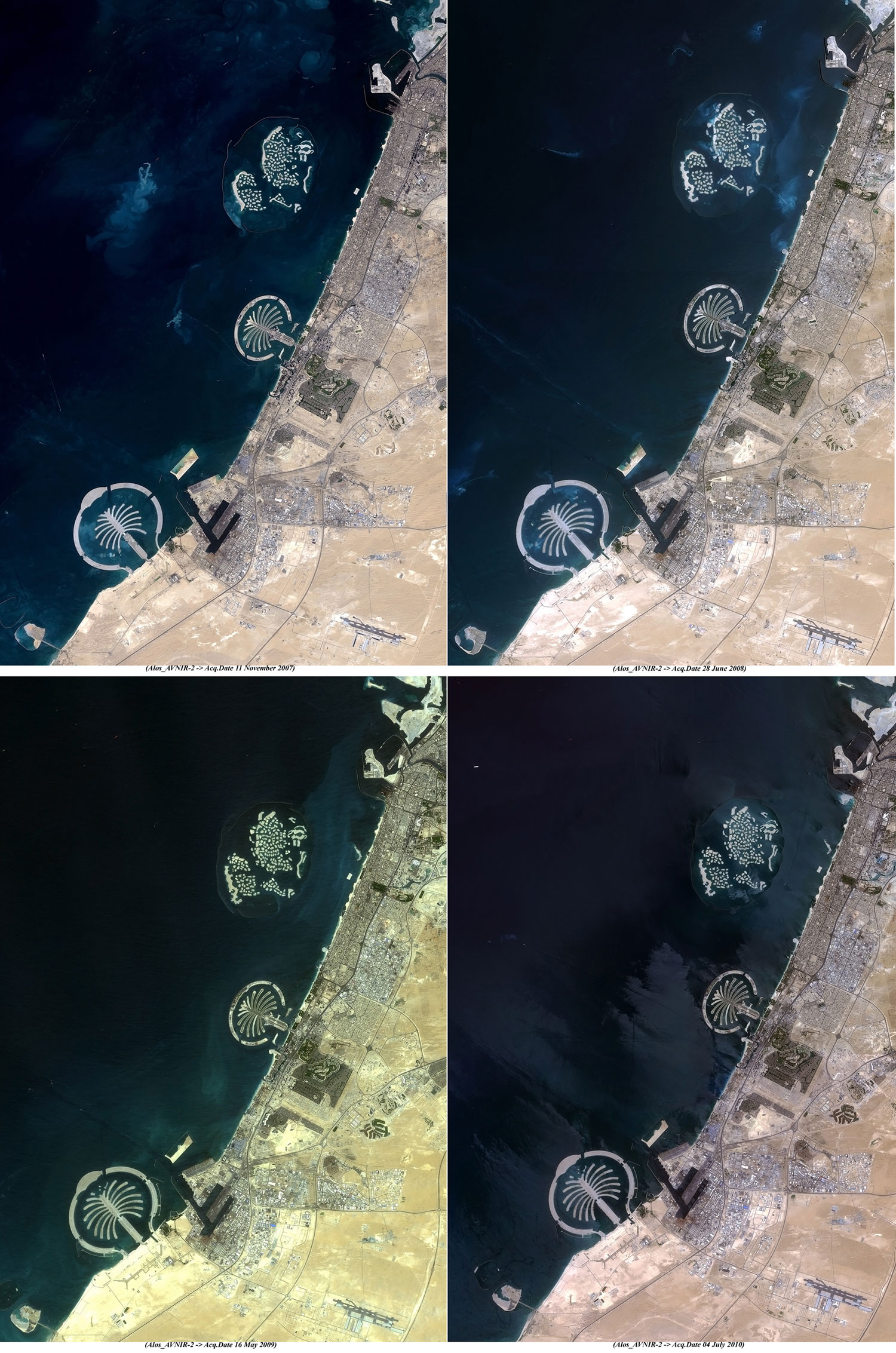
This animation, created with a series of images acquired by the ALOS AVNIR-2 (Japanese satellite), shows how Dubai changed from December 2006 to July 2010. In these images, the user can see the development and the building phases of the artificial islands along the coast.
|
Images used to create the animation above |
|
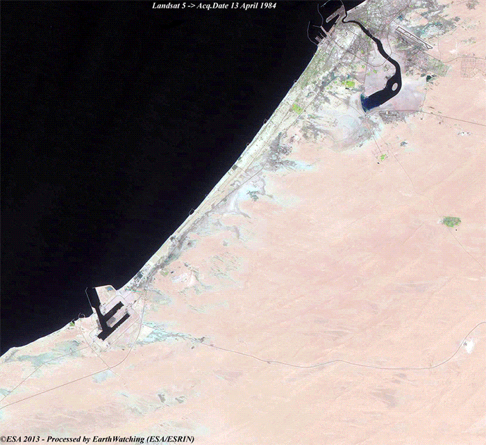
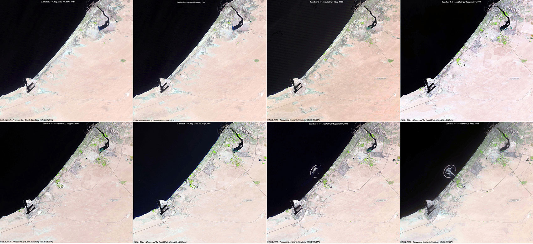
Landsat 4, 5 and 7 animation |
This animation created with a series of images acquired by the Landsat 4, 5 and 7 satellites, shows the growth of Dubai from April 1984 to May 2003. The user can see the progress of the development and the building phases of the artificial islands.
|
Images used to create the animation above |
Back to top
 Dubai grows on the sea