- All Categories (67186)
- Data (320)
- News (717)
- Missions (84)
- Events (206)
- Tools (24)
- Activities (77)
- Campaigns (106)
- Documents (65615)
Processing Tools
Find the tools you need to visualise, analyse and process the European Space Agency's Earth observation data.
Tools - Processing
23 Mar 2022Aeolus VRE
The Aeolus Virtual Research Environment (VRE) is the latest extension to the VirES for Aeolus service, which offers more direct and in-depth data exploitation of the Aeolus mission. The VRE is a cloud service that provides a web-based development environment in the form of a JupyterLab workspace.
Tools - Processing
 25 May 2021
SMOS Artificial Scene Library (ASL)
The ASL function allows users to directly use the L1B product version 7 by mimicking the Gibbs-2 image reconstruction correction algorithm as it is implemented in the level 1 operational processor.
Tools - Analysis
 1 Oct 2020
ESA PDGS Jupyter Notebook
A series of Jupyter Notebooks are available, in order to understand how to exploit the API that provides the data access service for different types of datasets included in the ESA PDGS datacube.
Tools - Analysis
 2 Mar 2020
Sentinel-3 Toolbox
The Toolbox consists of a set of visualisation, analysis and processing tools for the exploitation of OLCI and SLSTR data.
Tools - Analysis
 2 Mar 2020
Sentinel-2 Toolbox
The Toolbox consists of a rich set of visualisation, analysis and processing tools for the exploitation of optical high-resolution products including the Sentinel-2 MSI sensor.
Tools - Analysis
 2 Mar 2020
Sentinel-1 Toolbox
The Toolbox consists of: processing tools, data product readers and writers and a display and analysis application to support the archive of SAR data from ESA and 3rd party missions.
Tools - Analysis
 17 Dec 2019
GOCE User Toolbox
The GOCE User Toolbox is a compilation of tools for the utilisation and analysis of products from ESA's GOCE gravity mission.
Tools - Analysis
 8 Nov 2019
SNAP
SNAP is a common architecture for all Sentinel Toolboxes. It is ideal for Earth observation processing and analysis.
Tools - Analysis
7 Nov 2019VirES for Aeolus
VirES for Aeolus is a highly interactive data manipulation and retrieval interface for ESA's Aeolus mission products.
Tools - Processing
30 Sept 2019Atmospheric Toolbox
The Atmospheric Toolbox (previously known as BEAT) is a collection of executable tools and API, developed to facilitate the utilisation, viewing and processing of e.g. GOMOS, MIPAS, SCIAMACHY and GOME data.
Tools - Processing
 26 Sept 2019
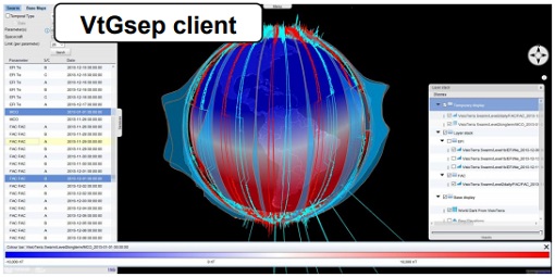
GSEP
GSEP (GOCE-Swarm Exploration Platform) is an online client tool designed to select GOCE and Swarm products, display them on a virtual globe and disseminate views of them.
Tools - Processing
1 July 2019HDFclean
HDFclean is a programme for reprocessing images stored in the HDF file format. The intended use is to tidy up images of the Earth captured by the CHRIS hyper-spectral imager onboard the PROBA satellite
Tools - Processing
 28 June 2019
PolSARpro
PolSARpro is a toolbox for the scientific exploitation of polarimetric SAR data and a tool for high-level education in radar polarimetry.
Tools - Processing
20 June 2019HDFView
HDFView is a visual tool, written in Java, is suitable for browsing and editing HDF (HDF5 and HDF4) files, such as the SMOS L2 data.
Tools - Processing
 20 June 2019
SMOS NetCDF Conversion Tool
The SMOS NetCDF Conversion Tool, for batch processing of large amounts of files, is available as a stand-alone command line executable or integrated in the SMOS Toolbox/SNAP.
Tools - Processing
 20 June 2019
SMOS Toolbox
SMOS Toolbox for SNAP (SMOS-Box) supports those using data acquired by ESA’s Soil Moisture and Ocean Salinity (SMOS) mission.
Tools - Processing
 19 June 2019
EO CFI Software
Earth Observation CFI Software is a collection of multiplatform precompiled C libraries for timing, coordinate conversions, orbit propagation, satellite pointing calculations, and target visibility calculations.
Tools - Processing
 19 June 2019
SciaL1C Command-line Tool
The SCIAMACHY Calibration and Extraction Tool (SciaL1c) is an application to process SCIAMACHY Level 1b products. It allows you to select specific calibrations to apply to Level 1b data.
Tools - Processing
17 June 2019AMORGOS
The AMORGOS tool generates accurate geo-location GOS E information (longitude, latitude, altitude) for each MERIS pixel.
Tools - Other
12 June 2019Broadview Radar Altimetry Toolbox
BRAT is an extensive tutorial on what is altimetry, techniques used and examples of usage of data; plus software to read, process and visualise altimetry data.