- News
- Discover how RADARSAT scans Ea...
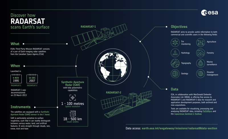
Discover how RADARSAT scans Earth's surface
28 Mar 2023
The Canadian Space Agency's RADARSAT series consists of two satellites carrying C-band Synthetic Aperture Radar (SAR) instruments.
The satellites were launched in 1995 and 2007. RADARSAT-1 completed its mission in 2013, but RADARSAT-2 is still operational, continuing to gather data useful for many fields of application, some of which include ice monitoring, forestry, topography, and disaster management.
RADARSAT is part of ESA's Third Party Missions programme, in which ESA has an agreement to promote the availability of free data collections for research and applications development.
Learn about RADARSAT in our new infographic: